Category:Old maps of Connecticut
Jump to navigation
Jump to search
States of the United States: Alabama · Alaska · Arizona · Arkansas · California · Colorado · Connecticut · Delaware · Florida · Georgia · Hawaii · Idaho · Illinois · Indiana · Iowa · Kansas · Kentucky · Louisiana · Maine · Maryland · Massachusetts · Michigan · Minnesota · Mississippi · Missouri · Montana · Nebraska · Nevada · New Hampshire · New Jersey · New Mexico · New York · North Carolina · North Dakota · Ohio · Oklahoma · Oregon · Pennsylvania · Rhode Island · South Carolina · South Dakota · Tennessee · Texas · Utah · Vermont · Virginia · Washington · West Virginia · Wisconsin · Wyoming – District of Columbia: Washington, D.C.
Guam · Northern Mariana Islands · Puerto Rico
Guam · Northern Mariana Islands · Puerto Rico
Subcategories
This category has the following 12 subcategories, out of 12 total.
H
L
N
T
Pages in category "Old maps of Connecticut"
This category contains only the following page.
Media in category "Old maps of Connecticut"
The following 195 files are in this category, out of 195 total.
-
 (Bird's-eye view of Thompsonville (now Enfield), Connecticut). LOC 91680391.jpg 8,384 × 5,904; 14.74 MB
-
 102 of 'The Boundary Disputes of Connecticut' (11149905813).jpg 2,336 × 2,206; 271 KB
-
 113 of 'The Boundary Disputes of Connecticut' (11148460834).jpg 3,168 × 1,446; 404 KB
-
 A correct map of Connecticut from actual survey (4578699907).jpg 2,000 × 1,648; 3.39 MB
-
 1827 Finley Map of Connecticut - Geographicus - Connecticut-finley-1827.jpg 3,000 × 2,348; 2.01 MB
-
 1857 Colton Map of Connecticut and Long Island - Geographicus - Connecticut-colton-1857.jpg 3,500 × 2,824; 3.08 MB
-
 1867 Map of Trumbull Connecticut.JPG 2,468 × 2,985; 12.11 MB
-

-
 1879 map of Seymour, Connecticut.jpg 4,000 × 3,187; 3.54 MB
-
 1893 Connecticut Railroads Map.jpg 8,368 × 6,784; 18.96 MB
-

-

-
 39 of 'The Boundary Disputes of Connecticut' (11152365274).jpg 2,583 × 2,000; 331 KB
-

-

-
 98 of 'The Boundary Disputes of Connecticut' (11150666066).jpg 6,790 × 1,788; 1.45 MB
-
 A correct map of Connecticut from actual survey. LOC 99466757.jpg 5,206 × 4,363; 3.58 MB
-

-
 A map of Connecticut and Rhode Island with Long Island Sound, etc. LOC 99466764.tif 2,790 × 2,368; 18.9 MB
-

-

-

-

-

-

-

-

-
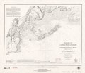
 Admiralty Chart No 2755 Long Island Sound Sheet 2 New Haven Oyster Bay &c, Published 1861.jpg 11,934 × 8,141; 18.59 MB
-
 Aero view of Ansonia, Connecticut 1921. LOC 75693145.jpg 9,968 × 6,880; 9.56 MB
-
 Aero view of Meriden, Connecticut 1918. LOC 73693115.jpg 11,616 × 7,680; 20.97 MB
-
 Aero view of Middletown, Connecticut, 1915 LOC 78692975.jpg 11,584 × 7,552; 15.69 MB
-
 Aero view of Norwich, Connecticut 1912. LOC 75693159.jpg 12,416 × 9,856; 26.97 MB
-
 Aero view of Shelton, Connecticut 1919. LOC 75693162.jpg 9,744 × 6,544; 9.87 MB
-
 Aero view of Waterbury, Connecticut 1917 LOC gm71005376.jpg 10,032 × 7,200; 14.58 MB
-
 Aero view of Watertown, Connecticut 1918. LOC 75693168.jpg 10,736 × 6,976; 11.94 MB
-
 Aero view of Willimantic, Connecticut 1909. LOC 75693169.jpg 10,432 × 8,896; 13.94 MB
-
 Aero view of Windsor Locks, Connecticut, 1913. LOC 2008624183.jpg 12,211 × 8,688; 20.87 MB
-
 BattleOfRidgefield1.png 1,351 × 1,777; 4.8 MB
-
 BattleOfRidgefield2.png 1,351 × 1,777; 4.79 MB
-
 Bell telephone magazine (1922) (14756067232).jpg 1,418 × 1,172; 199 KB
-
 Bicycle road-map - New Haven, Connecticut, to New London, Connecticut. LOC 2010592716.jpg 3,817 × 4,784; 1.64 MB
-
 Bicycle road-map - New Haven, Connecticut, to New London, Connecticut. LOC 2010592716.tif 3,817 × 4,784; 52.24 MB
-
 Bird's eye view of Plainville, Connecticut 1907. LOC 75693161.jpg 9,040 × 6,272; 16.8 MB
-
 Bird's eye view of Torrington, Connecticut 1907. LOC 75693164.jpg 11,392 × 9,120; 16.45 MB
-
 Bird's eye view of Winsted, Connecticut 1908. LOC 75693170.jpg 10,912 × 9,824; 24.38 MB
-
 Bird's-eye-view of New Milford, Connecticut, 1906. LOC 75693155.jpg 9,536 × 7,840; 14.26 MB
-
 Bird's-eye-view of New Milford, Connecticut, 1906. LOC 75693155.tif 9,536 × 7,840; 213.9 MB
-
 Birmingham, Conn. 1876. LOC 74693153.jpg 7,808 × 6,496; 9.05 MB
-
 Bridgeport 1824.png 3,450 × 2,762; 6.04 MB
-
 Britannica Connecticut.jpg 2,603 × 1,890; 2.42 MB
-
 City of Bridgeport, Fairfield County, Connecticut LOC 2017591006.jpg 4,822 × 6,595; 5.72 MB
-
 City of Bridgeport, Fairfield County, Connecticut LOC 2017591006.tif 4,822 × 6,595; 90.98 MB
-
 Connecticut (3046242030).jpg 2,000 × 1,466; 3.04 MB
-
 Connecticut (4586563441).jpg 2,000 × 1,197; 3.47 MB
-
 Connecticut for schools, families, and general use LOC gm70001741.jpg 12,368 × 9,249; 15.38 MB
-
 Connecticut from the best authorites. LOC 99466756.jpg 5,388 × 4,381; 4.15 MB
-
 Connecticut from the best authorites. LOC 99466756.tif 5,388 × 4,381; 67.53 MB
-
 Connecticut from the best authorities (3046153908).jpg 2,000 × 1,777; 3.2 MB
-
 Connecticut, from actual survey (4071868211).jpg 2,000 × 1,730; 3.39 MB
-
 Connecticut, from actual survey. LOC 00561205.jpg 11,169 × 9,122; 16.44 MB
-
 Connecticut, from actual survey. LOC 00561205.tif 11,169 × 9,122; 291.49 MB
-
 Connecticut, from the best authorities. LOC 99466758.jpg 4,504 × 3,673; 3.04 MB
-
 Connecticut, from the best authorities. LOC 99466758.tif 4,504 × 3,673; 47.33 MB
-
 Connecticut, from the best authorities. LOC gm71000973.jpg 5,490 × 4,510; 3.09 MB
-
 Connecticut, from the best authorities. LOC gm71000973.tif 5,490 × 4,510; 70.84 MB
-
 Connecticut. LOC 99466759.jpg 5,316 × 4,349; 5 MB
-
 Connecticut. LOC 99466761.jpg 2,736 × 2,172; 1,010 KB
-
 Connecticut. LOC 99466761.tif 2,736 × 2,172; 17 MB
-
 Connecticut. NYPL1401777.tiff 5,475 × 4,848; 75.96 MB
-
 Connecticut; a study of a commonwealth-democracy (1903) (14580730828).jpg 4,240 × 3,496; 1.33 MB
-
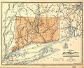
 Connecticut; county subdivisions, towns and places. 1970. LOC gm72003038.jpg 5,816 × 4,800; 1.98 MB
-
 Connecticut; county subdivisions, towns and places. 1970. LOC gm72003038.tif 5,816 × 4,800; 79.87 MB
-
 Books from the Library of Congress (IA connecticuthisto01barbe).pdf 800 × 1,306, 570 pages; 47.09 MB
-
 CT Pikes.jpg 2,788 × 2,036; 1.24 MB
-
 Danbury, Conn. LOC 85695099.jpg 11,744 × 6,208; 16.17 MB
-
 Danbury, Conn. LOC 85695099.tif 11,744 × 6,208; 208.59 MB
-

-

-
 EB9 Connecticut.jpg 2,500 × 1,819; 2.18 MB
-
 EB9 New Haven.jpg 829 × 752; 360 KB
-
 FMIB 37686 Oyster Grounds - State of Connecticut, 1889.jpeg 1,188 × 972; 309 KB
-
 Fort-Griswold. LOC gm71000696.jpg 2,388 × 2,903; 998 KB
-
 Fort-Griswold. LOC gm71000696.tif 2,388 × 2,903; 19.83 MB
-
 Geer's New map of the city of Hartford - from the latest surveys. LOC 79695213.jpg 3,398 × 4,748; 2.41 MB
-
 Geer's New map of the city of Hartford - from the latest surveys. LOC 79695213.tif 3,398 × 4,748; 46.16 MB
-
 Georgetown, Fairfield County, Connecticut, Clark 1856.jpg 600 × 451; 136 KB
-
 Gov. Tryon's expedition to Danbury, 1777. LOC gm71000884.jpg 4,291 × 5,438; 3.06 MB
-

-

-

-
-
 Litchfield County, Connecticut LOC 81690029.jpg 7,117 × 8,971; 9.22 MB
-
 Litchfield County, Connecticut LOC 81690029.tif 7,117 × 8,971; 182.67 MB
-
 LowsCTmap.jpeg 2,884 × 2,296; 3.13 MB
-
 Map (of the) borough of Stonington, Connecticut, 1851. LOC 75692234.jpg 6,525 × 8,023; 7.52 MB
-
 Map (of the) borough of Stonington, Connecticut, 1851. LOC 75692234.tif 6,525 × 8,023; 149.78 MB
-

-

-

-

-
 Map of Bridgeport, 1824.jpg 2,370 × 1,918; 367 KB
-
 Map of Long Island sound and Connecticut by Laura Roys in 1857.jpg 2,000 × 1,613; 3.34 MB
-
 Map of Middlesex County, Connecticut. LOC 2001620491.jpg 15,331 × 14,870; 35.59 MB
-
 Map of New London and Windham counties in Conn. LOC 2001620492.jpg 7,128 × 9,127; 13.54 MB
-
 Map of New London County, Connecticut. LOC 2001620486.jpg 18,636 × 13,721; 45.92 MB
-
 Map of New Milford, Litchfield Co., Conn.. LOC 2011589302.jpg 10,213 × 13,995; 18.84 MB
-

-

-
 Map of the city of Bridgeport, Conn. LOC gm71003380.jpg 11,110 × 11,468; 15 MB
-
 Map of the city of Bridgeport, Conn. LOC gm71003380.tif 11,110 × 11,468; 364.52 MB
-
 Map of the county of New Haven, Connecticut. LOC 2001620488.jpg 15,797 × 11,838; 24.24 MB
-
-

-
 Map of the town of Goshen, Litchfield County, Connecticut LOC 2011589312.jpg 11,395 × 14,157; 16.49 MB
-
 Map of the town of New Hartford, Litchfield Co., Conn.. LOC 2011589292.jpg 15,368 × 11,682; 20.07 MB
-
 Map of the town of Norfolk, Litchfield County, Ct. LOC 2011589304.jpg 9,970 × 15,309; 17.6 MB
-
 Map of the town of Salisbury, Litchfield Co., Connecticut. LOC 2011589306.jpg 12,521 × 15,845; 24.11 MB
-
 Map of the town of Washington, Litchfield Co., Conn. LOC 2011589308.jpg 10,203 × 15,579; 20.21 MB
-
 Map of Tolland County, Connecticut. LOC 2001620485.jpg 14,069 × 16,066; 29.71 MB
-
 Map of Windham County, Connecticut. LOC 2001620487.jpg 12,292 × 15,316; 31.05 MB
-

-
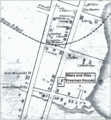 Mary and Eliza Freeman Houses map 1850.png 1,167 × 1,265; 917 KB
-
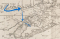 MeigsRaidMap.png 557 × 363; 379 KB
-
 Middlesex County, Connecticut LOC 81690031.jpg 5,063 × 6,577; 4.68 MB
-
 Middletown, Conn. 1877. LOC 75693151.jpg 12,180 × 10,366; 23.33 MB
-
 Mill River, Hamden, Connecticut. Flood plains. LOC gm69002790.jpg 5,104 × 6,701; 4.01 MB
-
 New Haven Harbor LOC 99447264.jpg 4,284 × 5,209; 3.88 MB
-
 New Haven Harbor LOC 99447264.tif 4,284 × 5,209; 63.84 MB
-
 New Haven Harbor LOC 99447265.jpg 4,576 × 5,803; 4.43 MB
-
 New Haven Harbor LOC 99447265.tif 4,576 × 5,803; 75.97 MB
-
 Norwalk 1847 Map, CT, 06854, USA.jpg 3,016 × 4,718; 3.2 MB
-
 Norwalk, South Norwalk, and East Norwalk, Conn. LOC 75693156.jpg 13,840 × 9,856; 35.97 MB
-
 A map of Connecticut (NYPL b14115138-1567523).jpg 6,598 × 5,428; 4.37 MB
-
 Map of the state of New York (NYPL b14919980-2020738).jpg 5,496 × 4,680; 43.22 MB
-
 Map of the state of New York (NYPL b14919980-2020738).tiff 6,300 × 5,248; 94.62 MB
-
 Old Stratfield (Bridgeport) Map before 1886.jpg 1,851 × 2,267; 325 KB
-
 Plan of New Haven LOC 2011589293.jpg 15,096 × 11,692; 20.35 MB
-
 Plan of the city of Hartford - from a survey made in 1824 LOC 2011589284.jpg 8,029 × 10,317; 12.66 MB
-
 Plan of the Colony of Connecticut, Moses Park, 1766.jpg 1,116 × 825; 220 KB
-

-

-
-
 Rockville, Connecticut, 1895. LOC 2005628467.tif 9,996 × 7,677; 219.55 MB
-
 Scantic River (Connecticut) map.jpg 1,700 × 2,800; 1.57 MB
-
 State of Connecticut. LOC 76693266.jpg 16,326 × 12,638; 24.31 MB
-
 Status of flood plain management studies, Connecticut - October 1994 LOC 2002621253.jpg 3,236 × 2,516; 1.11 MB
-
 Status of flood warning projects, Connecticut - October 1987 LOC 89694237.jpg 3,268 × 2,542; 1.1 MB
-
 Status of flood warning projects, Connecticut - October 1994 LOC 2002621254.jpg 3,232 × 2,516; 1.1 MB
-
 Status of river basin projects, Connecticut - October 1987 LOC 89694236.jpg 7,864 × 6,046; 11.12 MB
-
 Status of river basin projects, Connecticut - October 1987 LOC 89694236.tif 7,864 × 6,046; 136.03 MB
-
 Status of water resource projects, Connecticut - October 1987 LOC 89694235.jpg 3,245 × 2,531; 1.08 MB
-
 Status of water resource projects, Connecticut - October 1994 LOC 2002621252.jpg 3,220 × 2,513; 945 KB
-
 Status of water resource projects, Connecticut - October 1994 LOC 2002621252.tif 3,220 × 2,513; 23.15 MB
-
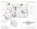
 Status of water resource projects, Connecticut LOC 81690081.jpg 3,273 × 2,500; 1 MB
-
 T19-1.jpg 12,870 × 9,285; 7.91 MB
-
 T19-2.jpg 12,669 × 9,058; 6.55 MB
-
 T20-1.jpg 13,301 × 9,555; 17.03 MB
-
 T20-2.jpg 12,867 × 9,823; 7.18 MB
-
 T22-1.jpg 12,717 × 9,320; 7.72 MB
-
 T22-2.jpg 11,869 × 9,195; 6.36 MB
-
 T48-2-li.jpg 11,417 × 8,548; 5.98 MB
-
 T49-li.jpg 13,392 × 9,273; 11.53 MB
-
 T50-li.jpg 12,617 × 9,469; 7.22 MB
-
 T51-li.jpg 13,441 × 9,938; 9.26 MB
-
 T76.jpg 12,657 × 9,485; 5.7 MB
-
 T80.jpg 12,457 × 9,877; 6.66 MB
-
 T82-1.jpg 11,808 × 8,501; 5.31 MB
-
 T82-2.jpg 11,807 × 8,662; 5.21 MB
-
 T82-3.jpg 11,926 × 9,246; 4.5 MB
-
 The city of Hartford, Connecticut. LOC 2018593481.jpg 10,521 × 8,450; 20.97 MB
-
 The city of New Haven, Conn. 1879. LOC 75693153.jpg 11,776 × 9,088; 18.84 MB
-
 United States Coast Guard Academy, New London, CT. LOC 2006628317.jpg 3,284 × 2,548; 1.61 MB
-
 View of Bethel, Conn. LOC 88694060.jpg 7,848 × 6,159; 10.48 MB
-
 View of Bridgeport, Ct. 1875. LOC 74693240.jpg 11,264 × 8,368; 18.91 MB
-
 View of Clinton, Connecticut 1881. LOC 74693231.jpg 7,968 × 6,288; 9.16 MB
-
 View of Collinsville, Conn. LOC 2008624184.jpg 9,808 × 8,124; 12.56 MB
-
 View of Danbury, Conn. 1875. LOC 74693229.jpg 8,272 × 6,480; 11.12 MB
-
 View of East Haddam, Connecticut, and Goodspeeds Landing - 1880. LOC 2008624295.jpg 10,675 × 8,311; 16.75 MB
-
 View of Madison, Conn. 1881. LOC 74693144.jpg 7,568 × 5,216; 6.96 MB
-
 View of Mystic River & Mystic Bridge, Conn. 1879. LOC 74693238.jpg 7,776 × 6,080; 10.84 MB
-
 View of Naugatuck, Conn. 1877. LOC 74693234.jpg 8,336 × 6,512; 7.69 MB
-
 View of New Britain, Conn. 1875. LOC 74693235.jpg 8,336 × 6,576; 10.01 MB
-
 View of Putnam, Conn. 1877. LOC 74693232.jpg 8,192 × 6,528; 8.74 MB
-
 View of Rockville, Conn. 1877. LOC 74693228.tif 8,688 × 6,912; 171.81 MB
-
 View of Seymour, Conn. 1879. LOC 74693230.jpg 7,712 × 6,144; 8.54 MB
-
 View of South Manchester, Conn. 1880. LOC gm71005342.jpg 8,336 × 6,448; 12.24 MB
-
 View of Unionville, Conn. LOC 88694131.jpg 8,432 × 6,656; 10.75 MB
-
 View of Windsor Locks, Conn., 1877 LOC 79694190.jpg 8,304 × 5,872; 8.8 MB
-
 Water-resources investigations in Connecticut, 1978 LOC 83692526.jpg 14,460 × 9,600; 15.32 MB
-
 Waterbury, Conn. 1899. LOC 75693167.jpg 14,208 × 10,880; 39.44 MB
-
 Waterbury, Conn. 1899. LOC 75693167.tif 14,208 × 10,880; 442.27 MB
-
 Weir Farm National Historic Site, Connecticut LOC 2001620236.jpg 7,090 × 5,061; 5.84 MB
-
 Weir Farm National Historic Site, Connecticut LOC 2004626257.jpg 7,110 × 5,062; 6.05 MB
-
 Weir Farm National Historic Site, Connecticut LOC 2008624294.jpg 7,086 × 5,172; 6.33 MB
-
 Weir Farm National Historic Site, Connecticut LOC 98684718.jpg 7,100 × 5,070; 5.63 MB
,_Connecticut)._LOC_91680391.jpg)
.jpg)
.jpg)
.jpg)


.jpg)
,_with_illustrations_and_biographical_sketches_of_some_of_its_prominent_men_and_pioneers_(by_other_authors)%27_(11132706385).jpg)
.jpg)
.jpg)
.jpg)

.jpg)

.jpg)


.jpg)


_(14756067232).jpg)


.jpg)
.jpg)


.jpg)
.jpg)


_(14580730828).jpg)


_(20808643460).jpg)
_(20808796238).jpg)


_(14590128277).jpg)
_(14753602246).jpg)
_LOC_79695331.jpg)


_borough_of_Stonington,_Connecticut,_1851._LOC_75692234.jpg)


.jpg)
.jpg)
_Map_before_1886.jpg)


_(14584859030).jpg)
_(14584913189).jpg)
_map.jpg)


.jpg)
_(14585083657).jpg)