Category:Old maps of Arizona
Jump to navigation
Jump to search
States of the United States: Alabama · Alaska · Arizona · Arkansas · California · Colorado · Connecticut · Delaware · Florida · Georgia · Hawaii · Idaho · Illinois · Indiana · Iowa · Kansas · Kentucky · Louisiana · Maine · Maryland · Massachusetts · Michigan · Minnesota · Mississippi · Missouri · Montana · Nebraska · Nevada · New Hampshire · New Jersey · New Mexico · New York · North Carolina · North Dakota · Ohio · Oklahoma · Oregon · Pennsylvania · Rhode Island · South Carolina · South Dakota · Tennessee · Texas · Utah · Vermont · Virginia · Washington · West Virginia · Wisconsin · Wyoming – District of Columbia: Washington, D.C.
Guam · Northern Mariana Islands · Puerto Rico
Guam · Northern Mariana Islands · Puerto Rico
Subcategories
This category has the following 8 subcategories, out of 8 total.
Pages in category "Old maps of Arizona"
This category contains only the following page.
Media in category "Old maps of Arizona"
The following 135 files are in this category, out of 135 total.
-

-

-
 1875-sahuarito.JPG 605 × 467; 104 KB
-
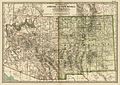
 1877 Mitchell Map of Arizona and New Mexico - Geographicus - AZNM-mitchell-1877.jpg 4,000 × 3,237; 3.33 MB
-
 1903 Congress quadrangle Walnut Grove and Prescott Forest Reserve.jpg 850 × 1,680; 716 KB
-
 1911 Britannica - Arizona.png 860 × 1,171; 2.53 MB
-
 Map of the Grand Canyon National Park 1926.jpg 4,696 × 2,668; 2.43 MB
-

-
 A portion of south eastr'n Arizona (NBY 15529).jpg 3,600 × 2,420; 1.28 MB
-

-

-

-

-
 Annual Reports of the Department of the Interior 1905 (1905) (14598033359).jpg 3,408 × 4,354; 2.36 MB
-
 Arbuckle Bros. Coffee Company (3093819838).jpg 799 × 476; 319 KB
-

-
 Arizona 1860 2.jpg 890 × 1,002; 106 KB
-
 Arizona 1860 3.jpg 890 × 1,002; 106 KB
-
 Arizona 1860 4.jpg 890 × 1,002; 106 KB
-
 Arizona and New Mexico Territories Map, 1867.jpg 2,946 × 2,422; 2.77 MB
-
 Arizona and New Mexico Territories Map, 1899.jpg 3,112 × 2,212; 3.68 MB
-
 Arizona and New Mexico. LOC 98687198.jpg 4,402 × 3,564; 3.51 MB
-
 Arizona and New Mexico. LOC 98687198.tif 4,402 × 3,564; 44.89 MB
-
 Arizona and Sonora Missions.png 723 × 1,183; 1.57 MB
-
 Arizona Map 1883.jpg 2,839 × 4,001; 4.12 MB
-
 Arizona-New Mexico. LOC 73693046.jpg 9,560 × 5,650; 7.91 MB
-
 Arizona-New Mexico. LOC 73693046.tif 9,560 × 5,650; 154.54 MB
-
 Arizona. LOC 99446127-1.jpg 4,777 × 5,916; 4.11 MB
-
 Arizona. LOC 99446127-1.tif 4,777 × 5,916; 80.85 MB
-
 Arizona. LOC 99446127-2.jpg 4,428 × 5,734; 3.3 MB
-
 Arizona. LOC 99446127-2.tif 4,428 × 5,734; 72.64 MB
-
 Arizona. LOC 99446127-3.jpg 4,664 × 5,890; 3.64 MB
-
 Arizona. LOC 99446127-3.tif 4,664 × 5,890; 78.6 MB
-
 Arizona. LOC 99446127-4.jpg 4,698 × 5,861; 4.39 MB
-
 Arizona. LOC 99446127-4.tif 4,698 × 5,861; 78.78 MB
-
 AZ NW 1866 Public Surveys Map 290375.JPG 1,600 × 1,510; 1.73 MB
-
 AZ-NM1867.jpg 621 × 484; 97 KB
-
 Bulletin. 1901-13 (20235907148).jpg 2,182 × 3,576; 1.32 MB
-
 CLAREMONT DIGITAL Title Map of Pimeria Alta, 1687-1711 P15831coll14 129 full.jpg 4,001 × 2,927; 3.35 MB
-
 Cochise County 1881.jpg 759 × 705; 318 KB
-
 Cochise County, Arizona 1882 (Charleston-Millville).jpg 537 × 665; 340 KB
-
 EB9 Utah - Utah and Arizona.jpg 3,720 × 5,409; 2.84 MB
-

-
 First Powell Expedition 1869 USGS Pioh120.jpg 4,356 × 5,456; 3.7 MB
-
 From the Pimas villages to Fort Fillmore - from explorations and surveys LOC 98688427.jpg 11,820 × 7,495; 9.31 MB
-
 From the Pimas villages to Fort Fillmore - from explorations and surveys LOC 98688427.tif 11,820 × 7,495; 253.46 MB
-
 G. M. Wheeler, Topographical atlas 1869-1878 Wellcome L0027632.jpg 1,529 × 1,321; 1.1 MB
-
 Geology and water resources of Sulphur Spring Valley, Arizona (1913) (14578465509).jpg 2,128 × 3,560; 971 KB
-
 Geology and water resources of Sulphur Spring Valley, Arizona (1913) (14761936401).jpg 1,692 × 3,748; 983 KB
-
 Geology and water resources of Sulphur Spring Valley, Arizona (1913) (14765103725).jpg 2,144 × 3,588; 1.02 MB
-
 Geology and water resources of Sulphur Spring Valley, Arizona (1913) (14765104875).jpg 2,116 × 3,512; 952 KB
-
 Geology and water resources of Sulphur Spring Valley, Arizona (1913) (14784983473).jpg 1,948 × 3,368; 1,019 KB
-
 Grand Canyon LOC 84695480.jpg 7,103 × 5,049; 7.27 MB
-
 Grand Canyon LOC 84695480.tif 7,103 × 5,049; 102.61 MB
-
 Grand Canyon National Monument within Grand Canyon National Forest Arizona. LOC 98687191.jpg 4,976 × 7,535; 5.63 MB
-
 Grand Canyon National Monument within Grand Canyon National Forest Arizona. LOC 98687191.tif 4,976 × 7,535; 107.27 MB
-
 Grand Canyon National Park and vicinity, Arizona - 1962 LOC 96682204.jpg 17,903 × 11,295; 48.35 MB
-
 Grand Canyon National Park and vicinity, Arizona LOC 97682276.jpg 17,887 × 11,264; 37.57 MB
-
 Grand Canyon National Park, Arizona LOC 91682960.jpg 6,935 × 4,951; 9.24 MB
-
 Grand Canyon National Park, Arizona LOC 91682960.tif 6,935 × 4,951; 98.23 MB
-
 Grand Canyon National Park, Arizona LOC 96682413.jpg 7,043 × 4,970; 8.81 MB
-
 Grand Canyon National Park, Arizona LOC 96682413.tif 7,043 × 4,970; 100.15 MB
-
 Grand Canyon of the Colorado. LOC 98687190.jpg 4,458 × 3,808; 2.96 MB
-
 Grand Canyon of the Colorado. LOC 98687190.tif 4,458 × 3,808; 48.57 MB
-
 Grand Canyon. LOC 78691582.jpg 7,163 × 5,508; 6.18 MB
-
 Grand Canyon. LOC 78691582.tif 7,163 × 5,508; 112.88 MB
-
 Harshaw Area USGS Topographical Map.JPG 1,200 × 800; 1.62 MB
-
 Hartley's map of Arizona. LOC 98687199.tif 11,180 × 9,362; 299.46 MB
-
-
 Indexed map of Arizona showing the stage lines, counties, lakes & rivers. LOC 98688443.tif 3,912 × 6,024; 67.42 MB
-

-

-
 Map of Colonel Sanford's Expedition to Sombrero Butte - NARA - 103396422.jpg 6,376 × 4,746; 1.91 MB
-

-
 Map of Gila Valley, Arizona USGS 1903 Gila and Salt River Meridian.png 1,675 × 1,788; 3.24 MB
-
 Map of Grand Canyon National Park. LOC 98687204.jpg 4,696 × 2,668; 2.77 MB
-
 Map of Grand Canyon National Park. LOC 98687204.tif 4,696 × 2,668; 35.85 MB
-
 Map of Hermit Rim Road and Hermit Trail. LOC 98687194.jpg 2,520 × 1,752; 867 KB
-
 Map of Hermit Rim Road and Hermit Trail. LOC 98687194.tif 2,520 × 1,752; 12.63 MB
-
 Map of Indian Areas in Arizona and New Mexico - NARA - 84785487.jpg 8,896 × 11,409; 8.76 MB
-
 Map of Navajo Areas - NARA - 84785481.jpg 11,360 × 12,430; 10.31 MB
-
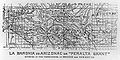 Map of Peralta land grant.jpg 1,994 × 990; 384 KB
-
 Maricopa and Pimas Villages, Military District of New Mexico 1858.jpg 745 × 1,002; 181 KB
-
 Mineral resources of the United States (1913) (14775414434).jpg 1,552 × 3,632; 503 KB
-
 National Wetlands Inventory, (Arizona). LOC 99446173.jpg 6,917 × 4,944; 9.2 MB
-
 National Wetlands Inventory, (Arizona). LOC 99446173.tif 6,917 × 4,944; 97.84 MB
-
 North Rim, Grand Canyon National Park, Arizona. LOC 78691591.jpg 3,896 × 5,056; 4.17 MB
-
 North Rim, Grand Canyon National Park, Arizona. LOC 78691591.tif 3,896 × 5,056; 56.36 MB
-
 Parts of Northern and North Western Arizona and Southern Utah. LOC 99446142.jpg 6,994 × 5,591; 6.9 MB
-
 Parts of Northern and North Western Arizona and Southern Utah. LOC 99446142.tif 6,994 × 5,591; 111.88 MB
-
 Pclmaps-topo-az-maricopa-1913.jpg 2,700 × 3,228; 1.71 MB
-
 Pg-23.jpg 1,247 × 1,043; 629 KB
-
 Pima County, Arizona circa 1883 (Harshaw).jpg 1,263 × 598; 873 KB
-
 Preliminary map no.2 of the country surveyed in 1872 and 1873. LOC 98687121.jpg 6,832 × 8,456; 10.82 MB
-
 Preliminary map no.2 of the country surveyed in 1872 and 1873. LOC 98687121.tif 6,832 × 8,456; 165.29 MB
-
 Probable Route of Cardenas BHoU-p5.png 3,935 × 3,141; 147 KB
-
 R.P. Kelley's map of the territory of Arizona LOC 2008621510.jpg 12,609 × 7,174; 11.44 MB
-
 R.P. Kelley's map of the territory of Arizona LOC 2008621510.tif 12,609 × 7,174; 258.8 MB
-
-

-
 Rio Colorado of the West 1858.jpg 10,701 × 4,739; 6.96 MB
-
 Sacate Arizona 1913 bless the Perry-Castañeda library.jpg 391 × 391; 76 KB
-
 Sacate Sacaton Mountain Sacaton Gila River Pima Butte.jpg 570 × 570; 130 KB
-
 Sheet 23. Ocatilla to Norton (north line) and Estrella, Ariz. (south line).jpg 1,050 × 1,096; 154 KB
-
 South Rim, Grand Canyon National Park, Arizona. LOC 78691592.jpg 3,904 × 5,072; 4.09 MB
-
 South Rim, Grand Canyon National Park, Arizona. LOC 78691592.tif 3,904 × 5,072; 56.65 MB
-
 Southeast Cochise County 1880.png 1,647 × 982; 3.99 MB
-
 Southwestern Defense System before the Civil War.jpg 450 × 286; 22 KB
-
 Territory of Arizona - DPLA - 73e2919e51f9cdf382c8de1a323a5881.jpg 8,352 × 10,500; 11.87 MB
-
 Territory of Arizona. LOC 98687197.jpg 9,641 × 11,506; 23.85 MB
-
 Territory of Arizona. LOC 98687197.tif 9,641 × 11,506; 317.37 MB
-
 Territory of Arizona. LOC 99446141.jpg 9,123 × 7,643; 10.74 MB
-
 Territory of Arizona. LOC 99446141.tif 9,123 × 7,643; 199.49 MB
-
 Territory of New Mexico - DPLA - b23869ff2be039061d8f5bd436ac1381.jpg 8,999 × 7,260; 7.57 MB
-
 The American journal of science (1913) (18153915521).jpg 2,928 × 2,000; 1.02 MB
-
 The American Museum journal (c1900-(1918)) (17537857744).jpg 946 × 1,026; 369 KB
-

-

-

-
 Tombstone area map 1887.jpg 1,385 × 931; 379 KB
-
 Tombstone Mining Map 1907.jpg 2,616 × 3,880; 4.58 MB
-
 Topographic map of the Grand Canyon National Park Arizona . LOC 98687188.jpg 12,009 × 13,640; 10.49 MB
-
 Topographic map of the Grand Canyon National Park Arizona . LOC 98687188.tif 12,009 × 13,640; 468.64 MB
-
 Topographic map of the Grand Canyon National Park Arizona . LOC 98687189.jpg 12,198 × 13,675; 29.21 MB
-
 Topographic map of the Grand Canyon National Park Arizona . LOC 98687189.tif 12,198 × 13,675; 477.24 MB
-
 Township 14N 3W 1871 ARIZONA Plat 196539 1.jpg 3,568 × 3,304; 9.34 MB
-
 Tucson Arizona area 1883.jpg 500 × 400; 71 KB
-
 USGS Map of Santa Rita and Patagonia Mts 1910.jpg 928 × 588; 280 KB
-
 Utah and Nevada 1795 BHoU-p27a.png 3,911 × 3,091; 216 KB
-
 Visitors' guide to Grand Canyon National Park, North Rim. LOC 99446143.jpg 4,318 × 3,174; 2.02 MB
-
 Visitors' guide to Grand Canyon National Park, North Rim. LOC 99446143.tif 4,318 × 3,174; 39.21 MB
-
 Visitors' guide to Grand Canyon National Park, South Rim. LOC 99446144.jpg 4,284 × 3,174; 1.81 MB
-
 Visitors' guide to Grand Canyon National Park, South Rim. LOC 99446144.tif 4,284 × 3,174; 38.9 MB
-
 Walnut Grove in Arizona Territory circa 1877.jpg 736 × 736; 146 KB
-
 Yuma County, Arizona circa 1883 (Castle Dome Landing).jpg 793 × 1,233; 958 KB
.jpg)
.jpg)


.jpg)
.jpg)
_(19174181100).jpg)
_(19361836725).jpg)
_(19365855031).jpg)
_(19336876556).jpg)
_(14598033359).jpg)
.jpg)


.jpg)


.jpg)


_(14578465509).jpg)
_(14761936401).jpg)
_(14765103725).jpg)
_(14765104875).jpg)
_(14784983473).jpg)


.jpg)


_(14775414434).jpg)
._LOC_99446173.jpg)


.jpg)


_(14574452109).jpg)
_(14577624139).jpg)


_and_Estrella,_Ariz._(south_line).jpg)


_(18153915521).jpg)
)_(17537857744).jpg)
_of_the_Colorado_of_the_West_and_the_cliffs_of_southern_Utah._LOC_98687193.jpg)
.jpg)


.jpg)