Category:Old maps of New Hampshire
Jump to navigation
Jump to search
States of the United States: Alabama · Alaska · Arizona · Arkansas · California · Colorado · Connecticut · Delaware · Florida · Georgia · Hawaii · Idaho · Illinois · Indiana · Iowa · Kansas · Kentucky · Louisiana · Maine · Maryland · Massachusetts · Michigan · Minnesota · Mississippi · Missouri · Montana · Nebraska · Nevada · New Hampshire · New Jersey · New Mexico · New York · North Carolina · North Dakota · Ohio · Oklahoma · Oregon · Pennsylvania · Rhode Island · South Carolina · South Dakota · Tennessee · Texas · Utah · Vermont · Virginia · Washington · West Virginia · Wisconsin · Wyoming – District of Columbia: Washington, D.C.
Guam · Northern Mariana Islands · Puerto Rico
Guam · Northern Mariana Islands · Puerto Rico
Subcategories
This category has the following 16 subcategories, out of 16 total.
B
C
D
G
H
M
R
S
Pages in category "Old maps of New Hampshire"
This category contains only the following page.
Media in category "Old maps of New Hampshire"
The following 8 files are in this category, out of 8 total.
-

-
-
-

-
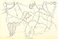
 Diagram of the south part of Shaker Village, Canterbury, NH. LOC 00552211.jpg 3,709 × 4,839; 2.27 MB
-
 Diagram of the south part of Shaker Village, Canterbury, NH. LOC 00552211.tif 3,709 × 4,839; 51.35 MB
-
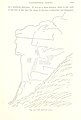
 The Saint-Gaudens National Historic Site LOC 78696403.jpg 3,696 × 5,592; 2.67 MB
-
 The Saint-Gaudens National Historic Site LOC 78696403.tif 3,696 × 5,592; 59.13 MB
._1719-1883_..._With_the_history_and_genealogy_of_its_first_settlers_and_their_descendants,_etc%27_(11162093254).jpg)
.jpg)
_C._H._Hitchcock,_State_Geologist,_J._H._Huntington,_Principal_Assistant%27_(11107640645).jpg)
.jpg)

