
Category:Old maps of Oklahoma
States of the United States: Alabama · Alaska · Arizona · Arkansas · California · Colorado · Connecticut · Delaware · Florida · Georgia · Hawaii · Idaho · Illinois · Indiana · Iowa · Kansas · Kentucky · Louisiana · Maine · Maryland · Massachusetts · Michigan · Minnesota · Mississippi · Missouri · Montana · Nebraska · Nevada · New Hampshire · New Jersey · New Mexico · New York · North Carolina · North Dakota · Ohio · Oklahoma · Oregon · Pennsylvania · Rhode Island · South Carolina · South Dakota · Tennessee · Texas · Utah · Vermont · Virginia · Washington · West Virginia · Wisconsin · Wyoming – District of Columbia: Washington, D.C.
Guam · Northern Mariana Islands · Puerto Rico
Guam · Northern Mariana Islands · Puerto Rico
Subcategories
This category has the following 12 subcategories, out of 12 total.
C
S
Media in category "Old maps of Oklahoma"
The following 118 files are in this category, out of 118 total.
-
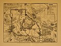
 1894 Map of Indian & Oklahoma Terrs.jpg 1,247 × 950; 370 KB
-

-
 Abraham Lincoln and the battles of the Civil War (1886) (14576348348).jpg 1,926 × 1,444; 564 KB
-
 Aero view of Tulsa, Oklahoma 1918. LOC gm71005372.jpg 11,072 × 5,120; 9.42 MB
-
 Aero view of Tulsa, Oklahoma, 1918. LOC 87692752.jpg 10,683 × 4,841; 9.24 MB
-
 Ajax Gasoline Company, Switch Property, Nowata, Oklahoma - NARA - 6093426.jpg 4,000 × 3,037; 1.41 MB
-

-
 Annual report - New York Zoological Society (1905) (18243576168).jpg 3,200 × 2,451; 1.09 MB
-
 Arbuckle Bros. Coffee Company (3093816184).jpg 799 × 489; 351 KB
-
 Ardmore, Indian Territory, 1891. LOC 73693205.jpg 7,224 × 4,304; 5.38 MB
-

-
 Bartlesville, Oklahoma 1917 LOC gm71005359.jpg 8,864 × 4,312; 6.07 MB
-
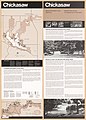
 Chickasaw LOC 78695764.jpg 5,180 × 7,163; 5.42 MB
-
 Chickasaw National Recreation Area LOC 2010592127.jpg 10,130 × 4,784; 5.89 MB
-
 Chickasaw National Recreation Area LOC 2010592133.jpg 10,153 × 4,825; 5.96 MB
-
 Chickasaw National Recreation Area LOC 2010592546.jpg 10,129 × 4,781; 6.19 MB
-
 Chickasaw National Recreation Area LOC 2011590442.jpg 10,152 × 4,810; 6.27 MB
-
 Chickasaw National Recreation Area, Oklahoma LOC 2001624183.jpg 10,145 × 4,829; 5.74 MB
-
 Chickasaw National Recreation Area, Oklahoma LOC 2002630362.jpg 10,160 × 4,844; 5.93 MB
-
 Chickasaw National Recreation Area, Oklahoma LOC 2003629335.jpg 10,155 × 4,830; 5.76 MB
-
 Chickasaw National Recreation Area, Oklahoma LOC 2003629369.jpg 10,171 × 4,838; 5.84 MB
-
 Chickasaw National Recreation Area, Oklahoma LOC 2003682950.jpg 10,091 × 4,809; 5.97 MB
-
 Chickasaw National Recreation Area, Oklahoma LOC 86694140.jpg 5,156 × 7,180; 5.06 MB
-
 Chickasaw National Recreation Area, Oklahoma LOC 87693954.jpg 5,194 × 7,175; 5.1 MB
-
 Chickasaw National Recreation Area, Oklahoma LOC 93684149.jpg 10,145 × 4,807; 5.92 MB
-
 Chickasaw National Recreation Area, Oklahoma LOC 95685263.jpg 10,163 × 4,833; 6.31 MB
-

-

-
 Democrat-Topic's map of Cleveland County, Oklahoma. 1900. LOC 2011590015.jpg 9,436 × 9,765; 11.33 MB
-

-
 Designated counties in Great Plains Conservation Program, P.L. 1021, Oklahoma LOC 92682930.tif 3,217 × 2,473; 22.76 MB
-
 Designated counties in rural abandoned mine program, Oklahoma LOC 82692893.jpg 3,128 × 2,358; 501 KB
-
 Designated counties in rural abandoned mine program, Oklahoma LOC 82692893.tif 3,128 × 2,358; 21.1 MB
-
 Designated counties in rural abandoned mine program, Oklahoma LOC 93682953.jpg 3,275 × 2,467; 500 KB
-
 Designated counties in rural abandoned mine program, Oklahoma LOC 93682953.tif 3,275 × 2,467; 23.12 MB
-
 EB1911 Oklahoma.jpg 2,490 × 1,818; 2.24 MB
-
 EB9 Texas.jpg 3,886 × 5,413; 3.49 MB
-
 Edmond, Oklahoma Territory, 1891. LOC 74693065.jpg 6,304 × 3,776; 5.1 MB
-
 El Reno, Oklahoma Territory 1891. LOC 75693045.jpg 6,736 × 5,144; 7.62 MB
-
 El Reno, Oklahoma Territory 1891. LOC 75693045.tif 6,736 × 5,144; 99.13 MB
-
 Experimental perspective map, Cache, OK - LOC 2013592460.jpg 8,603 × 6,717; 6.08 MB
-
 Experimental perspective map, Cache, OK - LOC 2013592460.tif 8,603 × 6,717; 165.33 MB
-
 Floods in Guthrie, Oklahoma, LOC gm71001990.jpg 8,661 × 5,186; 5.65 MB
-
 Floods in Guthrie, Oklahoma, LOC gm71001990.tif 8,661 × 5,186; 128.51 MB
-
 Fort Reno, Oklahoma Territory 1891. LOC 73693207.jpg 7,624 × 3,936; 6.01 MB
-
 Fort Reno, Oklahoma Territory 1891. LOC 73693207.tif 7,624 × 3,936; 85.85 MB
-

-

-
 George Mayo Map.png 623 × 474; 525 KB
-
 Hugo Lake LOC 90684334.tif 5,103 × 7,173; 104.72 MB
-
 Iiif-service gmd gmd402 g4020 g4020 rr002880-full-pct 12.5-0-default.jpg 1,246 × 949; 353 KB
-
 Indian Territory, with part of the adjoining state of Kansas, etc. LOC 2011590003.tif 10,770 × 8,148; 251.07 MB
-

-

-
 Lake Texoma - Denison Dam, Red River, Texas & Oklahoma LOC 90681975.jpg 7,366 × 10,407; 11.19 MB
-
 Lake Texoma - Denison Dam, Red River, Texas & Oklahoma LOC 90681975.tif 7,366 × 10,407; 219.32 MB
-

-
 Map of Choctaw Nation, Indian territory, coal and asphalt segregation LOC 2007627494.jpg 10,355 × 11,674; 14.28 MB
-
 Map of Greer County Texas.png 1,321 × 1,000; 1.64 MB
-
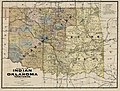
 Map of Indian Territory and Oklahoma. LOC 2012586269.jpg 9,309 × 7,225; 9.58 MB
-
 Map of Indian Territory and Oklahoma. LOC 2012586269.tif 9,309 × 7,225; 192.43 MB
-
-
 Map of Pawnee Reservation showing allotments. LOC 2016586525.jpg 7,185 × 10,758; 7.39 MB
-
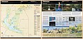
 Map of Platt National Park, Murray County, Oklahoma LOC 2018585320.jpg 9,952 × 4,481; 3.53 MB
-
 Map of Platt National Park, Murray County, Oklahoma LOC 2018585320.tif 9,952 × 4,481; 127.59 MB
-
 Map of Seminole Nation. LOC 2007627488.jpg 3,215 × 5,280; 1.42 MB
-
 Map of Seminole Nation. LOC 2007627488.tif 3,215 × 5,280; 48.57 MB
-

-

-
 Map of the extreme southern portion of Oklahoma (NBY 15540).jpg 2,396 × 3,600; 2.16 MB
-

-

-
 Map of the Indian and Oklahoma territories. LOC 98687110.jpg 9,774 × 7,200; 14.92 MB
-
 Map of the Indian and Oklahoma territories. LOC 98687110.tif 9,774 × 7,200; 201.34 MB
-

-

-

-

-
 Map of the Indian Territory showing Oklahoma country LOC 2013592013.jpg 12,886 × 7,916; 13.77 MB
-
 Map of the Indian Territory showing Oklahoma country LOC 2013592013.tif 12,886 × 7,916; 291.84 MB
-
 Map showing progress of allotment in Cherokee Nation LOC 2007627493.jpg 8,207 × 11,103; 10.23 MB
-
 Map showing progress of allotment in Creek Nation LOC 2007627492.jpg 5,830 × 6,272; 4.99 MB
-
 Map showing progress of allotment in the Creek Nation LOC 2007627513.jpg 8,546 × 9,363; 8.43 MB
-
 McCurtainCounty1909.jpg 478 × 678; 111 KB
-
-

-
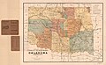
 Oklahoma 1889.jpg 8,086 × 5,422; 4.83 MB
-
 Oklahoma minor civil divisions and townships LOC 2011590624.jpg 13,905 × 8,522; 9.06 MB
-
 Oklahoma1885.jpg 2,085 × 1,605; 1.65 MB
-

-

-
 Premier series map of Oklahoma and Indian Territory. LOC 2001620495.jpg 8,624 × 13,422; 24.45 MB
-
 Premier series map of Oklahoma and Indian Territory. LOC 2001620495.tif 8,624 × 13,422; 331.17 MB
-
 Project map, Carney Creek watershed, Choctaw County, Oklahoma. LOC 81692268.jpg 3,100 × 4,275; 1.04 MB
-
 Project map, Carney Creek watershed, Choctaw County, Oklahoma. LOC 81692268.tif 3,100 × 4,275; 37.92 MB
-

-

-

-
 Project map, Paw Paw Bottoms Watershed, a portion of Sequoyah County, Oklahoma LOC 85693522.tif 5,028 × 3,102; 44.62 MB
-
 Rand McNally & Co.'s new 11 x 14 map of Indian Territory and Oklahoma. LOC gm71005406.jpg 3,412 × 3,838; 2.17 MB
-
 Rand McNally & Co.'s new 11 x 14 map of Indian Territory and Oklahoma. LOC gm71005406.tif 3,412 × 3,838; 37.47 MB
-
 Soil Map, Kiowa County, Oklahoma LOC 2010587906.jpg 13,583 × 11,735; 16.63 MB
-
 Sorghums - sure money crops (1914) (14593386719).jpg 2,928 × 1,914; 960 KB
-
 Stillwater Creek and tributaries, vicinity of Stillwater, Oklahoma. LOC gm69001897.jpg 8,602 × 5,200; 4.63 MB
-
 Stillwater Creek and tributaries, vicinity of Stillwater, Oklahoma. LOC gm69001897.tif 8,602 × 5,200; 127.97 MB
-

-
 The essential facts of Oklahoma history and civics (1914) (14770607371).jpg 2,880 × 1,912; 571 KB
-
 The essential facts of Oklahoma history and civics (1914) (14770610601).jpg 2,992 × 1,992; 558 KB
-
-

-
 Warner formerly Russell Cherokee Nation - Ind. Terr. LOC 2014589170.jpg 7,816 × 9,141; 8.23 MB
-
 Warner formerly Russell Cherokee Nation - Ind. Terr. LOC 2014589170.tif 7,816 × 9,141; 204.41 MB
-
 Water-resources investigations in Oklahoma, 1976 LOC 83692041.jpg 14,760 × 6,487; 10.67 MB
-
 Water-resources investigations in Oklahoma, 1976 LOC 83692041.tif 14,760 × 6,487; 273.94 MB
-
 Wichitas, Kiowas, Comanches and Apaches, Oklahoma Territory. LOC gm71005385.jpg 7,876 × 9,437; 12.24 MB
-
 Wichitas, Kiowas, Comanches and Apaches, Oklahoma Territory. LOC gm71005385.tif 7,876 × 9,437; 212.65 MB
-
 Wichitas, Kiowas, Comanches and Apaches, Oklahoma Territory. LOC gm71005386.jpg 7,703 × 9,517; 12.29 MB
-
 Wichitas, Kiowas, Comanches and Apaches, Oklahoma Territory. LOC gm71005386.tif 7,703 × 9,517; 209.74 MB


_(14576348348).jpg)


_(18243576168).jpg)
.jpg)


.jpg)


.jpg)


_(14580835498).jpg)
_(14764294971).jpg)


_(14593386719).jpg)

_(14597914939).jpg)
_(14770607371).jpg)
_(14770610601).jpg)


