Category:Old maps of Washington (state)
Jump to navigation
Jump to search
States of the United States: Alabama · Alaska · Arizona · Arkansas · California · Colorado · Connecticut · Delaware · Florida · Georgia · Hawaii · Idaho · Illinois · Indiana · Iowa · Kansas · Kentucky · Louisiana · Maine · Maryland · Massachusetts · Michigan · Minnesota · Mississippi · Missouri · Montana · Nebraska · Nevada · New Hampshire · New Jersey · New Mexico · New York · North Carolina · North Dakota · Ohio · Oklahoma · Oregon · Pennsylvania · Rhode Island · South Carolina · South Dakota · Tennessee · Texas · Utah · Vermont · Virginia · Washington · West Virginia · Wisconsin · Wyoming – District of Columbia: Washington, D.C.
Guam · Northern Mariana Islands · Puerto Rico
Guam · Northern Mariana Islands · Puerto Rico
Subcategories
This category has the following 7 subcategories, out of 7 total.
C
Pages in category "Old maps of Washington (state)"
This category contains only the following page.
Media in category "Old maps of Washington (state)"
The following 77 files are in this category, out of 77 total.
-

-
-

-
-

-
-

-

-

-

-

-

-

-

-
 Cedar River Watershed land ownership map, 1920 (51897543771).jpg 3,040 × 1,620; 869 KB
-
-
 Distribution of Farming, Lumbering, and Mining Industries in Washington, 1914.jpg 1,777 × 1,187; 1.05 MB
-
 EB1911 Washington.jpg 2,042 × 1,491; 1.76 MB
-
 FMIB 33420 Chart Showing the Fisheries of Shoalwater Bay, Washington.jpeg 659 × 1,214; 137 KB
-

-
-

-
 FMIB 44345 Summer Fishing Grounds of Seattle Halibut Fleet.jpeg 791 × 855; 82 KB
-
-
 General Information Regarding the National Monuments (1917) (14585725898).jpg 2,152 × 2,888; 1.3 MB
-

-
 Indians of Oregon, Idaho, and Washington (map).png 2,202 × 1,358; 2.92 MB
-
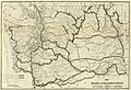
 Map Eastern Oregon and Western Idaho - NARA - 93193210.jpg 8,888 × 4,539; 2.12 MB
-

-
 Map of Indian Reservations under the Tulalip Agency - NARA - 76028865.jpg 10,618 × 9,536; 10.84 MB
-
 Map of Indian Reservations under the Tulalip Agency - NARA - 76028867.jpg 10,780 × 9,600; 12.96 MB
-
 Map of Indian Reservations under the Tulalip Agency - NARA - 76028875.jpg 11,085 × 10,048; 9.97 MB
-
 Map of Indian Reservations under the Tulalip Agency - NARA - 76028883.jpg 10,654 × 9,568; 9.01 MB
-
 Map of Indian Reservations under the Tulalip Agency - NARA - 76028887.jpg 10,041 × 8,800; 7.98 MB
-
 Map of Indian Reservations under the Tulalip Agency - NARA - 76028891.jpg 11,168 × 10,119; 9.16 MB
-
 Map of Indian Reservations under the Tulalip Agency - NARA - 76028893.jpg 10,688 × 9,545; 8.72 MB
-

-
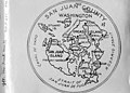 Map of San Juan County, Washington, ca 1910s (WASTATE 2584).jpeg 768 × 553; 59 KB
-
 Map of the Channeled Scablands.png 582 × 541; 814 KB
-
 Map of the Department of the Columbia - NARA - 122206769.jpg 14,073 × 10,384; 13.75 MB
-
 Map of the Department of the Columbia - NARA - 122206771.jpg 3,928 × 3,118; 822 KB
-
 Map of the Department of the Columbia - NARA - 122206775.jpg 13,870 × 10,800; 12.17 MB
-
 Map of the Department of the Columbia - NARA - 122206777.jpg 13,744 × 10,724; 30.52 MB
-
 Map of the Department of the Columbia - NARA - 122206783.jpg 13,524 × 10,412; 35.83 MB
-
 Map of the Department of the Columbia - NARA - 122206785.jpg 13,673 × 10,784; 13.5 MB
-
 Map of the Department of the Columbia - NARA - 122206787.jpg 13,699 × 10,792; 24.91 MB
-
 Map of the Department of the Columbia - NARA - 122206793.jpg 13,500 × 10,460; 33.12 MB
-
 Map of the Department of the Columbia - NARA - 122206795.jpg 13,470 × 10,412; 32.89 MB
-
 Map of the Department of the Columbia - NARA - 122206797.jpg 13,454 × 10,456; 26.67 MB
-
 Map of the Department of the Columbia - NARA - 122206799.jpg 13,333 × 10,272; 13.2 MB
-
 Map of the Department of the Columbia - NARA - 122206801 (page 1).jpg 3,468 × 4,752; 1.21 MB
-
 Map of the Department of the Columbia - NARA - 122206801 (page 2).jpg 3,480 × 4,778; 2.59 MB
-
 Map of the Department of the Columbia Label - NARA - 122206773.jpg 2,896 × 4,521; 645 KB
-
 Map of the Department of the Columbia, with notations - NARA - 122206779.jpg 14,021 × 10,792; 26.56 MB
-
 Map of the Department of the Columbia, with notations - NARA - 122206789.jpg 13,691 × 10,788; 31.3 MB
-

-

-
 Naches Pass 1850s.jpg 1,479 × 2,000; 1.25 MB
-
 NSH 1959 map.jpg 1,413 × 2,048; 734 KB
-
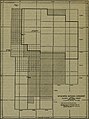
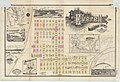 Plat of Everett, Snohomish County, Washington.jpg 2,000 × 1,364; 462 KB
-

-
 Provisional Government of Oregon map.png 487 × 315; 33 KB
-
 Quillayute Needles Reservation EO 705 illustration.jpg 1,867 × 1,788; 444 KB
-
 Quillehuyte ("Quillimute") County, Washington Territory.png 571 × 496; 796 KB
-
 Raisz 1941 Olympic Peninsula Puget Sound.png 1,241 × 920; 2.02 MB
-
 Seattle City Light newspaper ad, 1943 (42786528950).jpg 4,589 × 5,794; 3.82 MB
-
 The Commercial and financial chronicle (1909) (14576909558).jpg 4,208 × 2,592; 3.06 MB
-
 The Commercial and financial chronicle (1909) (14581945839).jpg 4,324 × 2,656; 2.96 MB
-
 The Commercial and financial chronicle (1909) (14581990089).jpg 4,320 × 2,664; 3.34 MB
-

-
-

-
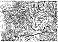
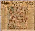
 Washington State Map - 1914.jpg 3,350 × 2,443; 3.62 MB
-
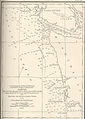
 Washington State Roads 1908-1910.jpg 2,048 × 1,406; 622 KB
-
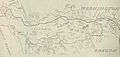
 Washington Territory map Snowden 1909.jpg 1,479 × 2,000; 532 KB
-
 Yellow3.png 351 × 251; 15 KB
-


.jpg)
.jpg)
.jpg)
.jpg)
_(1899)_(19997206773).jpg)
_(1899)_(20430124030).jpg)
.jpg)
_(19174699718).jpg)
_(19366302401).jpg)
_(14596175347).jpg)
.jpg)
_-_Timber_flows_and_utilization_patterns_in_the_Douglas-fir_region,_1966_(IA_CAT92272726)_(page_10_crop).jpg)
.jpg)


_(14585725898).jpg)
_1866-1912_(1915)_(14770113775).jpg)
.png)


.jpg)
.jpeg)


.jpg)
.jpg)


.jpg)
.jpg)


_(14767166412).jpg)


_County,_Washington_Territory.png)

.jpg)
_(14576909558).jpg)
_(14581945839).jpg)
_(14581990089).jpg)
_(14596571550).jpg)
.jpg)
_(14779975184).jpg)


.jpg)