Category:Old maps of Iowa
Jump to navigation
Jump to search
States of the United States: Alabama · Alaska · Arizona · Arkansas · California · Colorado · Connecticut · Delaware · Florida · Georgia · Hawaii · Idaho · Illinois · Indiana · Iowa · Kansas · Kentucky · Louisiana · Maine · Maryland · Massachusetts · Michigan · Minnesota · Mississippi · Missouri · Montana · Nebraska · Nevada · New Hampshire · New Jersey · New Mexico · New York · North Carolina · North Dakota · Ohio · Oklahoma · Oregon · Pennsylvania · Rhode Island · South Carolina · South Dakota · Tennessee · Texas · Utah · Vermont · Virginia · Washington · West Virginia · Wisconsin · Wyoming – District of Columbia: Washington, D.C.
Guam · Northern Mariana Islands · Puerto Rico
Guam · Northern Mariana Islands · Puerto Rico
Subcategories
This category has the following 5 subcategories, out of 5 total.
*
C
Pages in category "Old maps of Iowa"
This category contains only the following page.
Media in category "Old maps of Iowa"
The following 32 files are in this category, out of 32 total.
-
 11 of 'The history of Henry County, Iowa. ... Illustrated' (11128083163).jpg 2,545 × 1,760; 1.17 MB
-
 11 of 'The History of Monroe County, Iowa ... Illustrated' (11124287486).jpg 1,661 × 2,681; 1.36 MB
-
 14 of 'The History of Benton County, Iowa ... Illustrated' (11124796724).jpg 2,624 × 1,708; 1.17 MB
-
 14 of 'The History of Black Hawk County ... Illustrated' (11125842275).jpg 2,608 × 1,237; 1.02 MB
-
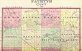 14 of 'The history of Fayette County, Iowa. ... Illustrated' (11121353085).jpg 2,576 × 1,591; 1.18 MB
-
 14 of 'The History of Jackson County, Iowa ... Illustrated' (11129514915).jpg 1,576 × 2,486; 1.22 MB
-
 14 of 'The History of Marshall County ... Illustrated' (11122837634).jpg 2,780 × 1,680; 1.17 MB
-
 15 of 'The History of Benton County, Iowa ... Illustrated' (11121327843).jpg 2,608 × 1,669; 1 MB
-
 15 of 'The History of Black Hawk County ... Illustrated' (11121537873).jpg 2,656 × 1,782; 1.04 MB
-
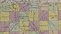
 15 of 'The history of Fayette County, Iowa. ... Illustrated' (11123025956).jpg 2,560 × 1,727; 1.13 MB
-
 15 of 'The History of Marshall County ... Illustrated' (11121720563).jpg 2,818 × 1,536; 1.22 MB
-
 379 of 'The History of Iowa County ... Illustrated' (11278338384).jpg 1,235 × 1,212; 157 KB
-

-

-

-
 A township map of the state of Iowa (NBY 15587).jpg 3,600 × 2,177; 1.48 MB
-
 A Township Map of the State of Iowa - DPLA - 5a87c6e3949b3a2e21c2c236bb727dcf (page 1).jpg 10,176 × 6,235; 5.52 MB
-
 Afton Township Map.jpg 396 × 600; 86 KB
-
 Bancroft-historic-map.jpg 1,920 × 1,080; 398 KB
-
 CoalvilleMines.png 586 × 664; 80 KB
-
 Crocker county railroad map.png 900 × 506; 719 KB
-

-
 Gordon-Van Tine homes (1921) (14801976273).jpg 2,980 × 2,136; 663 KB
-
-
 Iowa 1798.jpg 1,618 × 970; 1.15 MB
-
 Iowa cessions map.png 3,009 × 2,254; 10.67 MB
-
 Iowa. NYPL1401779.tiff 4,864 × 5,571; 77.55 MB
-
 Map of Cedar County, State of Iowa LOC 2012587557.jpg 11,983 × 14,740; 26.77 MB
-
 Map of Crawford County, Iowa LOC 2012587572.jpg 17,968 × 16,088; 30.63 MB
-
 Map of Linn County, Iowa LOC 2012587581.jpg 12,303 × 17,340; 31.65 MB
-
 Map of Polk County, Iowa LOC 2012587716.jpg 17,433 × 19,976; 44.34 MB
-
 Omaha migration after Dorsey.png 1,934 × 2,386; 5.19 MB
.jpg)
.jpg)
.jpg)
.jpg)
.jpg)
.jpg)
.jpg)
.jpg)
.jpg)
.jpg)
.jpg)
.jpg)
.jpg)
.jpg)
_C._Ashton,_J._O._Crosby_and_J._W._Jarnagin,_etc%27_(11224211716).jpg)
.jpg)
.jpg)


_and_Les_Maha_Nation_errente.png)
_(14801976273).jpg)


