Category:Old maps of Wisconsin
Jump to navigation
Jump to search
States of the United States: Alabama · Alaska · Arizona · Arkansas · California · Colorado · Connecticut · Delaware · Florida · Georgia · Hawaii · Idaho · Illinois · Indiana · Iowa · Kansas · Kentucky · Louisiana · Maine · Maryland · Massachusetts · Michigan · Minnesota · Mississippi · Missouri · Montana · Nebraska · Nevada · New Hampshire · New Jersey · New Mexico · New York · North Carolina · North Dakota · Ohio · Oklahoma · Oregon · Pennsylvania · Rhode Island · South Carolina · South Dakota · Tennessee · Texas · Utah · Vermont · Virginia · Washington · West Virginia · Wisconsin · Wyoming – District of Columbia: Washington, D.C.
Guam · Northern Mariana Islands · Puerto Rico
Guam · Northern Mariana Islands · Puerto Rico
Subcategories
This category has the following 9 subcategories, out of 9 total.
C
O
Pages in category "Old maps of Wisconsin"
This category contains only the following page.
Media in category "Old maps of Wisconsin"
The following 69 files are in this category, out of 69 total.
-

-
 1848 Public Survey Map of Wisconsin - Geographicus - WI-gs-1848.jpg 2,500 × 2,181; 848 KB
-

-

-
 424 of 'History of the Northern Pacific Railroad' (11164810983).jpg 2,272 × 1,558; 901 KB
-

-

-

-

-

-

-
 Annual Reports of the Department of the Interior 1905 (1905) (14598025649).jpg 3,501 × 5,052; 1.97 MB
-
 Appleton, Outagamie County, Wisconsin 1867. LOC 73694533.jpg 8,936 × 6,784; 13.51 MB
-
 Aztalan Plate 34.png 1,200 × 797; 91 KB
-
 Bird's eye view of Boscobel, Grant Co., Wisconsin 1869. LOC 73694537.jpg 7,496 × 6,552; 11.74 MB
-
 Bird's eye view of Fort Atkinson, Jefferson County, Wisconsin 1870. LOC 73694540.jpg 6,832 × 5,584; 7.79 MB
-
 Bird's eye view of Jefferson, Jefferson County, Wisconsin 1870. LOC 73694544.jpg 7,680 × 6,512; 10.61 MB
-
 Bird's eye view of Prairie du Sac, Sauk County, Wisconsin 1870. LOC 73694551.jpg 5,896 × 5,112; 5.44 MB
-
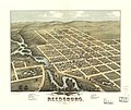 Bird's eye view of Reedsburg, Sauk County, Wis. 1874. LOC 73694552.jpg 5,760 × 4,840; 5.93 MB
-
 Bird's eye view of Sauk City, Sauk County, Wisconsin 1870. LOC 73694554.jpg 6,304 × 4,912; 5.47 MB
-
 Bird's eye view of the city of Beaver Dam, Dodge Co., Wisconsin 1867. LOC 73694535.jpg 8,176 × 7,008; 12.55 MB
-
 Bird's eye view of the city of Hudson, St. Croix County, Wisconsin 1870. LOC 73694543.jpg 7,784 × 6,568; 10.22 MB
-
 Bird's eye view of the city of Portage, Columbia Co., Wisconsin 1868. LOC 73694548.jpg 8,912 × 6,864; 16.47 MB
-
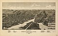
 Birds eye view of the city of La Crosse, Wisconsin 1867. LOC 73694545.jpg 8,944 × 6,992; 15.44 MB
-
 Diagram Showing Allotments of Land on Bad River Reservation - NARA - 84786026.jpg 15,576 × 12,352; 9.74 MB
-

-
 FMIB 38991 Wisconsin Lakes - Thirty Stations Where Collections were Made.jpeg 1,020 × 1,133; 233 KB
-
 Fort Le Sueur 1750.jpg 500 × 328; 207 KB
-
 Green Bay and Fort Howard, Brown Co., Wisconsin 1867. LOC 73694541.jpg 8,912 × 6,784; 12.97 MB
-
 Indian Campaign of 1832 (NBY 1348).jpg 2,990 × 3,600; 1.53 MB
-

-
 Map from Indian land cessions in the United States by Charles C. Royce 67.jpg 3,297 × 4,256; 3.95 MB
-
 Map of Eau Claire County, Wis. LOC 2012593644.jpg 16,695 × 10,959; 27.74 MB
-
 Map of Lac Court Oreilles Indian Reservation - NARA - 84785628.jpg 12,608 × 9,546; 7.34 MB
-
 Map of Lac Court Oreilles Indian Reservation - NARA - 84785636.jpg 12,834 × 9,152; 16.8 MB
-
 Map of Lac du Flambeau Indian Reservation - NARA - 84785632.jpg 11,142 × 14,529; 8.67 MB
-
 Map of Lac du Flambeau Indian Reservation - NARA - 84785634.jpg 10,026 × 12,728; 8.47 MB
-

-
 Map of Sheboygan County, Wisconsin LOC 2012593175.tif 14,745 × 16,199; 683.37 MB
-
 Map of the county of La Crosse, Wisconsin LOC 2012593191.jpg 16,402 × 16,786; 39.68 MB
-

-

-
 Map of the La Crosse and Milwaukee Rail Road and connections. LOC 98688691.jpg 12,514 × 7,881; 14.52 MB
-
 Map of the Wisconsin Central Line and connections. LOC 98688860.jpg 9,222 × 8,403; 11.74 MB
-
 Map of treaty cessions in Wisconsin - NARA - 84786040.jpg 17,478 × 15,072; 11.88 MB
-
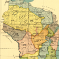
 Map of Winnebago County, Wisconsin LOC 2012593179.jpg 14,726 × 15,681; 33.05 MB
-

-
 Map of Wiskonsan1844.jpg 422 × 600; 53 KB
-
 Menomonee Falls, Waukesha County, Wisconsin. 1886. LOC 75696714.jpg 6,824 × 4,248; 4.84 MB
-
 Michigan official directory and legislative manual for the years (1901) (14595851699).jpg 2,220 × 3,640; 1.29 MB
-
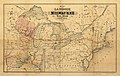
 Michigan, Minnesota, and Wisconsin. Walling, H. F.; Gray, Ormando Willis; Lloyd, H. H. 1872.jpg 5,809 × 4,249; 34.09 MB
-
 New map of Grant County, Wisconsin LOC 2012593189.jpg 18,192 × 20,065; 47.55 MB
-
 Northern Pacific Railroad map circa 1900 Schleisingerville.png 481 × 282; 323 KB
-

-
 Official highway service map of Wisconsin - btv1b53195479f.jpg 12,464 × 14,244; 32.08 MB
-

-

-
 The making of a park system in La Crosse (1911) (20580777760).jpg 3,646 × 2,811; 1.25 MB
-
 The making of a park system in La Crosse (1911) (20768761745).jpg 3,644 × 2,678; 1.14 MB
-
 The white pine (Pinus strobus Linnaeus) (1899) (14761282661).jpg 3,776 × 2,906; 1.64 MB
-
 The Wisconsin blue book (1893) (14778186762).jpg 3,968 × 2,795; 1.06 MB
-
 The-five-geographical-provinces-of-Wisconsin.gif 780 × 859; 27 KB
-
 Topographical Map of Wisconsin Territory WDL6769.png 1,299 × 1,024; 2.08 MB
-
 Treaty of St Peters 1837 WI.png 1,870 × 1,339; 4.62 MB
-
 View of the city of Whitewater, Wis. Walworth-County 1855. LOC 75696730.jpg 10,016 × 6,208; 15.24 MB
-
 Watertown, Jefferson Co., Wisconsin 1867. LOC 73694555.jpg 9,000 × 6,960; 14.13 MB
-
 Wisconsin 1866 US land Office.jpg 2,732 × 2,944; 1.36 MB
-
 Wisconsin Central Railroad Lands 1881.jpg 4,593 × 6,239; 5.78 MB
-
 Wisconsin Land Cession Map 1 – Close up of 242 & 243 & 245.png 2,300 × 2,300; 11.76 MB
.jpg)

.jpg)
.jpg)
%27_(11241553063).jpg)
.jpg)
_(18739765514).jpg)
_(18741667603).jpg)
_(19176129389).jpg)
_(19362300255).jpg)
_(14598025649).jpg)


.jpg)


_(14595851699).jpg)


.jpg)
_(20580777760).jpg)
_(20768761745).jpg)
_(1899)_(14761282661).jpg)
_(14778186762).jpg)


.jpg)