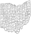
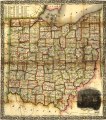
Category:Old maps of Ohio
Jump to navigation
Jump to search
States of the United States: Alabama · Alaska · Arizona · Arkansas · California · Colorado · Connecticut · Delaware · Florida · Georgia · Hawaii · Idaho · Illinois · Indiana · Iowa · Kansas · Kentucky · Louisiana · Maine · Maryland · Massachusetts · Michigan · Minnesota · Mississippi · Missouri · Montana · Nebraska · Nevada · New Hampshire · New Jersey · New Mexico · New York · North Carolina · North Dakota · Ohio · Oklahoma · Oregon · Pennsylvania · Rhode Island · South Carolina · South Dakota · Tennessee · Texas · Utah · Vermont · Virginia · Washington · West Virginia · Wisconsin · Wyoming – District of Columbia: Washington, D.C.
Guam · Northern Mariana Islands · Puerto Rico
Guam · Northern Mariana Islands · Puerto Rico
Subcategories
This category has the following 79 subcategories, out of 79 total.
Media in category "Old maps of Ohio"
The following 152 files are in this category, out of 152 total.
-
(Ohio) LOC 2011585897.jpg 2,156 × 2,732; 762 KB
-
(Ohio) LOC 2011585897.tif 2,156 × 2,732; 16.85 MB
-
18 of 'The History of Clark County, Ohio ... Illustrated' (11145637763).jpg 1,580 × 2,230; 897 KB
-
1801 Refugee Land Map - DPLA - 11bfb5d50a4f73441011bf68b5017cd2.jpg 5,022 × 6,885; 2.49 MB
-
1805 Survey - Twelve Mile Square Reserve.png 1,854 × 1,854; 1.16 MB
-
Plan of Fort Meigs' and its environs by Sebree, 1813.jpg 11,441 × 7,260; 26.93 MB
-
Ketch map of Camp Meigs by Eliza Clay, 1814.jpg 5,600 × 7,664; 5.09 MB
-
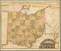
1820 Ohio Map by Bourne & Kilbourne.jpg 5,589 × 6,324; 11.06 MB
-
1827 Finley Map of Ohio - Geographicus - Ohio-finley-1827.jpg 2,308 × 3,000; 1.95 MB
-
1828 Ohio topographical map by Alfred Kelley.jpg 2,971 × 2,500; 7.44 MB
-
1846 Burroughs - Mitchell Map of Ohio - Geographicus - Ohio-m-1846.jpg 2,854 × 3,500; 2.81 MB
-
1850 Mitchell Map of Ohio - Geographicus - Ohio-m-50.jpg 3,313 × 4,000; 3.68 MB
-
1855 Colton Map of Ohio - Geographicus - Ohio-colton-1855.jpg 4,000 × 3,268; 4.23 MB
-
US-MAPS(1891) p496 - MAP OF OHIO.jpg 1,504 × 2,160; 1,017 KB
-
464 of 'History of Coshocton County, Ohio ... Illustrated' (11277773596).jpg 1,733 × 1,145; 619 KB
-
A Map of the western parts of the province of Pennsylvania, Virginia, etc. LOC gm71002323.tif 4,656 × 6,494; 86.51 MB
-
A plat showing the position of the different townships (4231922420).jpg 2,000 × 1,454; 1.52 MB
-
Beaver Creek, or Riviere en Grys-1778.jpg 863 × 304; 164 KB
-
Berlin Lake LOC 99441579.jpg 9,755 × 5,474; 4.94 MB
-
Berlin Lake LOC 99441579.tif 9,755 × 5,474; 152.78 MB
-
Bird's eye view of Camp Chase near Columbus, Ohio. LOC 73694505.jpg 7,800 × 5,936; 11.73 MB
-
Book of the Royal blue (1897) (14572404969).jpg 3,184 × 2,194; 1.17 MB
-
Camp Chase Aerial View.jpg 1,950 × 1,484; 734 KB
-
Camp Dennison - taken from Old Aunt Roady's Hill LOC 89694912.jpg 8,245 × 4,401; 6.25 MB
-
Camp Dennison - taken from Old Aunt Roady's Hill LOC 89694912.tif 8,245 × 4,401; 103.82 MB
-
Circleville illustrated LOC 2011592044.jpg 7,370 × 9,354; 9.97 MB
-
Circleville illustrated LOC 2011592044.tif 7,370 × 9,354; 197.24 MB
-
Cleveland and Toledo Rail-Road 1856. LOC 98688636.jpg 1,904 × 1,720; 539 KB
-
Cleveland and Toledo Rail-Road 1856. LOC 98688636.tif 1,904 × 1,720; 9.37 MB
-
Colton's township map of the State of Ohio. LOC 2018586202.jpg 8,672 × 7,525; 12.68 MB
-
Congress Lands in Ohio.png 696 × 824; 734 KB
-
Detailed map of Ohio in 1895.jpg 2,593 × 1,692; 1.72 MB
-
Donation Tract (Ohio).png 970 × 507; 767 KB
-
East of Scioto River Survey.png 697 × 919; 415 KB
-
EB11 Ohio.jpg 4,443 × 3,161; 4.47 MB
-
FMIB 39499 Map showing the effect of the glacial dam at Cincinnati.jpeg 1,339 × 863; 253 KB
-
Fort Washington Cincinnati map.png 455 × 701; 45 KB
-
French Grant in Ohio.png 696 × 1,038; 1.02 MB
-
French Grants.jpg 3,522 × 5,276; 1.27 MB
-
Greenville Treaty Line Map.png 544 × 711; 79 KB
-
Hand Map of Symmes.jpg 599 × 600; 116 KB
-
Historic highways of America (Volume 4) - II.jpg 2,138 × 3,395; 4.33 MB
-
Map of Ohio and the settled parts of Michigan, 1833 LOC 89694898.jpg 4,196 × 7,072; 4.41 MB
-
Map of Ohio and the settled parts of Michigan, 1833 LOC 89694898.tif 4,196 × 7,072; 84.9 MB
-
Map of Ohio compiled from the latest authorities LOC 2004627754.jpg 7,076 × 7,854; 9.23 MB
-
Map of Ohio compiled from the latest authorities LOC 2004627754.tif 7,076 × 7,854; 159 MB
-
Map of the Marietta and Pittsburgh Railroad and its connections. LOC 98688707.jpg 7,194 × 4,528; 6.93 MB
-
Map of the Marietta and Pittsburgh Railroad and its connections. LOC 98688707.tif 7,194 × 4,528; 93.2 MB
-
Map of the State of Ohio LOC 2011585875.tif 5,312 × 6,016; 91.43 MB
-
Map of the state of Ohio LOC 90682167.jpg 4,189 × 5,517; 2.53 MB
-
Map of the state of Ohio LOC 90682167.tif 4,189 × 5,517; 66.12 MB
-
Map of the Western Reserve - DPLA - d50bc16ba2d31355bed137ff54c575f2.jpg 10,000 × 7,750; 10.97 MB
-
Map, boundary, Michigan and Ohio (8347660926).jpg 9,784 × 5,559; 6.44 MB
-
Maumee Road Lands.png 936 × 543; 372 KB
-
Miami Valley-map-1919.jpg 800 × 1,230; 450 KB
-
Ministerial lands.png 587 × 721; 79 KB
-
Muskingum Salt Reservations.png 835 × 554; 83 KB
-
North and East of First Principal Meridian.png 811 × 845; 701 KB
-
North of Old Seven Ranges.png 764 × 828; 941 KB
-
NorthwestIndianWarMap.jpg 408 × 459; 35 KB
-
Notes on Virginia (1802) - Virginia map segment (Logan murders).jpg 2,030 × 1,531; 481 KB
-
Ohio (NYPL b13692629-1401778).jpg 4,864 × 5,571; 6.28 MB
-
Ohio (NYPL b13692629-1401778).tiff 4,864 × 5,571; 77.55 MB
-
Ohio - Newark Earth Works - drawn 1860.jpg 864 × 652; 226 KB
-
Ohio archæological and historical publications (1891) (14595488269).jpg 2,540 × 3,296; 1.04 MB
-
Ohio archæological and historical publications (1891) (14595490600).jpg 1,350 × 2,400; 359 KB
-
Ohio archæological and historical publications (1891) (14595538979).jpg 1,588 × 2,148; 296 KB
-
Ohio archæological and historical publications (1891) (14779054871).jpg 1,598 × 2,076; 343 KB
-
Ohio archæological and historical quarterly (1887) (14764717285).jpg 2,012 × 2,096; 504 KB
-
Ohio archæological and historical quarterly (1887) (14784095482).jpg 2,036 × 2,128; 526 KB
-
Ohio archæological and historical quarterly (1887) (14784121702).jpg 1,808 × 2,224; 343 KB
-
Ohio Company and Donation Tract.png 538 × 822; 633 KB
-
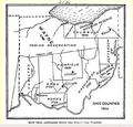
Ohio Counties 1802.png 649 × 621; 254 KB
-
Ohio LOC 91681725.jpg 2,857 × 4,392; 1.88 MB
-
Ohio LOC 91681725.tif 2,857 × 4,392; 35.9 MB
-
Ohio. NYPL1401778.tiff 3,362 × 4,281; 35.6 MB
-
Point Pleasant, Ohio 1877 map.jpg 506 × 703; 127 KB
-
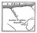
Portage at Cuyahoga.jpg 340 × 308; 18 KB
-
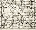
Portage County 1826.jpg 1,634 × 1,374; 622 KB
-
Porter1796WesternReserve-300.jpg 7,403 × 4,937; 6.67 MB
-
PSM V72 D046 Tenant farmers of ohio based on the 12th census of 1900.png 1,639 × 1,784; 372 KB
-
PSM V72 D047 Farm acreage of ohio by county based on the 12th census of 1900.png 1,675 × 1,789; 425 KB
-
Rail road map of Ohio 1873. LOC 98688540.jpg 6,288 × 4,976; 5.56 MB
-
Rail road map of Ohio 1873. LOC 98688540.tif 6,288 × 4,976; 89.52 MB
-
Railroad & township map of Ohio. LOC 98688538.tif 8,430 × 9,545; 230.21 MB
-
Reneshua river-1778.jpg 863 × 304; 111 KB
-
Robinson's Darke County, Ohio rural directory (1910) (14596898979).jpg 2,136 × 3,500; 1.23 MB
-
Seismicity map of the state of Ohio LOC 2016430212.jpg 11,628 × 7,721; 8.61 MB
-
Seismicity map of the state of Ohio LOC 2016430212.tif 11,628 × 7,721; 256.86 MB
-
Silas Allen's 1810 Royalton Map.jpg 3,264 × 1,840; 1.24 MB
-
Silas Allen's 1810 Royalton Ohio Map.jpg 3,264 × 1,840; 754 KB
-
South Perry (4232061102).jpg 2,000 × 1,591; 2.76 MB
-
The Commercial and financial chronicle (1908) (14775132831).jpg 4,256 × 2,598; 1.75 MB
-
The Commercial and financial chronicle (1910) (14577761600).jpg 4,230 × 2,608; 2.03 MB
-
The Commercial and financial chronicle (1911) (14595469479).jpg 4,304 × 2,632; 2.51 MB
-
The State of Ohio, with part of Upper Canada, etc. LOC 2011585896.jpg 5,530 × 6,474; 3.16 MB
-
The State of Ohio, with part of Upper Canada, etc. LOC 2011585896.tif 5,530 × 6,474; 102.43 MB
-
Two Mile Square Reserve.png 539 × 650; 53 KB
-
US Military Dist (Ohio).png 1,143 × 597; 601 KB
-
Vaughnsville Map as of 1895 Atlas.jpg 678 × 568; 182 KB
-
View of Johnson's Island, near Sandusky City, O. LOC 99447489.jpg 10,697 × 6,931; 16.99 MB
-
Wetland areas, Beaver Creek watershed, Greene County, Ohio LOC 96681729.jpg 4,672 × 3,377; 2 MB
-
Wetland areas, Beaver Creek watershed, Greene County, Ohio LOC 96681729.tif 4,672 × 3,377; 45.14 MB


