
Category:Old maps of South Carolina
States of the United States: Alabama · Alaska · Arizona · Arkansas · California · Colorado · Connecticut · Delaware · Florida · Georgia · Hawaii · Idaho · Illinois · Indiana · Iowa · Kansas · Kentucky · Louisiana · Maine · Maryland · Massachusetts · Michigan · Minnesota · Mississippi · Missouri · Montana · Nebraska · Nevada · New Hampshire · New Jersey · New Mexico · New York · North Carolina · North Dakota · Ohio · Oklahoma · Oregon · Pennsylvania · Rhode Island · South Carolina · South Dakota · Tennessee · Texas · Utah · Vermont · Virginia · Washington · West Virginia · Wisconsin · Wyoming – District of Columbia: Washington, D.C.
Guam · Northern Mariana Islands · Puerto Rico
Guam · Northern Mariana Islands · Puerto Rico
Subcategories
This category has the following 38 subcategories, out of 38 total.
A
B
C
D
F
G
L
M
O
S
U
Y
Media in category "Old maps of South Carolina"
The following 200 files are in this category, out of 373 total.
(previous page) (next page)-
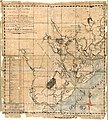
 (Map of the coast of South Carolina, from Charleston to Savannah). LOC 2006635349.jpg 5,182 × 6,976; 5.09 MB
-
 (Map of the coast of South Carolina, from Charleston to Savannah). LOC 2006635349.tif 5,182 × 6,976; 103.43 MB
-

-

-

-
 (Plan of Fort Sumter, South Carolina) - surveyed, March 20th, 22, 27, 1865. LOC 2003623397.tif 7,483 × 6,713; 143.72 MB
-

-
 (Plat of land grant survey in South Carolina, accompanied by deed of grant) LOC 2003623396.tif 7,832 × 4,072; 91.24 MB
-

-

-
-
-
 1676 John Speed Map of Carolina - Geographicus - Carolina-speed-1676.jpg 5,000 × 3,783; 5.23 MB
-
 1757 map of South Carolina.jpeg 5,830 × 6,474; 2.4 MB
-
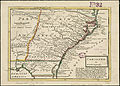
 1779 map of South Carolina.jpeg 2,233 × 2,690; 904 KB
-
-
 1818 map of South Carolina.jpeg 2,654 × 2,390; 912 KB
-
 1846 Mitchell - Burroughs Map of South Carolina - Geographicus - SC-m-1846.jpg 3,500 × 2,831; 2.69 MB
-

-

-
 1855 Colton Map of South Carolina - Geographicus - SouthCarolina-colton-1855.jpg 4,000 × 3,310; 3.92 MB
-

-

-

-

-

-

-

-

-

-
 A chart of South Carolina and Georgia (3045543193).jpg 1,655 × 2,000; 3.16 MB
-

-

-
 A draught of South Carolina and Georgia from Sewee to St. Estaca. LOC 74692766.jpg 9,922 × 5,871; 9.43 MB
-
 A draught of South Carolina and Georgia from Sewee to St. Estaca. LOC 74692766.tif 9,922 × 5,871; 166.66 MB
-
 A large draft of SOUTH CAROLINA from cape Roman to Port Royall NYPL1640623.tiff 7,230 × 5,428; 112.28 MB
-
 A large draught Port Royall harbour in CAROLINA NYPL1640622.tiff 5,428 × 7,230; 112.28 MB
-

-
-

-
 A map of South Carolina, from the best authorities. NYPL1567534.tiff 7,230 × 5,428; 112.28 MB
-

-

-

-
 A New and accurate map of the province of South Carolina in North America (5120560367).jpg 1,662 × 2,000; 3.43 MB
-

-
 A new and accurate map of the province of South Carolina in North America. LOC 2013593294.tif 3,465 × 4,155; 41.19 MB
-
 A new map of Carolina (8643472096).jpg 660 × 800; 122 KB
-
 A new mapp of Carolina (9492653817).jpg 800 × 644; 161 KB
-
 A new mapp of CAROLINA; A large draught of Ashly and Coopers River. NYPL1640624.tiff 7,230 × 5,428; 112.28 MB
-

-
 A plan of Port Royal in South Carolina. LOC 74692650.jpg 7,136 × 8,832; 8.89 MB
-
 A plan of Port Royal in South Carolina. LOC 74692650.tif 7,136 × 8,832; 180.32 MB
-

-

-

-

-
 A sketch of the battle near Camden in South Carolina, 16 Augst. 1780. LOC 73691876.jpg 4,167 × 3,869; 3.07 MB
-
 A sketch of the battle near Camden in South Carolina, 16 Augst. 1780. LOC 73691876.tif 4,167 × 3,869; 46.13 MB
-

-
-
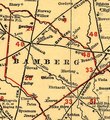 Bamberg County on South Carolina railroads 1900 (cropped).tif 750 × 820; 1.76 MB
-
 Beaufort County, South Carolina LOC 2013593120.jpg 7,525 × 9,900; 15.21 MB
-
 Beaufort County, South Carolina LOC 2013593120.tif 7,525 × 9,900; 213.14 MB
-

-

-
 Bird's eye view of the city of Charleston, South Carolina 1872. LOC 75696567.jpg 10,456 × 6,880; 20.13 MB
-
 Bird's eye view of the city of Charleston, South Carolina 1872. LOC 75696567.tif 10,456 × 6,880; 205.81 MB
-
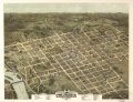
 Bird's eye view of the city of Columbia, South Carolina 1872. LOC 75696568.jpg 8,880 × 6,848; 14.2 MB
-
 Bird's eye view of the city of Columbia, South Carolina 1872. LOC 75696568.tif 8,880 × 6,848; 173.98 MB
-
 Broad River and its tributaries, S.C. LOC 99448812.jpg 3,028 × 4,606; 1.84 MB
-
 Broad River and its tributaries, S.C. LOC 99448812.tif 3,028 × 4,606; 39.9 MB
-
 Bulletin of the U.S. Department of Agriculture (1913-1923.) (20489487082).jpg 2,976 × 3,444; 1.36 MB
-
 Carolina (4578776095).jpg 5,116 × 3,676; 9.42 MB
-
 Carolina newly discribed - by Iohn Seller. NYPL433729.tiff 3,798 × 3,265; 35.48 MB
-
 Carolinas1856.jpg 6,522 × 4,652; 2.61 MB
-
 Caroline méridionale et partie de la Georgie, LOC 75693290.jpg 12,703 × 15,995; 22.39 MB
-

-

-
 Carte des costes de la Floride Françoise, suivant les premieres découvertes (3120844840).jpg 1,508 × 2,000; 3.26 MB
-
 Carte des deux Carolines et de la Géorgie (4579394300).jpg 4,796 × 3,164; 6.4 MB
-
 Charles-Town, capitale de la Caroline. LOC gm71002162.jpg 1,670 × 2,496; 592 KB
-
 Charles-Town, capitale de la Caroline. LOC gm71002162.tif 1,670 × 2,496; 11.93 MB
-
 Charleston and its defences. LOC 99448819.jpg 3,085 × 3,749; 1.94 MB
-
 Charleston and its defences. LOC 99448819.tif 3,085 × 3,749; 33.09 MB
-
 Charleston Harbor and city defences LOC 99448816.jpg 8,773 × 5,369; 4.87 MB
-
 Charleston Harbor and city defences LOC 99448816.tif 8,773 × 5,369; 134.76 MB
-

-
 Charleston Harbor and its approaches showing the positions of the Rebel batteries LOC lva0000206.tif 6,261 × 7,650; 137.03 MB
-

-

-

-

-
 Charleston Harbor and its approaches showing the positions of the Rebel batteries. LOC 99448828.tif 6,181 × 7,970; 140.94 MB
-

-
 Charleston Harbor and its approaches showing the positions of the Rebel batteries. LOC 99448829.tif 8,494 × 8,330; 202.43 MB
-
 Charleston Harbor S.C. Bombardment of Fort Sumter. LOC gvhs01.vhs00058.jpg 1,518 × 2,195; 527 KB
-
 Charleston Harbor S.C. Bombardment of Fort Sumter. LOC gvhs01.vhs00058.tif 1,518 × 2,195; 9.53 MB
-
 Charleston S.C., A.D. 1864 LOC gvhs01.vhs00284.jpg 2,682 × 3,594; 1.58 MB
-
 Charleston S.C., A.D. 1864 LOC gvhs01.vhs00284.tif 2,682 × 3,594; 27.58 MB
-
 Christ Church Parish, So. Ca. - (Charleston District) LOC 2006636708.jpg 5,883 × 4,873; 2.84 MB
-
 Christ Church Parish, So. Ca. - (Charleston District) LOC 2006636708.tif 5,883 × 4,873; 82.02 MB
-
 Clemson campus map 1896.png 2,363 × 2,779; 4.72 MB
-
 Climatological data, South Carolina (1900) (14777834152).jpg 2,864 × 2,096; 536 KB
-
 Coast of South Carolina from Charleston to Hilton Head (close up on Edisto Island).tif 1,681 × 1,547; 7.25 MB
-
 Coast of South Carolina from Charleston to Hilton Head.tif 10,667 × 6,832; 208.52 MB
-
 Columbia, S.C. LOC 77696234.tif 9,233 × 9,347; 246.91 MB
-

-
 Copy of the plot of the city of Beaufort, South Carolina LOC 79690340.jpg 8,360 × 5,473; 5.61 MB
-
 Copy of the plot of the city of Beaufort, South Carolina LOC 79690340.tif 8,360 × 5,473; 130.9 MB
-

-
 Defences of Charleston Harbor. Fortifications on James Island LOC 99448830.jpg 9,575 × 4,336; 3.8 MB
-
 Defences of Charleston Harbor. Fortifications on James Island LOC 99448830.tif 9,575 × 4,336; 118.78 MB
-
 Defences of Charleston S.C. Fortifications on Sullivan's Island LOC 99448831.jpg 10,961 × 3,716; 4.16 MB
-
 Defences of Charleston S.C. Fortifications on Sullivan's Island LOC 99448831.tif 10,961 × 3,716; 116.53 MB
-
 Defences of Charleston, South Carolina LOC 99448832.jpg 10,999 × 4,867; 4.94 MB
-
 Defences of Charleston, South Carolina LOC 99448832.tif 10,999 × 4,867; 153.16 MB
-

-
 Fort Moultrie, Fort Sumter National Monument, South Carolina LOC 2008621681.jpg 10,130 × 4,785; 7.53 MB
-
 Fort Moultrie, Fort Sumter National Monument, South Carolina LOC 2008621681.tif 10,130 × 4,785; 138.68 MB
-
 Fort Moultrie, Fort Sumter National Monument, South Carolina LOC 2008626737.jpg 10,152 × 4,784; 9.57 MB
-
 Fort Moultrie, Fort Sumter National Monument, South Carolina LOC 2008626737.tif 10,152 × 4,784; 138.95 MB
-
 Fort Moultrie, Fort Sumter National Monument, South Carolina LOC 98683614.jpg 5,228 × 9,648; 8.27 MB
-
 Fort Moultrie, Fort Sumter National Monument, South Carolina LOC 98683614.tif 5,228 × 9,648; 144.31 MB
-
 Fort Sumter today LOC 2002625062.jpg 10,106 × 4,752; 8.85 MB
-
 Fort Sumter today LOC 2002625062.tif 10,106 × 4,752; 137.4 MB
-

-

-
 Fort Wagner. Morris Island LOC gvhs01.vhs00230.jpg 1,583 × 2,591; 727 KB
-
 Fortifications around Charleston, H.B. ... LOC lva0000154.jpg 3,144 × 2,666; 1.23 MB
-
 Francis Marion and Sumter National Forests recreation directory LOC 2005633309.jpg 13,993 × 5,262; 10.9 MB
-
 Francis Marion and Sumter National Forests recreation directory LOC 98683611.jpg 13,902 × 5,268; 10.84 MB
-
 Francis Marion National Forest, South Carolina LOC 83690424.jpg 13,495 × 7,029; 14.97 MB
-
 Francis Marion National Forest, South Carolina LOC 83690424.tif 13,495 × 7,029; 271.39 MB
-
 Francis Marion National Forest, South Carolina LOC 97683428.tif 16,022 × 7,124; 326.56 MB
-
 Francis Marion National Forest, South Carolina, 1968. LOC 75690001.jpg 12,389 × 6,794; 12.31 MB
-
 Francis Marion National Forest, South Carolina, 1968. LOC 75690001.tif 12,389 × 6,794; 240.82 MB
-
 Francis Marion National Forest, South Carolina. LOC 75695936.jpg 7,242 × 6,940; 7.33 MB
-
 Francis Marion National Forest, South Carolina. LOC 75695936.tif 7,242 × 6,940; 143.79 MB
-
 General descriptive map of Anderson County, S.C LOC 2013593118.jpg 11,072 × 8,362; 17.34 MB
-
 General descriptive map of Anderson County, S.C LOC 2013593118.tif 11,072 × 8,362; 264.89 MB
-
-

-

-

-

-

-

-
 Hartwell Lake fishing information LOC 80690812.jpg 9,773 × 11,145; 16.19 MB
-
 Hartwell Lake fishing information LOC 80690812.tif 9,773 × 11,145; 311.62 MB
-
 Hartwell Lake recreation LOC 2005633603.jpg 9,964 × 5,583; 7.45 MB
-
 Hartwell Lake recreation LOC 2005633603.tif 9,964 × 5,583; 159.16 MB
-
 Hartwell Lake recreation LOC 2006629749.tif 9,908 × 5,532; 156.82 MB
-
 Hartwell Lake recreation LOC 98683623.jpg 9,941 × 5,552; 7.86 MB
-
 Hartwell Lake recreation LOC 98683623.tif 9,941 × 5,552; 157.91 MB
-
 Hartwell Lake, Georgia and South Carolina LOC 83692819.jpg 13,050 × 7,398; 13 MB
-
 Hartwell Lake, Georgia and South Carolina LOC 83692819.tif 13,050 × 7,398; 276.21 MB
-
 Hartwell Lake, Georgia and South Carolina. LOC 75690124.jpg 10,534 × 6,806; 7.9 MB
-
 Hartwell Lake, Georgia and South Carolina. LOC 75690124.tif 10,534 × 6,806; 205.12 MB
-
 Hartwell Lake, Georgia and South Carolina. LOC 77696223.jpg 10,689 × 5,573; 8.11 MB
-
 Hartwell Lake, Georgia and South Carolina. LOC 77696223.tif 10,689 × 5,573; 170.43 MB
-
 Hartwell Reservoir, Georgia and South Carolina. LOC 77696311.jpg 10,675 × 5,579; 8.25 MB
-
 Hartwell Reservoir, Georgia and South Carolina. LOC 77696311.tif 10,675 × 5,579; 170.39 MB
-
 Hydrologic unit map, South Carolina LOC 97683355.jpg 3,334 × 2,574; 1.22 MB
-
 Hydrologic unit map, South Carolina LOC 97683355.tif 3,334 × 2,574; 24.55 MB
-
 Hydrologic unit map, South Carolina LOC 97683356.jpg 6,372 × 5,146; 4.73 MB
-
 Hydrologic unit map, South Carolina LOC 97683356.tif 6,372 × 5,146; 93.81 MB
-

-
 Important farmlands map, Darlington County, South Carolina LOC 95682944.tif 16,205 × 7,634; 353.93 MB
-

-

-
 J. H. Colton's School Atlas, 1860 - DPLA - 9afa4d40de861bb7b2a7e024bba61c0e (page 16).jpg 4,093 × 4,918; 2.35 MB
-
 J. Strom Thurmond project recreation LOC 2005632189.jpg 9,837 × 5,544; 7.04 MB
-
 J. Strom Thurmond project recreation LOC 2005632189.tif 9,837 × 5,544; 156.03 MB
-

-
 Kings Mountain National Military Park, South Carolina LOC 95682512.jpg 5,937 × 4,591; 3.96 MB
-
 Kings Mountain National Military Park, South Carolina LOC 95682512.tif 5,937 × 4,591; 77.98 MB
-
 Kings Mountain National Military Park, South Carolina LOC 96683869.jpg 5,983 × 4,546; 3.95 MB
-
 Kings Mountain National Military Park, South Carolina LOC 96683869.tif 5,983 × 4,546; 77.82 MB
-
 Kings Mountain official map and guide LOC 2002625048.jpg 10,216 × 4,790; 7.79 MB
-
 Kings Mountain official map and guide LOC 2002625048.tif 10,216 × 4,790; 140 MB
-
 Kings Mountain, National Military Park, South Carolina LOC 2003629043.jpg 10,270 × 4,831; 7.69 MB
-
 Kings Mountain, National Military Park, South Carolina LOC 2003629043.tif 10,270 × 4,831; 141.95 MB
-
 Kings Mountain, National Military Park, South Carolina LOC 2005632711.jpg 10,297 × 4,840; 8.38 MB
-
 Kings Mountain, National Military Park, South Carolina LOC 2005632711.tif 10,297 × 4,840; 142.59 MB
-
 Kings Mountain, National Military Park, South Carolina LOC 2008621682.jpg 10,217 × 4,833; 8.08 MB
-
 Kings Mountain, National Military Park, South Carolina LOC 2008621682.tif 10,217 × 4,833; 141.27 MB
-
 Kings Mountain, National Military Park, South Carolina LOC 2008627708.jpg 10,190 × 4,837; 8.16 MB
-
 Kings Mountain, National Military Park, South Carolina LOC 2010594825.jpg 10,139 × 4,822; 8.14 MB
-
 Kings Mountain, National Military Park, South Carolina LOC 2010594825.tif 10,139 × 4,822; 139.88 MB
-
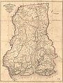
 Laurens District, South Carolina LOC 2007627645.jpg 7,278 × 5,677; 4.94 MB
-
 Laurens District, South Carolina LOC 2007627645.tif 7,278 × 5,677; 118.21 MB
-
 Map of Anderson County, South Carolina LOC 2013593119.jpg 11,573 × 12,331; 23.71 MB
-
 Map of Anderson County, South Carolina LOC 2013593119.tif 11,573 × 12,331; 408.29 MB
-
 Map of Charleston and its defences LOC 99448840.jpg 8,221 × 6,509; 10.21 MB
-
 Map of Charleston Harbor showing defenses. 186- LOC 99448813.jpg 3,287 × 2,260; 1.2 MB
-
 Map of Charleston Harbor showing defenses. 186- LOC 99448813.tif 3,287 × 2,260; 21.25 MB
-

-
 Map of Charleston Harbor, S.C. LOC 99448815.jpg 7,460 × 5,628; 6.1 MB
-
 Map of Charleston Harbor, S.C. LOC 99448815.tif 7,460 × 5,628; 120.12 MB
._LOC_2006635349.jpg)
._LOC_2006636167.jpg)
_-_surveyed,_March_20th,_22,_27,_1865._LOC_2003623397.jpg)
_LOC_2003623396.jpg)

.jpg)


.jpg)


_-_Geographicus_-_EdistoRiver-uscs-1852.jpg)


.jpg)
.jpg)
.jpg)
.jpg)


.jpg)

.jpg)
.jpg)
_(14739761956).jpg)


_01.jpg)
.jpg)

_Ga.,_with_5_mile_distance_lines_in_circles_round_Beaufort,_and_R.R._connections,_roads,_etc._etc._LOC_99448811.jpg)


_(20489487082).jpg)
.jpg)


,_jusqu%27%C3%A0_Brunswick_(G%C3%A9orgie),_indiquant_les_moyens_de_communication_entre_Beaufort,_Savanah_LOC_79695129.jpg)
.jpg)
.jpg)


_LOC_2006636708.jpg)

_(14777834152).jpg)


_and_obstructions_LOC_lva0000205.jpg)


.jpg)

_-_Geographicus_-_EdistoRiver-uscs-1852.jpg)


.jpg)