Category:Maps of Connecticut
Jump to navigation
Jump to search
States of the United States: Alabama · Alaska · Arizona · Arkansas · California · Colorado · Connecticut · Delaware · Florida · Georgia · Hawaii · Idaho · Illinois · Indiana · Iowa · Kansas · Kentucky · Louisiana · Maine · Maryland · Massachusetts · Michigan · Minnesota · Mississippi · Missouri · Montana · Nebraska · Nevada · New Hampshire · New Jersey · New Mexico · New York · North Carolina · North Dakota · Ohio · Oklahoma · Oregon · Pennsylvania · Rhode Island · South Carolina · South Dakota · Tennessee · Texas · Utah · Vermont · Virginia · Washington · West Virginia · Wisconsin · Wyoming – Washington, D.C.
insular area of the United States: American Samoa · Guam · Northern Mariana Islands · Puerto Rico · United States Virgin Islands – United States Minor Outlying Islands: Baker Island · Howland Island · Jarvis Island · Johnston Atoll · Kingman Reef · Midway Atoll · Navassa Island · Palmyra Atoll · Wake Island
insular area of the United States: American Samoa · Guam · Northern Mariana Islands · Puerto Rico · United States Virgin Islands – United States Minor Outlying Islands: Baker Island · Howland Island · Jarvis Island · Johnston Atoll · Kingman Reef · Midway Atoll · Navassa Island · Palmyra Atoll · Wake Island
Wikimedia category | |||||
| Upload media | |||||
| Instance of | |||||
|---|---|---|---|---|---|
| Category combines topics | |||||
| Connecticut | |||||
state of the United States of America | |||||
| Pronunciation audio | |||||
| Instance of | |||||
| Part of | |||||
| Named after | |||||
| Location |
| ||||
| Located in or next to body of water | |||||
| Capital | |||||
| Legislative body | |||||
| Executive body | |||||
| Highest judicial authority | |||||
| Anthem |
| ||||
| Head of government |
| ||||
| Inception |
| ||||
| Highest point | |||||
| Population |
| ||||
| Area |
| ||||
| Elevation above sea level |
| ||||
| Replaces | |||||
| Different from | |||||
| Maximum temperature record |
| ||||
| Minimum temperature record |
| ||||
| official website | |||||
 | |||||

Subcategories
This category has the following 33 subcategories, out of 33 total.
Media in category "Maps of Connecticut"
The following 46 files are in this category, out of 46 total.
-
1713 border map of Massachusetts and Connecticut.jpg 6,623 × 3,201; 1.43 MB
-
2012NewtownShootingLocation.png 1,069 × 1,628; 660 KB
-
A map showing the majority racial or ethnic group in Connecticut by census block.png 10,367 × 8,732; 2.82 MB
-
BartlettCT.png 760 × 693; 493 KB
-
Borough of Woodmont CT FEMA flood map 2013.jpg 1,085 × 799; 166 KB
-
Connecticut 90.jpg 435 × 389; 75 KB
-
Connecticut Communities by per capita income.png 1,200 × 870; 219 KB
-
Connecticut Köppen.png 6,300 × 6,600; 327 KB
-
Connecticut POI.png 726 × 531; 20 KB
-
Connecticut population map.png 700 × 400; 111 KB
-
Connecticut wind resource map 50m 800.jpg 1,100 × 850; 560 KB
-
Connecticut, from Actual Survey, Made in 1811 - NARA - 102279673 (page 1).jpg 7,298 × 11,657; 11.91 MB
-
Connecticut, from Actual Survey, Made in 1811 - NARA - 102279673 (page 2).jpg 7,082 × 11,715; 10.61 MB
-
COVID-19 Cases in Connecticut by counties.png 1,624 × 1,184; 116 KB
-
CT - DOC Facilities Map.png 816 × 600; 100 KB
-
CT Counties by Population (2020 census).png 721 × 543; 31 KB
-
CT regions 2013.jpg 595 × 433; 55 KB
-
Ct trunklines.jpg 560 × 447; 110 KB
-
CT-15 map.png 1,750 × 1,280; 60 KB
-
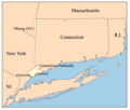
Ctpanhandle.png 300 × 254; 12 KB
-
CTswineflu.png 710 × 500; 40 KB
-
CtUScensusMap.png 2,815 × 2,222; 1.44 MB
-
Dave's Redistricting 2020 - Connecticut.png 2,560 × 1,472; 3.15 MB
-
FMIB 37689 Oyster Grounds - State of Connecticut, 1889.jpeg 1,171 × 933; 276 KB
-
Franklin CT Map 1811.png 770 × 710; 1.03 MB
-
Goldcoastct.png 472 × 341; 12 KB
-
Greater Hartford.png 589 × 429; 17 KB
-
HighlandsConnecticutNewJerseyNewYorkPennsylvaniaMap.jpg 2,550 × 3,300; 529 KB
-
Indiantrails1625.jpg 640 × 480; 39 KB
-
Joshuas Trust Towns.png 792 × 612; 172 KB
-
Long island1.jpg 1,005 × 437; 169 KB
-
Map of Connecticut Regions.png 2,534 × 1,692; 321 KB
-
Map of the Atlantic Highway WDL11556.png 1,024 × 1,769; 3.08 MB
-
Meshomasic State Forest Locator Map.jpg 325 × 240; 12 KB
-
Pagegen ct-page-001.jpg 3,300 × 2,550; 1.01 MB
-
Population density of Connecticut counties (2020).jpg 4,293 × 3,972; 444 KB
-
Quinniapic University CDP (2020).jpg 1,123 × 673; 161 KB
-
Raymark Superfund Site Map 2016.png 1,650 × 2,550; 5.22 MB
-
Southeastct.png 539 × 394; 15 KB
-
Southport (Conn.) census tract.gif 575 × 425; 78 KB
-
Southwestct.png 474 × 344; 12 KB
-
US-CT-BSA-COUNCILS.PNG 450 × 336; 45 KB
-
Whitneyville1868BeersMap.jpg 953 × 1,047; 658 KB
-
Wpdms ev26188 blockislandsound.jpg 326 × 222; 19 KB


