Category:Old maps of Louisiana
Jump to navigation
Jump to search
States of the United States: Alabama · Alaska · Arizona · Arkansas · California · Colorado · Connecticut · Delaware · Florida · Georgia · Hawaii · Idaho · Illinois · Indiana · Iowa · Kansas · Kentucky · Louisiana · Maine · Maryland · Massachusetts · Michigan · Minnesota · Mississippi · Missouri · Montana · Nebraska · Nevada · New Hampshire · New Jersey · New Mexico · New York · North Carolina · North Dakota · Ohio · Oklahoma · Oregon · Pennsylvania · Rhode Island · South Carolina · South Dakota · Tennessee · Texas · Utah · Vermont · Virginia · Washington · West Virginia · Wisconsin · Wyoming – District of Columbia: Washington, D.C.
Guam · Northern Mariana Islands · Puerto Rico
Guam · Northern Mariana Islands · Puerto Rico
Subcategories
This category has the following 12 subcategories, out of 12 total.
Media in category "Old maps of Louisiana"
The following 200 files are in this category, out of 459 total.
(previous page) (next page)-

-

-
 (Livingston Parish, Louisiana) LOC 2012592320.jpg 8,278 × 6,881; 6.41 MB
-
 (Map of Spanish West Florida bounded by Rios Comite and Amite). LOC 2012593398.jpg 6,102 × 8,831; 5.56 MB
-
 (Map of the Tunica Bend area, Spanish West Florida). LOC 2013585031.jpg 5,689 × 6,096; 4.34 MB
-

-

-
 1718 Carte de la Louisiane - Ouabache detail.jpg 1,984 × 1,488; 399 KB
-
 1732 map of Louisiana.jpg 9,482 × 5,386; 11.85 MB
-
 1850 IC.jpg 3,536 × 5,856; 2.99 MB
-

-

-

-
-
 1853 U.S.C.S. Map of Timbalier Bay, Louisiana - Geographicus - TimballierBay-uscs-1853.jpg 4,000 × 2,721; 1,001 KB
-

-

-
 1874 U.S. Coast Survey Map of the Mississippi Delta - Geographicus - MissDelta-uscs-1874.jpg 6,000 × 7,325; 7.31 MB
-
 CARTE DE LA COTE DE LOUISIANE (1720).jpg 4,320 × 2,417; 3.94 MB
-
 Partie du Nord de l' Amerique (1717).jpg 2,188 × 2,990; 3.64 MB
-
 1895 Vernon Parish.jpg 800 × 724; 156 KB
-
 1984 classified Landsat Thematic Mapper Satellite, Louisiana LOC 92682945.jpg 4,979 × 3,266; 2.26 MB
-
 1995 census test site locator map for Louisiana Parishes. LOC 2017586068.jpg 2,530 × 3,264; 1.06 MB
-
 A draught of West Florida, from Cape St. Blaze to the River Iberville.jpg 11,934 × 4,971; 27 MB
-

-
 A map of Canada and the north part of Louisiana with the adjacent countrys. LOC 73695757.jpg 5,399 × 3,460; 2.46 MB
-
 A map of Canada and the north part of Louisiana with the adjacent countrys. LOC 73695758.jpg 9,492 × 4,088; 4.88 MB
-
 A map of Louisiana and of the River Mississipi (4231931192).jpg 2,000 × 1,782; 3.83 MB
-

-

-
 A new map of the River Mississipi from the sea to Bayagoulas (2673862061).jpg 2,000 × 1,517; 2.81 MB
-

-

-

-

-

-
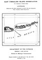
 Annual Reports of the Department of the Interior 1905 (1905) (14804494123).jpg 3,314 × 1,556; 829 KB
-

-
 Approaches to Fort Butte La Rose, Louisiana, LOC 99447199.jpg 5,145 × 4,549; 2.22 MB
-
 Arbuckle Bros. Coffee Company (3093818696).jpg 799 × 472; 317 KB
-
 Archives nationales d’outre-mer - Louisiane - Jacques-Nicolas Bellin - 1744 - 001.jpg 5,262 × 3,921; 3.73 MB
-

-

-
 Atchafalaya outlet, Mississippi River and tributaries LOC 94680614.jpg 10,055 × 7,447; 11.72 MB
-
 BalizeMap1723.jpeg 595 × 468; 115 KB
-
 Barthelemy Lafon - Map of Louisiana - 1806 - 001.jpg 12,999 × 8,929; 17.15 MB
-
 Battle of Stirling's Plantation.jpg 3,270 × 2,472; 1.68 MB
-
 BattleOfNewOrleansAreaMap.jpg 1,100 × 1,091; 294 KB
-
 Bayou Sauvage National Wildlife Refuge LOC 2014589212.jpg 5,366 × 8,848; 5.69 MB
-
 Birds eye view of the city of Louisiana, Pike County, Mo. LOC 2015594060.jpg 7,956 × 6,319; 9.65 MB
-
 Bocage's official map of the Parish of Terrebonne, Louisiana LOC 2013593065.jpg 11,489 × 14,415; 21.97 MB
-
 Bonnet Carré Spillway LOC 94680711.jpg 9,578 × 3,347; 4.37 MB
-

-
 Bulletin of the U.S. Department of Agriculture (1913-1923.) (19878072724).jpg 4,442 × 1,550; 1.85 MB
-
 Burr's Ferry (and vicinity, Sabine River, Louisana and Texas.) - NARA - 305711.tif 5,400 × 3,732; 57.66 MB
-

-

-
 Cadastral map of a portion of Feliciana District, Spanish West Florida. LOC 2013585064.jpg 5,938 × 4,010; 2.93 MB
-
 Calcasieu Pass, Louisiana LOC 80691506.jpg 4,731 × 6,736; 3.25 MB
-
 Canada et Louisiane, LOC 74695306.jpg 5,963 × 7,435; 8.05 MB
-
 Canada, Louisiane et terres angloises par le Sr. d'Anville ... MDCCLV. LOC 74694276.jpg 13,360 × 5,710; 12.85 MB
-
 Cane River Creole National Historical Park, Louisiana LOC 2014589368.jpg 7,303 × 5,417; 6.36 MB
-
 Cane River Creole National Historical Park, Louisiana LOC 2014590123.jpg 7,316 × 5,417; 5.64 MB
-
 Carte de l'embouchure du Mississippi et des rivières voisines en 1718.jpg 1,853 × 1,508; 1.01 MB
-

-

-

-
 Carte de la Louisiane et de la Floride. LOC 73691856.jpg 3,714 × 5,654; 2.96 MB
-
 Carte de la Louisiane et des pays voisins LOC 73693831.jpg 7,255 × 5,661; 6.77 MB
-
 Carte de la Louisiane et des pays voisins LOC 73696615.jpg 7,486 × 5,967; 6.95 MB
-

-
 Carte de la Louisiane et du cours du Mississippi (NBY 15584).jpg 3,600 × 2,537; 1.86 MB
-

-
 Carte de la Louisiane ou des voyages du Sr de LaSalle.png 6,344 × 4,871; 67.28 MB
-
 Carte de la Louisiane par le Sr. d'Anville. LOC 75692506.jpg 11,186 × 6,439; 9.59 MB
-
 Carte de la Louisiane, et de la Floride. LOC 73697603.jpg 4,176 × 6,321; 3.62 MB
-
 Carte de la Louisiane, et de la Floride. LOC 74692214.jpg 4,187 × 5,819; 3.55 MB
-
-
 Carte des embouchures du Mississipi (4578758073).jpg 6,276 × 9,258; 18.13 MB
-

-

-

-
 Carte Louisiane Benard de la Harpe 1724.jpg 1,022 × 1,386; 498 KB
-

-

-
 CartedelaLouisiane.jpg 800 × 615; 251 KB
-
 CarteRéduiteDesCostesDeLaLouisianeEtDeLaFloride1764-3.jpg 10,502 × 6,960; 19.84 MB
-

-
-
 Chalmette - a unit of Jean Lafitte National Historical Park, Louisiana LOC 93682549.jpg 5,443 × 4,953; 3.86 MB
-
 Chalmette battlefield - Jean Lafitte National Historical Park, Louisiana LOC 2001623226.jpg 5,338 × 4,961; 3.63 MB
-
 Chalmette battlefield - Jean Lafitte National Historical Park, Louisiana LOC 2002626309.jpg 5,326 × 4,897; 3.27 MB
-

-

-

-

-

-
 Chalmette Battlefield, Jean Lafitte National Historical Park, Louisiana LOC 2014590102.jpg 5,351 × 4,922; 3.55 MB
-
 Chalmette, a unit of Jean Lafitte National Historical Park LOC 2014590125.tif 5,388 × 4,979; 76.75 MB
-
 Colton's Louisiana. LOC 2010592397.jpg 5,062 × 4,269; 3.52 MB
-
 Colton's Louisiana. LOC 2010592398.jpg 5,069 × 4,256; 3.49 MB
-
 Cram's railroad and township map of Mississippi. (8973039532).jpg 5,362 × 6,949; 7.43 MB
-

-
 Darlington map of louisiana 1680.png 525 × 579; 691 KB
-
 Draught of the R. Ibbeville. LOC 2003627089.jpg 2,573 × 4,619; 1.63 MB
-
 Dto de Baton Rouge. LOC 2013585037.jpg 5,535 × 4,634; 2.97 MB
-
 East and West Florida 1810.jpg 412 × 245; 44 KB
-
 East Timbalier Island Reservation EO 718 illustration (cropped).jpg 1,757 × 1,514; 269 KB
-
 East Timbalier Island Reservation EO 718 illustration.jpg 1,976 × 2,829; 526 KB
-
 EB1911 Louisiana.jpg 2,596 × 1,896; 2.74 MB
-
 EB9 Louisiana.jpg 2,691 × 3,676; 1.53 MB
-

-
 Erosion on agricultural land, Louisiana statewide study. LOC 89697225.jpg 6,088 × 5,662; 4.32 MB
-
 Falls in Red River, surveyed by L. G. De Russy. LOC 99446417.jpg 13,270 × 5,520; 9.71 MB
-
 Flooded areas, vicinity of Monroe, Louisiana. LOC gm71001636.jpg 5,134 × 3,324; 2.54 MB
-
 Fort of Balise, no. 1 report May 30th 1813 LOC 2012588000.jpg 3,416 × 2,363; 1.1 MB
-
 Fort Petites Coquilles - ber the 12th 1813 LOC 2012591000.jpg 5,076 × 2,412; 1.38 MB
-
 Fort St. Philip II.jpg 5,312 × 2,988; 4.79 MB
-
 Fort-DeRussy-1863-05-09.jpg 1,209 × 1,325; 262 KB
-

-
 Frank bond 1912 louisiana and the louisiana purchase.jpg 540 × 330; 78 KB
-
 General soil map, De Soto Parish, Louisiana LOC 93684052.jpg 8,713 × 5,824; 5.24 MB
-
 General soil map, East Feliciania Parish, Louisiana. LOC gm69002185.jpg 6,169 × 8,576; 4.73 MB
-
 General soil map, LaFourche Parish, Louisiana. LOC gm69002240.jpg 6,153 × 8,567; 4.61 MB
-
 General soil map, LaSalle Parish, Louisiana LOC 89695108.jpg 6,190 × 8,613; 5.19 MB
-
 General soil map, Lincoln Parish, Louisiana LOC 92682547.jpg 6,313 × 9,210; 4.72 MB
-
 General soil map, Louisiana LOC 2002626323.jpg 5,044 × 3,266; 2.05 MB
-
 General soil map, Louisiana LOC 2002626324.jpg 4,991 × 3,212; 1.9 MB
-
 General soil map, Orleans Parish, Louisiana LOC 89695109.jpg 12,010 × 4,166; 4.1 MB
-
 General soil map, Sabine Parish, Louisiana LOC 89695111.jpg 6,107 × 8,553; 5.55 MB
-
 General soil map, St. Helena Parish, Louisiana LOC 89695110.jpg 6,121 × 8,588; 5.16 MB
-
 General soil map, St. Helena Parish, Louisiana LOC 89695110.tif 6,121 × 8,588; 150.4 MB
-
 General soil map, St. Tammany Parish, Louisiana. LOC gm69002807.jpg 6,070 × 8,495; 4.32 MB
-
 General soil map, St. Tammany Parish, Louisiana. LOC gm69002807.tif 6,070 × 8,495; 147.53 MB
-
 General soil map, Vernon Parish, Louisiana LOC 89695112.jpg 6,113 × 8,552; 6.12 MB
-
 General soil map, Vernon Parish, Louisiana LOC 89695112.tif 6,113 × 8,552; 149.57 MB
-
 General soil map, West Baton Rouge Parish, Louisiana LOC 89695113.jpg 6,089 × 8,539; 4.11 MB
-
 General soil map, West Baton Rouge Parish, Louisiana LOC 89695113.tif 6,089 × 8,539; 148.76 MB
-
 General soil map, Winn Parish, Louisiana LOC 89695114.jpg 6,059 × 8,482; 5.07 MB
-
 General soil map, Winn Parish, Louisiana LOC 89695114.tif 6,059 × 8,482; 147.04 MB
-
 Harpers Weekly Ship Island drawing.jpg 1,409 × 948; 299 KB
-
 Home Missionary, The (May 1890-April 1891) (1890) (14782943472).jpg 2,656 × 1,724; 496 KB
-

-

-
 Inner Harbor Canal LOC 89697258.jpg 4,455 × 8,952; 10.22 MB
-
 Inner Harbor Canal LOC 89697258.tif 4,455 × 8,952; 114.1 MB
-

-

-

-

-
 J. H. Colton's School Atlas, 1860 - DPLA - 9afa4d40de861bb7b2a7e024bba61c0e (page 18).jpg 4,093 × 4,918; 2.14 MB
-
 Jean Lafitte National Historical Park and Preserve Louisiana. LOC 2014589079.jpg 6,878 × 8,757; 4.68 MB
-
 Jean Lafitte National Historical Park and Preserve Louisiana. LOC 2014589079.tif 6,878 × 8,757; 172.32 MB
-
 Jean Lafitte, Jean Lafitte National Historical Park and Preserve, Louisiana LOC 2002627146.jpg 10,522 × 6,181; 10.21 MB
-
 Jean Lafitte, Jean Lafitte National Historical Park and Preserve, Louisiana LOC 2002627146.tif 10,522 × 6,181; 186.07 MB
-
 Jean Lafitte, Jean Lafitte National Historical Park and Preserve, Louisiana LOC 2010592130.jpg 10,313 × 6,061; 11.38 MB
-
 Jean Lafitte, Jean Lafitte National Historical Park and Preserve, Louisiana LOC 2010592130.tif 10,313 × 6,061; 178.83 MB
-
 Jean Lafitte, Jean Lafitte National Historical Park and Preserve, Louisiana LOC 2010592131.jpg 10,362 × 6,137; 9.61 MB
-
 Jean Lafitte, Jean Lafitte National Historical Park and Preserve, Louisiana LOC 2010592131.tif 10,362 × 6,137; 181.94 MB
-

-
 Jean Lafitte, Jean Lafitte National Historical Park and Preserve, Louisiana LOC 2010592136.tif 5,431 × 4,395; 68.29 MB
-
 JNBellinMap1744MississippiLaBalize.jpg 600 × 403; 106 KB
-
 John Wylie 600 acres. LOC 83695496.jpg 6,598 × 5,028; 3.36 MB
-
 John Wylie 600 acres. LOC 83695496.tif 6,598 × 5,028; 94.91 MB
-

-

-
 Kaart van Louisiana, en Florida. LOC 74692216.jpg 4,300 × 6,835; 3.73 MB
-
 Kaart van Louisiana, en Florida. LOC 74692216.tif 4,300 × 6,835; 84.09 MB
-
 Karte Louisiana 1824 9153.jpg 3,210 × 2,946; 2.23 MB
-
 Kisatchie National Forest (Caney Division), Louisiana. LOC 75695952.jpg 6,618 × 4,872; 3.46 MB
-
 Kisatchie National Forest (Catahoula and Winn Ranger Districts), Louisiana. LOC 75695953.jpg 8,791 × 9,988; 11.02 MB
-
 Kisatchie National Forest (Catahoula and Winn Ranger Districts), Louisiana. LOC 75695953.tif 8,791 × 9,988; 251.21 MB
-

-

-
 Kisatchie National Forest, Caney Ranger District, Louisiana 2006 LOC 2007630084.jpg 7,179 × 5,344; 2.73 MB
-
 Kisatchie National Forest, Caney Ranger District, Louisiana 2006 LOC 2007630084.tif 7,179 × 5,344; 109.76 MB
-
 Kisatchie National Forest, Caney Ranger District, Louisiana 2011 LOC 2011590625.jpg 7,432 × 11,111; 8.8 MB
-
 Kisatchie National Forest, Caney Ranger District, Louisiana 2011 LOC 2011590625.tif 7,432 × 11,111; 236.25 MB
-
 Kisatchie National Forest, Caney Ranger District, Louisiana LOC 2011590590.jpg 6,702 × 4,886; 4.15 MB
-
 Kisatchie National Forest, Caney Ranger District, Louisiana LOC 2011590590.tif 6,702 × 4,886; 93.69 MB
-
-

-

-

-
 Kisatchie National Forest, Louisiana - 2011 LOC 2011590589.jpg 9,483 × 10,708; 10.66 MB
-
 Kisatchie National Forest, Louisiana - 2011 LOC 2011590589.tif 9,483 × 10,708; 290.52 MB
-
 Kisatchie National Forest, Louisiana 2006 LOC 2008621523.jpg 9,600 × 10,733; 10.46 MB
-
 Kisatchie National Forest, Louisiana 2006 LOC 2008621523.tif 9,600 × 10,733; 294.79 MB
-
 Kisatchie National Forest, Louisiana LOC 2011590117.jpg 5,629 × 9,805; 6.06 MB
-
 Kisatchie National Forest, Louisiana LOC 2011590117.tif 5,629 × 9,805; 157.91 MB
-
 Kisatchie National Forest, Louisiana LOC 90681680.jpg 8,152 × 9,756; 13.17 MB
-
 Kisatchie National Forest, Louisiana LOC 90681680.tif 8,152 × 9,756; 227.54 MB
-
 Kisatchie National Forest, Louisiana, 1952 LOC map54000014.jpg 9,319 × 9,341; 9.22 MB
-
 Kisatchie National Forest, Louisiana, 1952 LOC map54000014.tif 9,319 × 9,341; 249.05 MB
-
 La Louisiane et pays voisins. LOC 73693698.jpg 4,928 × 3,458; 2.56 MB
-
 La Louisiane et pays voisins. LOC 73693698.tif 4,928 × 3,458; 48.76 MB
-
 LA Walls 333490 1954 24000 geo page 1.jpg 2,084 × 2,424; 1.62 MB
-
-

-

_LOC_2013585065.jpg)
_onts_et%C3%A9s_relev%C3%A9_a_l%27estime_%26_les_routtes_(i.e._routes)_par_terre_relev%C3%A9_%26_mesur%C3%A9es_aux_pas,_par_les_Srs._LOC_2003623372.jpg)
_LOC_2012592320.jpg)
._LOC_2012593398.jpg)
._LOC_2013585031.jpg)
%27_(11226069906).jpg)


_-_Geographicus_-_HornIslandPass-uscs-1853.jpg)
_-_Geographicus_-_SabinePass-uscs-1853.jpg)


_-_Geographicus_-_MissRive2Col-USCS-1864.jpg)

.jpg)
.jpg)


.jpg)

.jpg)
.jpg)


.jpg)

_(14804494123).jpg)
.jpg)

.jpg)


.jpg)


.jpg)


_onts_et%C3%A9s_relev%C3%A9_a_l%27estime_%26_les_routtes_(i.e._routes)_par_terre_relev%C3%A9_%26_mesur%C3%A9es_aux_pas,_par_les_Srs._LOC_2003623370.jpg)


_(14760365214).jpg)
_(14576023458).jpg)


.jpg)


.jpg)


_(1890)_(14782943472).jpg)


.jpg)


,_Louisiana._LOC_75695952.jpg)
,_Louisiana._LOC_75695953.jpg)
,_Louisiana._LOC_75695954.jpg)


_LOC_2013585038.jpg)
_(19878072724).jpg)