Category:Old maps of Litchfield County, Connecticut
Jump to navigation
Jump to search
Counties of Connecticut: Litchfield · New Haven ·
Subcategories
This category has the following 8 subcategories, out of 8 total.
L
N
T
Media in category "Old maps of Litchfield County, Connecticut"
The following 17 files are in this category, out of 17 total.
-
 (Map of the town of Sharon, Litchfield County, Conn.). LOC 2011589310.jpg 11,430 × 16,292; 21.26 MB
-
 (Map of the town of Sharon, Litchfield County, Conn.). LOC 2011589310.tif 11,430 × 16,292; 532.77 MB
-
 (Map of town of Canaan, Connecticut). LOC 2004626473.jpg 7,676 × 11,531; 14.16 MB
-
 Northville (New Milford) Map Snippet.png 406 × 309; 226 KB
-
 Wolcottville, Conn. LOC 74693297.jpg 7,712 × 6,208; 8.97 MB
-
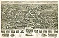
 View of Thomaston, Conn. 1879. LOC 74693239.jpg 7,744 × 6,000; 8.49 MB
-
 View of New Milford, Conn. (2674633970).jpg 2,000 × 1,564; 2.37 MB
-
 Aero view of Watertown, Connecticut 1918. LOC 75693168.jpg 10,736 × 6,976; 11.94 MB
-
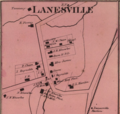 Lanesville-CT-Crop.png 692 × 660; 744 KB
-
 Map of New Milford, Litchfield Co., Conn. (10212587553).jpg 800 × 715; 137 KB
-
 Map of New Milford, Litchfield Co., Conn.. LOC 2011589302.jpg 10,213 × 13,995; 18.84 MB
-
 Map of the town of Norfolk, Litchfield County, Ct. LOC 2011589304.jpg 9,970 × 15,309; 17.6 MB
-
 Map of the town of Salisbury, Litchfield Co., Connecticut. LOC 2011589306.jpg 12,521 × 15,845; 24.11 MB
-

-
 Map of the town of Winchester, Litchfield County, Conn. (9136602783).jpg 648 × 800; 123 KB
-

-
 (Map of the town of New Hartford, Litchfield Co., Conn.). LOC 2011589292.tif 15,368 × 11,682; 513.64 MB
._LOC_2011589310.jpg)
._LOC_2004626473.jpg)
_Map_Snippet.png)


.jpg)


.jpg)


.jpg)
.jpg)
.jpg)