Category:Maps of Louisiana
Jump to navigation
Jump to search
States of the United States: Alabama · Alaska · Arizona · Arkansas · California · Colorado · Connecticut · Delaware · Florida · Georgia · Hawaii · Idaho · Illinois · Indiana · Iowa · Kansas · Kentucky · Louisiana · Maine · Maryland · Massachusetts · Michigan · Minnesota · Mississippi · Missouri · Montana · Nebraska · Nevada · New Hampshire · New Jersey · New Mexico · New York · North Carolina · North Dakota · Ohio · Oklahoma · Oregon · Pennsylvania · Rhode Island · South Carolina · South Dakota · Tennessee · Texas · Utah · Vermont · Virginia · Washington · West Virginia · Wisconsin · Wyoming – Washington, D.C.
insular area of the United States: American Samoa · Guam · Northern Mariana Islands · Puerto Rico · United States Virgin Islands – United States Minor Outlying Islands: Baker Island · Howland Island · Jarvis Island · Johnston Atoll · Kingman Reef · Midway Atoll · Navassa Island · Palmyra Atoll · Wake Island
insular area of the United States: American Samoa · Guam · Northern Mariana Islands · Puerto Rico · United States Virgin Islands – United States Minor Outlying Islands: Baker Island · Howland Island · Jarvis Island · Johnston Atoll · Kingman Reef · Midway Atoll · Navassa Island · Palmyra Atoll · Wake Island
Wikimedia category | |||||
| Upload media | |||||
| Instance of | |||||
|---|---|---|---|---|---|
| Category combines topics | |||||
| Louisiana | |||||
state of the United States of America | |||||
| Pronunciation audio | |||||
| Instance of | |||||
| Part of | |||||
| Named after | |||||
| Location |
| ||||
| Located in or next to body of water | |||||
| Capital | |||||
| Legislative body | |||||
| Executive body | |||||
| Highest judicial authority | |||||
| Anthem |
| ||||
| Head of government |
| ||||
| Inception |
| ||||
| Highest point | |||||
| Population |
| ||||
| Area |
| ||||
| Elevation above sea level |
| ||||
| Replaces | |||||
| Different from | |||||
| Maximum temperature record |
| ||||
| Minimum temperature record |
| ||||
| official website | |||||
 | |||||

Subcategories
This category has the following 31 subcategories, out of 31 total.
*
- Flag maps of Louisiana (1 F)
A
C
G
H
- Hurricane Katrina maps (43 F)
L
- Linguistic maps of Louisiana (10 F)
N
O
P
R
- Maps of rivers in Louisiana (18 F)
S
T
Media in category "Maps of Louisiana"
The following 106 files are in this category, out of 106 total.
-
52nd Massachusetts movement in Bayou Teche region.jpg 940 × 1,093; 222 KB
-
Acadiana and Cajun Heartland USA Louisiana region map.png 300 × 275; 43 KB
-
Acadiana parishes map.png 786 × 718; 36 KB
-
Atchafalaya River.png 254 × 250; 7 KB
-
Bathymetry across Southern Louisiana (38721352).jpg 711 × 636; 78 KB
-
Bayou Lafourche Bassin.png 485 × 536; 380 KB
-
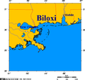
Beloxi.jpg 794 × 573; 190 KB
-
Cancer Alley Louisiana.png 6,900 × 4,326; 2.45 MB
-
Carte De La Louisiane Par Le St. D'Anville - NARA - 102278735.jpg 12,237 × 6,967; 8.3 MB
-
Chandeleurs Islands-Pos.png 500 × 407; 41 KB
-
Changes in Coastal Vegetation and Landmass in Louisiana, 1949–2021.png 2,550 × 3,300; 1.32 MB
-
Columbia debris detected by radar.jpg 621 × 525; 282 KB
-
Ecclesiastical Province of New Orleans map.png 523 × 330; 28 KB
-
EDLA map.PNG 331 × 303; 12 KB
-
Flag Map of Louisiana accurate.png 2,000 × 1,800; 902 KB
-
General soil map, Louisiana LOC 2002626323.jpg 5,044 × 3,266; 2.05 MB
-
Gom map.png 547 × 373; 280 KB
-
Greater New Orleans Metro Area Louisiana Region Map.png 300 × 275; 40 KB
-
Hurricanes Category 3 or greater within 100 miles of New Orleans.jpg 734 × 415; 72 KB
-
Blank Louisiana regions map.png 1,024 × 921; 281 KB
-
Islenos.JPG 701 × 565; 24 KB
-
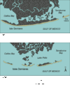
Isles Dernieres.gif 481 × 576; 23 KB
-
LA-23-ltgov-districts.svg 810 × 739; 97 KB
-
La.png 621 × 277; 23 KB
-
Lafayette CSA 2.png 485 × 434; 9 KB
-
Lafayette-Acadiana CSA.png 485 × 434; 9 KB
-
Lafitte-map.png 596 × 404; 177 KB
-
LAHydrocarbonPlaysVer001.png 2,203 × 1,842; 1.16 MB
-
Lake Charles-Jennings CSA.png 485 × 434; 9 KB
-
LAMap-doton-Chackbay.png 300 × 275; 12 KB
-
LAMap-doton-Junction City.png 300 × 275; 12 KB
-
LAMap-doton-Lacombe.png 300 × 275; 12 KB
-
LAMap-doton-St. Rose.png 300 × 275; 12 KB
-
LAMap-doton-Vinton.png 300 × 275; 12 KB
-
LAParishesv3.png 3,966 × 3,225; 257 KB
-
LASP Troop Map.jpg 2,254 × 1,875; 1.13 MB
-
Last Island Map4.JPG 1,000 × 851; 132 KB
-
LDH Regional Map.jpg 1,968 × 1,880; 443 KB
-
Louisiana - Poverty Point - Karte (blank version).png 1,178 × 1,719; 708 KB
-
Louisiana - Poverty Point - Karte (English version).png 1,178 × 1,719; 762 KB
-
Louisiana - Poverty Point - Karte.png 1,178 × 1,719; 1.01 MB
-
Louisiana civil war.jpg 700 × 611; 127 KB
-
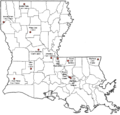
Louisiana Corrections Map.png 1,289 × 1,230; 465 KB
-
Louisiana House of Representatives 24th district (Frank Howard).png 325 × 575; 45 KB
-
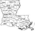
Louisiana judicial districts map.png 1,000 × 900; 181 KB
-
Louisiana Köppen.png 6,300 × 6,719; 343 KB
-
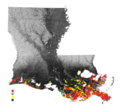
Louisiana Land Loss.png 700 × 643; 358 KB
-
Louisiana Level IV ecoregions.pdf 7,200 × 5,400; 15.46 MB
-
Louisiana Locator Map with rivers.PNG 331 × 303; 13 KB
-
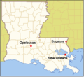
Louisiana opelousas new orleans.png 520 × 476; 309 KB
-
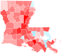
Louisiana Parish Flips 2004.svg 810 × 739; 60 KB
-
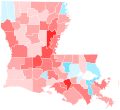
Louisiana Parish Swing 2016.svg 810 × 739; 64 KB
-
Louisiana Parish Trend 2016.svg 810 × 739; 64 KB
-
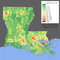
Louisiana population map.png 600 × 600; 219 KB
-
Louisiana regions map.png 1,024 × 921; 313 KB
-
Louisiana static map.png 2,001 × 1,781; 273 KB
-
Louisiana-locator.png 645 × 706; 8 KB
-
Louisiana.svg 512 × 717; 6 KB
-
LouisianaMetro.gif 485 × 434; 60 KB
-
Mag la.jpg 150 × 91; 11 KB
-
Map of Biloxi and Mississippi coast.png 514 × 482; 13 KB
-
Map of Contemporary Creolophone and Francophone Louisiana.png 873 × 492; 216 KB
-
Map of Creole-Speaking Parishes in Louisiana.JPG 673 × 540; 190 KB
-
Map of Ecoregions of Louisiana (USEPA).png 4,600 × 4,800; 1.12 MB
-
Map of Fucich Bayou, near Pointe A La Hache in Louisiana.png 1,198 × 654; 1.59 MB
-
Map of Louisiana Levee Districts.png 512 × 322; 131 KB
-
Map of Louisiana published in February 1866 in Harper's Weekly.jpg 2,149 × 3,205; 2.9 MB
-
Map of Mississippi coast.png 514 × 482; 18 KB
-
Map over Louisiana's regions.jpg 500 × 411; 69 KB
-
Mapa Virreinato Nueva España de Pensacola a Veracruz, de Janos a Sinaloa.jpg 3,793 × 2,755; 1.23 MB
-
MDLA map.PNG 331 × 303; 12 KB
-
Michael Brown views map at Office of Emergency Management briefing.jpg 3,773 × 2,819; 931 KB
-
Mississippi Valley Loess Plains Map.jpg 2,550 × 3,300; 8.66 MB
-
Monroe-Bastrop CSA.png 485 × 434; 9 KB
-
Morganza Floodway Travel Times May 2011.jpg 1,650 × 2,549; 485 KB
-
New Orleans West Bank.png 640 × 745; 345 KB
-
NO District Inundation Spring May 2011.jpg 5,000 × 3,263; 2.66 MB
-
NODInundationMay2011Scenario1a.jpg 2,550 × 1,651; 977 KB
-
NODInundationMay2011Scenario2.jpg 5,000 × 3,263; 2.55 MB
-
NODInundationMay2011Scenario3.jpg 5,000 × 3,263; 2.52 MB
-
Physiographic provinces of Louisiana, Mississippi, and Alabama (26309653203).jpg 2,178 × 1,678; 1.91 MB
-
Plan of the English Turn, 1814.png 1,536 × 712; 697 KB
-
Population density of Louisiana parishes (2020).png 3,636 × 2,920; 1.1 MB
-
Ports of New Orleans - Biloxi - Mobile.png 514 × 444; 12 KB
-
Redbone Parishes & Counties.svg 366 × 261; 2.76 MB
-
Ruston µSA.png 485 × 434; 9 KB
-
Shreveport CSA.png 485 × 434; 16 KB
-
Shreveport MSA.png 485 × 434; 9 KB
-
South Central Plains ecoregion, Level III.png 340 × 274; 77 KB
-
St George Map.png 1,069 × 577; 943 KB
-
Swartz in the Tornadoes of 2011 Super Outbreak (cropped).png 573 × 573; 159 KB
-
Swartz in the Tornadoes of 2011 Super Outbreak.png 1,737 × 758; 463 KB
-
TMS DNR.png 760 × 569; 156 KB
-
US map-Arklatex.PNG 572 × 371; 19 KB
-
US South Central Plains ecoregion map.png 3,300 × 2,550; 1.53 MB
-
US Southeastern Plains Map.jpg 3,300 × 2,550; 6.8 MB
-
US Southern Coastal Plain Map.jpg 3,300 × 2,550; 6.6 MB
-
Watson Brake - Map.png 2,478 × 1,872; 613 KB
-
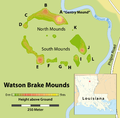
Watson Brake Mounds - Map.png 1,509 × 1,484; 297 KB
-
WDLA map.PNG 331 × 303; 12 KB
-
Yellow Louisiana.jpg 700 × 641; 123 KB
