Category:Old maps of cities in Iowa
Jump to navigation
Jump to search
States of the United States: Alabama · Alaska · Arizona · Arkansas · California · Colorado · Connecticut · Delaware · Florida · Georgia · Hawaii · Idaho · Illinois · Indiana · Iowa · Kansas · Kentucky · Louisiana · Maine · Maryland · Massachusetts · Michigan · Minnesota · Mississippi · Missouri · Montana · Nebraska · Nevada · New Hampshire · New Jersey · New Mexico · New York · North Carolina · North Dakota · Ohio · Oklahoma · Oregon · Pennsylvania · Rhode Island · South Carolina · South Dakota · Tennessee · Texas · Utah · Vermont · Virginia · Washington · West Virginia · Wisconsin · Wyoming
Subcategories
This category has only the following subcategory.
O
Media in category "Old maps of cities in Iowa"
The following 13 files are in this category, out of 13 total.
-
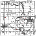
AlbiaMines.png 1,229 × 784; 197 KB
-
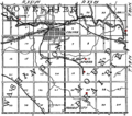
BooneMines.png 662 × 661; 96 KB
-
CentervilleMines.png 585 × 655; 79 KB
-
ColfaxMines.png 608 × 536; 67 KB
-
Donnan plat 1916.png 355 × 468; 251 KB
-
Iowa City circa 1868.jpg 7,677 × 5,999; 13.29 MB
-
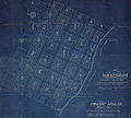
Map old rockingham.jpg 7,568 × 6,827; 2.97 MB
-
Marenga-1868.jpg 662 × 525; 105 KB
-
MarysvilleMines.png 463 × 598; 54 KB
-
OttumwaMines.png 600 × 536; 68 KB
-
Quad Cities 1919 Automobile Blue Book.jpg 673 × 457; 110 KB
-
SaylorvilleMines.png 586 × 530; 65 KB
-
The Commercial and financial chronicle (1906) (14595415419).jpg 4,192 × 2,534; 1.2 MB


