Category:Maps of the Isle of Wight
Jump to navigation
Jump to search
Ceremonial counties of England: Bedfordshire · Berkshire · Buckinghamshire · Cambridgeshire · Cheshire · Cornwall · Cumbria · Derbyshire · Devon · Dorset · Durham · East Riding of Yorkshire · East Sussex · Essex · Gloucestershire · Greater London · Greater Manchester · Hampshire · Herefordshire · Hertfordshire · Isle of Wight · Kent · Lancashire · Leicestershire · Lincolnshire · Merseyside · Norfolk · North Yorkshire · Northamptonshire · Northumberland · Nottinghamshire · Oxfordshire · Rutland · Shropshire · Somerset · South Yorkshire · Staffordshire · Suffolk · Surrey · Tyne and Wear · Warwickshire · West Midlands · West Sussex · West Yorkshire · Wiltshire · Worcestershire
City-counties: Bristol · City of London
Former historic counties: Cumberland · Huntingdonshire · Middlesex · Sussex · Westmorland · Yorkshire
Other former counties: Cleveland · Humberside · Isle of Ely ·
City-counties: Bristol · City of London
Former historic counties: Cumberland · Huntingdonshire · Middlesex · Sussex · Westmorland · Yorkshire
Other former counties: Cleveland · Humberside · Isle of Ely ·
Subcategories
This category has the following 7 subcategories, out of 7 total.
Media in category "Maps of the Isle of Wight"
The following 23 files are in this category, out of 23 total.
-
A view of the Isle of Wight Fleuron T063396-1.png 676 × 584; 26 KB
-
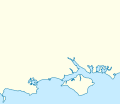
England Southampton area location map.svg 170 × 147; 383 KB
-
EnglandIsleWight.png 200 × 247; 26 KB
-
Isle of Wight Map.png 878 × 601; 48 KB
-
Isle of Wight Medina district map 1974.svg 1,425 × 868; 658 KB
-
Isle of Wight OS OpenData map.png 1,712 × 1,000; 369 KB
-
Isle of Wight public transport map September 2009.png 1,101 × 806; 550 KB
-
Isle of Wight public transport map September 2010.png 1,226 × 912; 434 KB
-
Isle of Wight South Wight district map 1974.svg 1,425 × 868; 660 KB
-
Isle of Wight UK district map (blank).svg 1,425 × 868; 617 KB
-
Isle of Wight UK district map 1974.svg 1,425 × 868; 639 KB
-
Isle of Wight UK location map.svg 1,425 × 868; 843 KB
-
Isle of Wight UK locator map 2010.svg 1,108 × 1,345; 302 KB
-
Isle of Wight UK parish map (blank).svg 1,425 × 868; 871 KB
-
Isle of Wight UK relief location map.jpg 1,999 × 1,218; 158 KB
-
Isle of Wight UK ward map (blank).svg 1,425 × 868; 881 KB
-
Isle of Wight UK ward map 2021 (blank).svg 1,425 × 868; 1.74 MB
-
IsleOfWightConstituency.svg 238 × 100; 47 KB
-
Ora-distribution.jpg 2,121 × 1,488; 698 KB
-
Ordnance Survey 1-250000 - SZ.jpg 4,000 × 4,000; 1.7 MB
-
Wight9265.png 538 × 497; 16 KB


