Category:Maps of Lincolnshire
Jump to navigation
Jump to search
Wikimedia category | |||||
| Upload media | |||||
| Instance of | |||||
|---|---|---|---|---|---|
| Category combines topics | |||||
| Lincolnshire | |||||
ceremonial county in the east of England | |||||
| Instance of | |||||
| Part of | |||||
| Location |
| ||||
| Capital | |||||
| Has part(s) | |||||
| Population |
| ||||
| Area |
| ||||
| Different from | |||||
| Said to be the same as | Lincolnshire (historic county of England, ceremonial county of England, 1844) | ||||
| official website | |||||
 | |||||
Subcategories
This category has the following 13 subcategories, out of 13 total.
!
E
- Election maps of Lincolnshire (123 F)
M
- Maps of Boston, Lincolnshire (11 F)
O
P
- Parts of Lincolnshire (4 F)
R
W
- Wapentakes of Lincolnshire (31 F)
Media in category "Maps of Lincolnshire"
The following 76 files are in this category, out of 76 total.
-
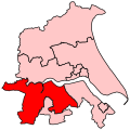
BriggGoole2007Constituency.svg 210 × 207; 134 KB
-
BriggGooleConstituency.svg 200 × 200; 38 KB
-
Defra map at Skendleby - geograph.org.uk - 554019.jpg 480 × 640; 80 KB
-
DoncasterCentralGraph.png 945 × 520; 49 KB
-
DoncasterNorthGraph.png 945 × 520; 46 KB
-
DonValleyGraph.png 944 × 519; 106 KB
-
England Police Forces (Lincolnshire).svg 1,108 × 1,345; 312 KB
-
EnglandLincolnshire.png 200 × 247; 22 KB
-
EnglandLincolnshireHolland.png 200 × 254; 24 KB
-
EnglandLincolnshireKesteven.png 200 × 254; 24 KB
-
EnglandLindsey.png 200 × 254; 24 KB
-
EnglandPoliceLincolnshire.png 2,165 × 2,670; 88 KB
-
Fens-OMC.jpg 514 × 432; 45 KB
-
Grimsby docks new clee stations map.png 522 × 487; 67 KB
-
HARROWBY SETTLEMENTS.jpg 2,307 × 1,648; 1.05 MB
-
Holland - Lincolnshire Brit Isles section.svg 555 × 792; 1.69 MB
-
Humberside 1974 Numbered.png 200 × 197; 5 KB
-
Lincolnshire Wapentakes.svg 1,018 × 1,410; 1.8 MB
-
Kesteven - Lincolnshire Brit Isles section.svg 555 × 792; 1.69 MB
-
Lincoln Cliff Map-topographic.svg 1,320 × 1,201; 2.04 MB
-
Lincoln Deaneries.png 550 × 705; 312 KB
-
Lincolnshire - British Isles.svg 1,250 × 1,835; 1,024 KB
-
Lincolnshire Admin Counties 1890-1965.png 453 × 621; 53 KB
-
Lincolnshire Brit Isles Sect 3.svg 939 × 677; 1,012 KB
-
Lincolnshire Brit Isles Sect 5.svg 809 × 743; 939 KB
-
Lincolnshire Ceremonial Numbered.png 200 × 270; 6 KB
-
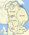
Lincolnshire districts.png 600 × 714; 373 KB
-
Lincolnshire numbered districts.svg 1,086 × 1,305; 1.25 MB
-
Lincolnshire outline map with UK.png 600 × 714; 334 KB
-
Lincolnshire UK district map (blank).svg 1,086 × 1,305; 1.27 MB
-
Lincolnshire UK electoral division map (blank).svg 1,086 × 1,305; 1.87 MB
-
Lincolnshire UK electoral division map 2017 (blank).svg 1,086 × 1,305; 1.75 MB
-
Lincolnshire UK location map.svg 1,086 × 1,305; 2.71 MB
-
Lincolnshire UK locator map 2010.svg 1,108 × 1,345; 302 KB
-
Lincolnshire UK PCC election 2024.svg 474 × 651; 301 KB
-
Lincolnshire UK relief location map.jpg 2,005 × 2,412; 448 KB
-
Lincolnshire UK ward map (blank).svg 1,086 × 1,305; 2.43 MB
-
Lincolnshire1832 Map.png 1,850 × 2,325; 714 KB
-
LincolnshireBrit5.PNG 625 × 569; 26 KB
-
LincolnshireNumbered.png 200 × 265; 18 KB
-
Lincs.jpg 555 × 667; 48 KB
-
Lindsey - Lincolnshire Brit Isles section.svg 555 × 792; 1.69 MB
-
Map of Bardney and Cherry Willingham electoral division (2017).svg 815 × 980; 1.75 MB
-
Map of Eagle and Hykeham West electoral division (2017).svg 815 × 980; 1.75 MB
-
Map of Gainsborough Hill electoral division (2017).svg 815 × 980; 1.75 MB
-
Map of Gainsborough Rural South electoral division (2017).svg 815 × 980; 1.75 MB
-
Map of Gainsborough Trent electoral division (2017).svg 815 × 980; 1.75 MB
-
Map of Louth North electoral division (2017).svg 815 × 980; 1.75 MB
-
Map of Louth South electoral division (2017).svg 815 × 980; 1.75 MB
-
Map of Louth Wolds electoral division (2017).svg 815 × 980; 1.75 MB
-
Map of Market Rasen Wolds electoral division (2017).svg 815 × 980; 1.75 MB
-
Map of Nettleham and Saxilby electoral division (2017).svg 815 × 980; 1.75 MB
-
Map of Saltfleet and the Cotes electoral division (2017).svg 815 × 980; 1.75 MB
-
Map of Scotter Rural electoral division (2017).svg 815 × 980; 1.75 MB
-
Map of Welton Rural electoral division (2017).svg 815 × 980; 1.75 MB
-
National Grid square TF at 1 in 250 000 scale.gif 4,000 × 4,000; 2.36 MB
-
National Grid square TF at 1 in 250 000 scale.png 4,000 × 4,000; 1.92 MB
-
North East Lincolnshire UK ward map 2010 (blank).svg 1,259 × 1,306; 287 KB
-
North Lincolnshire UK ward map 2010 (blank).svg 1,425 × 886; 508 KB
-
North Riding of Lindsey - Lincolnshire.svg 1,001 × 1,398; 1.37 MB
-
Nottinghamshire Lincolnshire Yorkshire exclaves.jpg 3,120 × 4,160; 4.48 MB
-
Ordnance Survey 1-250000 - SE.jpg 4,000 × 4,000; 8.57 MB
-
Ordnance Survey 1-250000 - SK.jpg 4,000 × 4,000; 9.31 MB
-
Ordnance Survey 1-250000 - TA.jpg 4,000 × 4,000; 2.3 MB
-
Ordnance Survey 1-250000 - TF.jpg 4,000 × 4,000; 6.07 MB
-
Ordnance Survey One-Inch Sheet 113 Lincoln & Grantham, Published 1963.jpg 8,302 × 9,870; 9.64 MB
-
Ridings of Lindsey - Lincolnshire.svg 1,001 × 1,398; 1.38 MB
-
Sleaford-Map-1891-Simplified.svg 746 × 569; 208 KB
-
Slystyn Lincolnshire.png 600 × 714; 374 KB
-
South Riding of Lindsey - Lincolnshire.svg 1,001 × 1,398; 1.37 MB
-
The Fens England map.svg 1,740 × 1,585; 1.6 MB
-
The Wash England.svg 919 × 1,201; 1.12 MB
-
Ukmap-lin.png 145 × 173; 6 KB
-
Washmap.png 534 × 552; 10 KB
-
West Riding of Lindsey - Lincolnshire.svg 1,001 × 1,398; 1.37 MB


