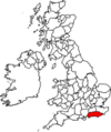
Category:Maps of Sussex
Jump to navigation
Jump to search
Wikimedia category | |||||
| Upload media | |||||
| Instance of | |||||
|---|---|---|---|---|---|
| Category combines topics | |||||
| Sussex | |||||
historic county of England, United Kingdom | |||||
| Instance of | |||||
| Location | South East England, England | ||||
| Population |
| ||||
| Area |
| ||||
| Different from | |||||
 | |||||
Subcategories
This category has the following 8 subcategories, out of 8 total.
Media in category "Maps of Sussex"
The following 24 files are in this category, out of 24 total.
-
England Police Forces (Sussex).svg 1,108 × 1,345; 312 KB
-
EnglandPoliceSussex.png 2,165 × 2,670; 88 KB
-
EnglandSussexTrad.png 200 × 250; 25 KB
-
FSH Trail presentation map with logos 2020.jpg 2,673 × 1,240; 380 KB
-
Haywards Heath built up area.png 16,276 × 10,518; 4.97 MB
-
Map, water services, Wellcome Veterinary Research Station Wellcome L0038247.jpg 21,261 × 13,033; 73.81 MB
-
Open Map of Hove seafront with Sussex Road.jpg 961 × 626; 119 KB
-
Prospectus; Ticehurst Private Asylum for insane persons Wellcome L0023013.jpg 2,030 × 1,022; 416 KB
-
Prospectus; Ticehurst Private Asylum for insane persons. Wellcome L0021140.jpg 1,918 × 970; 582 KB
-
SE England Aelle.gif 478 × 259; 48 KB
-
Sussex - British Isles.svg 1,250 × 1,835; 1,024 KB
-
Sussex administrative map 1832.png 2,500 × 1,073; 644 KB
-
Sussex administrative map 1851.png 2,500 × 1,072; 605 KB
-
Sussex Brit Isles Sect 5.svg 809 × 743; 939 KB
-
Sussex en 1851.svg 1,108 × 1,345; 323 KB
-
Sussex Hundreds (names).svg 997 × 372; 2.27 MB
-
Sussex Hundreds 1832 Blank Map.png 10,000 × 4,290; 730 KB
-
Sussex Hundreds blank.svg 997 × 372; 3.13 MB
-
Sussex Rapes and Hundreds (names).svg 997 × 372; 2.27 MB
-
Sussex UK PCC election 2024.svg 1,094 × 431; 541 KB
-
SussexBrit5.PNG 625 × 569; 26 KB
-
Ukmap-sus.png 145 × 173; 6 KB


