Category:Maps of Somerset
Jump to navigation
Jump to search
Wikimedia category | |||||
| Upload media | |||||
| Instance of | |||||
|---|---|---|---|---|---|
| Category combines topics | |||||
| Somerset | |||||
ceremonial county of England (use Q21694741 for administrative non-metropolitan county) | |||||
| Instance of | |||||
| Part of | |||||
| Location |
| ||||
| Capital | |||||
| Population |
| ||||
| Area |
| ||||
| Different from | |||||
| Said to be the same as | Somerset (historic county of England, ceremonial county of England, 1844) | ||||
| official website | |||||
 | |||||
Subcategories
This category has the following 11 subcategories, out of 11 total.
!
D
E
- Election maps of Somerset (115 F)
H
- Hundreds of Somerset (40 F)
M
- Maps of Minehead (10 F)
- Maps of Wookey (3 F)
O
R
T
Media in category "Maps of Somerset"
The following 58 files are in this category, out of 58 total.
-
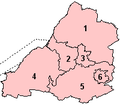
Avon 1974 Numbered.png 200 × 175; 4 KB
-
Avon and Somerset UK PCC election 2024.svg 814 × 697; 597 KB
-
Avon UK constituency map (blank).svg 1,425 × 1,241; 1.13 MB
-
Avon UK district map (blank).svg 1,425 × 1,241; 1,003 KB
-
Avon UK parish map (blank).svg 1,425 × 1,241; 1.91 MB
-
Avon UK ward map (blank).svg 1,425 × 1,241; 1.85 MB
-
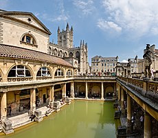
Bath - Bath and North East Somerset dot.png 417 × 599; 122 KB
-
Blagdon Lake showing bank features.jpg 2,254 × 1,563; 785 KB
-
Bridgy map.jpeg 241 × 173; 9 KB
-
Bristol channel detailed map.png 600 × 276; 47 KB
-
Bristol Channel map.png 539 × 381; 5 KB
-
Bristol-channel-clean-HE.jpg 600 × 276; 167 KB
-
Bristol-channel-clean.jpg 600 × 276; 139 KB
-
Brockey River map.png 1,508 × 1,211; 174 KB
-
Chew Valley Lake map.PNG 591 × 785; 41 KB
-
Chew Valley Map.png 2,147 × 2,343; 2.61 MB
-
EnglandSomerset.png 200 × 247; 26 KB
-
EnglandSomersetTrad.png 200 × 250; 28 KB
-
Somerset Hundreds.svg 1,000 × 683; 1.6 MB
-
Little River (River Barle) map.png 1,508 × 1,486; 99 KB
-
Map of Somerset Levels.png 2,400 × 1,800; 570 KB
-
Map SydenhamFamily Seats Somerset.PNG 578 × 507; 46 KB
-
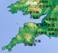
Moors zh.png 461 × 421; 242 KB
-
Moors.jpg 461 × 421; 94 KB
-
NorthEastSomersetconstituency.png 800 × 558; 255 KB
-
Ordnance Survey 1-250000 - SS.jpg 4,000 × 4,000; 4.77 MB
-
Ordnance Survey 1-250000 - ST.jpg 4,000 × 4,000; 8.92 MB
-
Ordnance Survey One-Inch Sheet 177 Taunton & Lyme Regis, Published 1960.jpg 8,269 × 9,931; 11.32 MB
-
Pulham River map.png 802 × 1,508; 136 KB
-
River Barle map.png 1,506 × 1,200; 577 KB
-
River Haddeo map.png 1,249 × 1,508; 268 KB
-
River Parrett relief map.png 1,507 × 947; 1.23 MB
-
River Quarme map.png 1,508 × 1,277; 209 KB
-
Sentinel Mapping of Flood Hit Areas MOD 45157032.jpg 842 × 595; 480 KB
-
Somer.svg 1,129 × 1,385; 107 KB
-
Somerset - British Isles.svg 1,250 × 1,835; 1,024 KB
-
Somerset Brit Isles Sect 5.svg 809 × 743; 939 KB
-
Somerset Brit Isles Sect 6.svg 545 × 593; 938 KB
-
Somerset Levels UK location map.svg 1,356 × 1,226; 1,007 KB
-
Somerset UK constituency map (blank).svg 1,425 × 901; 1.21 MB
-
Somerset UK electoral division map (blank).svg 1,425 × 901; 1.69 MB
-
Somerset UK electoral division map 2013 (blank).svg 1,425 × 901; 1.53 MB
-
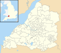
Somerset UK location map.svg 1,425 × 901; 2.38 MB
-
Somerset UK locator map 2010.svg 1,108 × 1,345; 302 KB
-
Somerset UK relief location map.jpg 2,019 × 1,275; 367 KB
-
Somerset UK ward map (blank).svg 1,425 × 901; 2.36 MB
-
Somerset1832Map.png 3,275 × 2,325; 1.02 MB
-
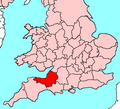
SomersetBrit5.PNG 625 × 569; 26 KB
-
SomersetNumbered.png 200 × 101; 11 KB
-
Taunton - Somerset dot.png 417 × 599; 122 KB
-
Taunton Tramways Network.png 800 × 600; 33 KB
-
Wansdyke UK ward map 1975 (blank).svg 1,425 × 982; 892 KB
-
Wells - Somerset dot.png 417 × 599; 122 KB
-
West of England Combined Authority UK map.svg 1,425 × 1,241; 1,003 KB
-
WestcountryCheddar-Counties.svg 611 × 787; 148 KB
-
Weston-super-Mare railway stations.png 960 × 720; 49 KB
-
Weston-super-Mare Tramways network.png 960 × 720; 44 KB
-
Yeovil - Somerset dot.png 417 × 599; 122 KB
