Category:Maps of Tyne and Wear
Jump to navigation
Jump to search
Wikimedia category | |||||
| Upload media | |||||
| Instance of | |||||
|---|---|---|---|---|---|
| Category combines topics | |||||
| Tyne and Wear | |||||
county in England | |||||
| Instance of |
| ||||
| Location |
| ||||
| Inception |
| ||||
| Population |
| ||||
| Area |
| ||||
| Different from | |||||
 | |||||
Subcategories
This category has the following 5 subcategories, out of 5 total.
E
H
R
Media in category "Maps of Tyne and Wear"
The following 38 files are in this category, out of 38 total.
-
Admiralty Chart No 3104 Hartlepool to Blyth, Published 1901, New Edition 1915.jpg 11,098 × 15,959; 65.95 MB
-
90 of 'A School Geography' (11153173253).jpg 947 × 857; 156 KB
-
Area map of the North Tyneside Steam Railway & Stephenson Railway Museum.jpg 1,452 × 936; 262 KB
-
Birtley unparished area UK locator map.svg 1,425 × 943; 246 KB
-
Boldon Colliery St Nicholas.png 1,700 × 1,594; 2.89 MB
-
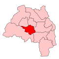
GatesheadConstituency.svg 500 × 500; 22 KB
-
Map of Byker Estate - geograph.org.uk - 1776969.jpg 1,024 × 769; 234 KB
-
Map of the North Tyneside Steam Railway & Stephenson Railway Museum.jpg 968 × 1,252; 213 KB
-
NE-belt.svg 1,713 × 1,996; 2.91 MB
-
Newcastle town wall map.jpg 1,134 × 857; 570 KB
-
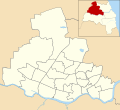
Newcastle upon Tyne UK ward map 2018 (blank).svg 1,425 × 1,305; 245 KB
-
North of Tyne Combined Authority among combined authorities in England map, 2021.svg 1,152 × 1,152; 9.4 MB
-
Ordnance Survey 1-250000 - NZ.jpg 4,000 × 4,000; 5.22 MB
-
Ordnance Survey Map of the Deckham Settlement (1895).gif 700 × 470; 27 KB
-
Proposed 1834 Plan Newcastle to North Shields Railway Tracts vol 57 p298 crop js.jpg 1,781 × 1,010; 806 KB
-
South Tyneside UK ward map 2010 (blank).svg 1,367 × 1,346; 245 KB
-
Sunderland Council area ward map with labels.png 1,071 × 1,345; 172 KB
-
Sunderland UK ward map 2010 (blank).svg 1,071 × 1,345; 333 KB
-
T&W.svg 1,129 × 1,385; 107 KB
-
Tyne & Wear stub map.png 181 × 175; 4 KB
-
Tyne and wear Ceremonial county locator map.png 200 × 247; 16 KB
-
Tyne and Wear County.png 2,879 × 2,106; 495 KB
-
Tyne and Wear numbered districts.svg 1,425 × 1,252; 167 KB
-
Tyne and Wear outline map with UK.png 600 × 500; 519 KB
-
Tyne and Wear population density map, 2011 census.png 3,118 × 3,023; 7.32 MB
-
Tyne and Wear UK constituency map (blank).svg 1,425 × 1,252; 773 KB
-
Tyne and Wear UK district map (blank).svg 1,425 × 1,252; 683 KB
-
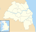
Tyne and Wear UK location map.svg 1,425 × 1,252; 1.09 MB
-
Tyne and Wear UK locator map 2010.svg 1,108 × 1,345; 302 KB
-
Tyne and Wear UK parish map (blank).svg 1,425 × 1,252; 748 KB
-
Tyne and Wear UK relief location map.jpg 1,999 × 1,756; 263 KB
-
Tyne and Wear UK ward map (blank).svg 1,425 × 1,252; 1.16 MB
-
TyneandWear1997.svg 200 × 195; 76 KB
-
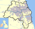
TynesideBUA.png 1,618 × 850; 1.43 MB
-
TyneWearNumberedAlpha copy.png 200 × 187; 6 KB
-
WearsideBUA.png 850 × 850; 1 MB


