Category:Maps of Herefordshire
Jump to navigation
Jump to search
Wikimedia category | |||||
| Upload media | |||||
| Instance of | |||||
|---|---|---|---|---|---|
| Category combines topics | |||||
| Herefordshire | |||||
ceremonial county, and unitary non-metropolitan county and district, in England | |||||
| Instance of |
| ||||
| Location | West Midlands, England | ||||
| Capital | |||||
| Legislative body |
| ||||
| Population |
| ||||
| Area |
| ||||
| Replaces | |||||
| Different from | |||||
| Said to be the same as | Herefordshire (historic county of England, ceremonial county of England, 1844) | ||||
| official website | |||||
 | |||||
Subcategories
This category has the following 5 subcategories, out of 5 total.
Media in category "Maps of Herefordshire"
The following 24 files are in this category, out of 24 total.
-
Almeley02.jpg 3,264 × 2,448; 2.55 MB
-
Coalbrookdale Formation map.jpg 986 × 1,403; 672 KB
-
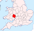
EnglandHerefordWorcester.png 200 × 247; 22 KB
-
Herefordshire - British Isles.svg 1,250 × 1,835; 1,024 KB
-
Herefordshire Brit Isles Sect 5.svg 809 × 743; 939 KB
-
Herefordshire Brit Isles Sect 6.svg 545 × 593; 938 KB
-
Herefordshire outline map with UK.png 569 × 714; 271 KB
-
Herefordshire UK constituency map (blank).svg 999 × 1,266; 825 KB
-
Herefordshire UK district map (blank).svg 999 × 1,266; 758 KB
-
Herefordshire UK location map.svg 999 × 1,266; 1.55 MB
-
Herefordshire UK locator map 2010.svg 1,108 × 1,345; 302 KB
-
Herefordshire UK parish map (blank).svg 999 × 1,266; 2.52 MB
-
Herefordshire UK relief location map.jpg 2,010 × 2,549; 594 KB
-
Herefordshire UK ward map (blank).svg 999 × 1,266; 1.45 MB
-
Herefordshire UK ward map 2015 (blank).svg 999 × 1,266; 1.6 MB
-
HerefordshireBrit5.PNG 625 × 569; 26 KB
-
HerefordWorcester 1974 Numbered.png 200 × 150; 4 KB
-
Herefordshire Hundreds.svg 1,001 × 1,237; 682 KB
-
Litton and Cascob.svg 1,281 × 733; 20 KB
-
Lost in Llangrove^ - geograph.org.uk - 757999.jpg 640 × 425; 98 KB
-
Map KnightFamilyProperties Herefordshire.png 933 × 1,001; 109 KB
-
Ordnance Survey 1-250000 - SO.jpg 4,000 × 4,000; 9.7 MB
-
Upper and Lower Lea.svg 2,590 × 3,116; 12 KB
-
West Mercia UK PCC election 2024.svg 508 × 658; 677 KB


