Category:Maps of Derbyshire
Jump to navigation
Jump to search
Wikimedia category | |||||
| Upload media | |||||
| Instance of | |||||
|---|---|---|---|---|---|
| Category combines topics | |||||
| Derbyshire | |||||
ceremonial county in East Midlands, England | |||||
| Instance of | |||||
| Location |
| ||||
| Capital | |||||
| Population |
| ||||
| Area |
| ||||
| Different from | |||||
| Said to be the same as | Derbyshire (historic county of England, ceremonial county of England, 1844) | ||||
| official website | |||||
 | |||||
Subcategories
This category has the following 10 subcategories, out of 10 total.
!
C
E
- Election maps of Derbyshire (127 F)
H
- Hundreds of Derbyshire (15 F)
M
O
R
- Derbyshire RJD 1914 (7 F)
Media in category "Maps of Derbyshire"
The following 42 files are in this category, out of 42 total.
-
BlackworkMap Derbyshire.jpg 391 × 600; 49 KB
-
Chatsworth House Surrounding Area Map.jpg 1,879 × 1,271; 958 KB
-
DDDC Wards 2023 Blank.svg 763 × 1,306; 5.05 MB
-
Derby UK ward map 2010 (blank).svg 1,400 × 1,305; 254 KB
-
Derby-BUA.jpg 1,700 × 1,700; 115 KB
-
Derbyshire - British Isles.svg 1,250 × 1,835; 1,024 KB
-
Derbyshire 1832 Map.png 2,000 × 3,000; 445 KB
-
Derbyshire Banham Commission First Round.png 200 × 317; 5 KB
-
Derbyshire Brit Isles Sect 3.svg 939 × 677; 1,012 KB
-
Derbyshire Brit Isles Sect 5.svg 809 × 743; 939 KB
-
Derbyshire districts transparent overlay.svg 360 × 530; 199 KB
-
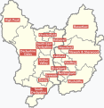
Derbyshire numbered districts.svg 800 × 1,284; 413 KB
-
Derbyshire outline map with UK.png 819 × 1,205; 185 KB
-
Derbyshire UK constituency map (blank).svg 884 × 1,305; 1,017 KB
-
Derbyshire UK district map (blank).svg 884 × 1,305; 1,000 KB
-
Derbyshire UK electoral division map (blank).svg 884 × 1,305; 1.49 MB
-
Derbyshire UK electoral division map 2013 (blank).svg 884 × 1,305; 1.17 MB
-
Derbyshire UK location map.svg 884 × 1,305; 2.38 MB
-
Derbyshire UK locator map 2010.svg 1,108 × 1,345; 302 KB
-
Derbyshire UK PCC election 2024.svg 884 × 1,305; 1,001 KB
-
Derbyshire UK relief location map.jpg 2,000 × 2,955; 730 KB
-
Derbyshire UK ward map (blank).svg 884 × 1,305; 1.95 MB
-
DerbyshireBrit5.PNG 625 × 569; 26 KB
-
East Midlands Mayor Councils.svg 417 × 429; 286 KB
-
England Police Forces (Derbyshire).svg 1,108 × 1,345; 312 KB
-
EnglandDerbyshire.png 200 × 247; 22 KB
-
EnglandDerbyshire.svg 200 × 247; 232 KB
-
EnglandPoliceDerbyshire.png 2,165 × 2,670; 88 KB
-
Geology Derby.png 2,058 × 1,732; 484 KB
-
Derbyshire Hundreds.svg 1,001 × 1,535; 564 KB
-
Derbyshire Hundreds A.svg 1,001 × 1,496; 520 KB
-
Hundreds of Derbyshire.svg 1,001 × 1,535; 251 KB
-
Manchester City Region.png 2,766 × 2,053; 423 KB
-
Map of Derbyshire boundaries plus Peak District.jpg 1,803 × 2,309; 2.35 MB
-
Midland to Manchester.jpg 800 × 502; 71 KB
-
Ordnance Survey 1-250000 - SJ.jpg 4,000 × 4,000; 9.38 MB
-
Ordnance Survey 1-250000 - SK.jpg 4,000 × 4,000; 9.31 MB
-
Peak District National Park map.svg 1,022 × 1,305; 1.2 MB
-
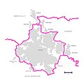
Sett Valley Trail.svg 1,738 × 957; 202 KB
-
Trijunct platform.jpg 900 × 177; 15 KB
-
Uk-derbyshire.png 145 × 173; 6 KB
-
Wilsthorpe parish overlay.jpg 2,913 × 4,134; 2.93 MB


