Category:Maps of Buckinghamshire
Jump to navigation
Jump to search
Wikimedia category | |||||
| Upload media | |||||
| Instance of | |||||
|---|---|---|---|---|---|
| Category combines topics | |||||
| Buckinghamshire | |||||
ceremonial county in England, UK (use Q21694636 for administrative unitary authority) | |||||
| Instance of | |||||
| Location |
| ||||
| Capital | |||||
| Population |
| ||||
| Area |
| ||||
| Different from | |||||
| Said to be the same as | Buckinghamshire (historic county of England, ceremonial county of England, 1844) | ||||
| official website | |||||
 | |||||
Subcategories
This category has the following 8 subcategories, out of 8 total.
Media in category "Maps of Buckinghamshire"
The following 47 files are in this category, out of 47 total.
-
Aylesbury parish and surrounding areas.svg 744 × 1,007; 459 KB
-
Beaconsfield - Buckinghamshire dot.png 417 × 599; 122 KB
-
BeaconsfieldConstituency.png 200 × 320; 5 KB
-
Buckingham - Buckinghamshire dot.png 417 × 599; 122 KB
-
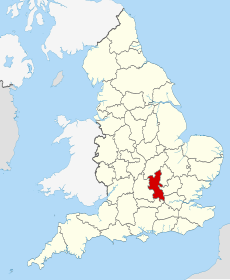
Buckinghamshire - British Isles.svg 1,250 × 1,835; 1,024 KB
-
Buckinghamshire 1832 Map.png 1,890 × 3,000; 690 KB
-
Buckinghamshire Brit Isles Sect 5.svg 809 × 743; 939 KB
-
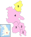
Buckinghamshire Ceremonial Numbered.png 200 × 333; 4 KB
-
Buckinghamshire hundreds 1 Aylesbury.jpg 800 × 1,205; 66 KB
-
Buckinghamshire hundreds 2 Desborough.jpg 800 × 1,205; 59 KB
-
Buckinghamshire hundreds 3 Ashendon.jpg 800 × 1,205; 64 KB
-
Buckinghamshire hundreds 4 Cottesloe.jpg 800 × 1,205; 66 KB
-
Buckinghamshire hundreds 5 Burnham.jpg 800 × 1,205; 60 KB
-
Buckinghamshire hundreds 6 Stoke.jpg 800 × 1,205; 56 KB
-
Buckinghamshire hundreds 7 Buckingham.jpg 800 × 1,205; 60 KB
-
Buckinghamshire hundreds 8 Newport.jpg 800 × 1,205; 61 KB
-
Buckinghamshire map.png 726 × 1,246; 30 KB
-
Buckinghamshire numbered districts (1974-2020).svg 1,070 × 1,266; 604 KB
-
Buckinghamshire numbered districts 2020.svg 1,070 × 1,266; 548 KB
-
Buckinghamshire outline map with UK.png 600 × 714; 292 KB
-
Buckinghamshire UK constituency map (blank).svg 1,070 × 1,266; 989 KB
-
Buckinghamshire UK district map 2010 (blank).svg 1,070 × 1,266; 921 KB
-
Buckinghamshire UK district map 2020 (blank).svg 1,070 × 1,266; 874 KB
-
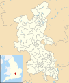
Buckinghamshire UK electoral division map (blank).svg 1,070 × 1,266; 1.33 MB
-
Buckinghamshire UK electoral division map 2013 (blank).svg 1,070 × 1,266; 1.15 MB
-
Buckinghamshire UK location map 1 April 2020.svg 1,070 × 1,266; 1.48 MB
-
Buckinghamshire UK location map.svg 1,070 × 1,266; 2.13 MB
-
Buckinghamshire UK locator map 2010.svg 1,108 × 1,345; 302 KB
-
Buckinghamshire UK parish map (blank).svg 1,070 × 1,266; 2.05 MB
-
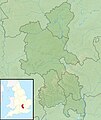
Buckinghamshire UK relief location map.jpg 2,005 × 2,374; 465 KB
-
Buckinghamshire UK ward map (blank).svg 1,070 × 1,266; 1.69 MB
-
BuckinghamshireBrit5.PNG 625 × 569; 26 KB
-
BuckinghamshireBrit5.png 625 × 569; 13 KB
-
BuckinghamshireNumbered.png 200 × 282; 3 KB
-
Bucks changes with numbers.png 904 × 1,769; 73 KB
-
Bucks-2-unitaries.png 386 × 500; 16 KB
-
Cheme Bletchley Park.jpg 700 × 518; 82 KB
-
EnglandBuckinghamshireTrad.png 200 × 250; 28 KB
-
EnglandSouthMidlands.png 200 × 247; 26 KB
-
London TTWA 2001.png 1,648 × 1,171; 121 KB
-
Map bletchley park.gif 1,102 × 802; 162 KB
-
Map of Buckinghamshire with Aylesbury Urban Area highlighted.png 504 × 600; 248 KB
-
Ordnance Survey 1-250000 - SP.jpg 4,000 × 4,000; 9.22 MB
-
Ordnance Survey 1-250000 - SU.jpg 4,000 × 4,000; 9.11 MB
-
Thames Valley UK PCC election 2024.svg 597 × 673; 651 KB
-
Ukmap-buc.png 145 × 173; 6 KB


