Category:Maps of Worcestershire
Jump to navigation
Jump to search
Wikimedia category | |||||
| Upload media | |||||
| Instance of | |||||
|---|---|---|---|---|---|
| Category combines topics | |||||
| Worcestershire | |||||
non-metropolitan county in the West Midlands of England | |||||
| Pronunciation audio | |||||
| Instance of |
| ||||
| Location |
| ||||
| Capital | |||||
| Legislative body |
| ||||
| Population |
| ||||
| Area |
| ||||
| Replaces | |||||
| Different from | |||||
| Said to be the same as | Worcestershire (historic county of England, ceremonial county of England, 1844) | ||||
| official website | |||||
 | |||||
Subcategories
This category has the following 6 subcategories, out of 6 total.
!
E
H
R
Media in category "Maps of Worcestershire"
The following 43 files are in this category, out of 43 total.
-
Bewdley and surroundings OS Vector Map District raster.png 1,314 × 960; 1.24 MB
-
Birmingham-Worcester rail routes.png 839 × 1,599; 76 KB
-
Cotswolds AONB locator map.svg 1,648 × 2,000; 1.08 MB
-
County of Worcestershire - Past & Present.png 2,270 × 2,000; 249 KB
-
Droitwich Canal map.png 734 × 716; 519 KB
-
EnglandHerefordWorcester.png 200 × 247; 22 KB
-
EnglandWorcestershireTrad.png 200 × 250; 27 KB
-
Exclaves & Enclaves - North Worcestershire.png 1,033 × 717; 193 KB
-
Exclaves & Enclaves - South Worcestershire.png 797 × 719; 222 KB
-
Exclaves and Enclaves - North West Worcestershire.png 859 × 711; 89 KB
-
Feckenham Forest.gif 842 × 725; 23 KB
-
Worcestershire Hundreds.svg 1,186 × 1,150; 778 KB
-
Ordnance Survey 1-250000 - SO.jpg 4,000 × 4,000; 9.7 MB
-
Ordnance Survey 1-250000 - SP.jpg 4,000 × 4,000; 9.22 MB
-
Redditch UK ward map 2024.svg 655 × 662; 188 KB
-
Staffs & Worcs Canal Map.png 918 × 2,474; 2.59 MB
-
The expansion of Redditch.png 359 × 351; 19 KB
-
The local government structure within the Black Country (Pre-1966).png 478 × 507; 315 KB
-
Upper Arley 1895.png 566 × 337; 32 KB
-
Wards of Malvern, Worcestershire.png 875 × 1,094; 199 KB
-
West Mercia UK PCC election 2024.svg 508 × 658; 677 KB
-
Worc.svg 1,129 × 1,385; 107 KB
-
Worcester & Birmingham, & Droitwich Canal map.png 1,156 × 1,558; 2.13 MB
-
Worcestershire (prior to 1965).png 581 × 566; 81 KB
-
Worcestershire - British Isles.svg 1,250 × 1,835; 1,024 KB
-
Worcestershire Brit Isles Sect 5.svg 809 × 743; 939 KB
-
Worcestershire Brit Isles Sect 6.svg 545 × 593; 938 KB
-
Worcestershire numbered districts.svg 1,375 × 1,188; 313 KB
-
Worcestershire outline map with UK.png 504 × 453; 157 KB
-
Worcestershire UK constituency map (blank).svg 1,425 × 1,262; 939 KB
-
Worcestershire UK district map (blank).svg 1,425 × 1,262; 890 KB
-
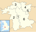
Worcestershire UK district map numbered.svg 1,425 × 1,262; 898 KB
-
Worcestershire UK electoral division map (blank).svg 1,425 × 1,262; 1.34 MB
-
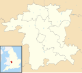
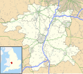
Worcestershire UK location map.svg 1,425 × 1,262; 1.8 MB
-
Worcestershire UK locator map 2010.svg 1,108 × 1,345; 302 KB
-
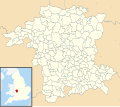
Worcestershire UK parish map (blank).svg 1,425 × 1,262; 2.04 MB
-
Worcestershire UK relief location map.jpg 1,999 × 1,770; 390 KB
-
Worcestershire UK ward map (blank).svg 1,425 × 1,262; 1.67 MB
-
Worcestershire's Hundreds (until 1844).png 1,074 × 1,024; 98 KB
-
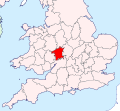
WorcestershireBrit5.PNG 625 × 569; 26 KB
-
WorcestershireMap1832.png 2,198 × 2,000; 707 KB
-
WorcestershireNumbered.png 200 × 176; 16 KB


