Category:Maps of Oxfordshire
Jump to navigation
Jump to search
Wikimedia category | |||||
| Upload media | |||||
| Instance of | |||||
|---|---|---|---|---|---|
| Category combines topics | |||||
| Oxfordshire | |||||
county in England, UK | |||||
| Instance of |
| ||||
| Location |
| ||||
| Capital | |||||
| Legislative body |
| ||||
| Population |
| ||||
| Area |
| ||||
| Different from | |||||
| Said to be the same as | Oxfordshire (historic county of England, ceremonial county of England, 1844) | ||||
| official website | |||||
 | |||||
Subcategories
This category has the following 6 subcategories, out of 6 total.
Media in category "Maps of Oxfordshire"
The following 37 files are in this category, out of 37 total.
-
Cotswolds AONB locator map.svg 1,648 × 2,000; 1.08 MB
-
Culham rd.png 452 × 600; 26 KB
-
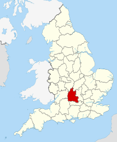
EnglandOxfordshireTrad.png 200 × 250; 28 KB
-
Growltiger Placenames.svg 689 × 274; 200 KB
-
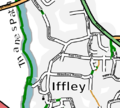
IffleyVillageMap.png 504 × 454; 128 KB
-
Islip map.JPG 1,680 × 2,240; 1.46 MB
-
Littlemore Priory location.png 693 × 576; 277 KB
-
Map on the Green - geograph.org.uk - 2642447.jpg 1,024 × 683; 123 KB
-
Map South East England - Oxfordshire.png 406 × 553; 43 KB
-
Ordnance Survey 1-250000 - SP.jpg 4,000 × 4,000; 9.22 MB
-
Ordnance Survey 1-250000 - SU.jpg 4,000 × 4,000; 9.11 MB
-
Oxfo.svg 1,129 × 1,385; 107 KB
-
Oxford Green Belt.svg 1,600 × 1,589; 2.49 MB
-
Oxford wards.svg 936 × 947; 239 KB
-
Oxfordshire - British Isles.svg 1,250 × 1,835; 1,024 KB
-
Oxfordshire Brit Isles Sect 5.svg 809 × 743; 939 KB
-
Oxfordshire Hundreds blank.svg 1,033 × 1,307; 693 KB
-
Oxfordshire numbered districts.svg 1,077 × 1,266; 638 KB
-
Oxfordshire outline map with UK.png 600 × 714; 296 KB
-
Oxfordshire Parishes Map.jpg 2,000 × 2,589; 997 KB
-
Oxfordshire UK constituency map (blank).svg 1,077 × 1,266; 966 KB
-
Oxfordshire UK district map (blank).svg 1,077 × 1,266; 921 KB
-
Oxfordshire UK electoral division map (blank).svg 1,077 × 1,266; 1.51 MB
-
Oxfordshire UK electoral division map 2013 (blank).svg 1,077 × 1,266; 1.23 MB
-
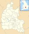
Oxfordshire UK location map.svg 1,077 × 1,266; 1.98 MB
-
Oxfordshire UK locator map 2010.svg 1,108 × 1,345; 302 KB
-
Oxfordshire UK parish map (blank).svg 1,077 × 1,266; 2.53 MB
-
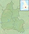
Oxfordshire UK relief location map.jpg 2,003 × 2,357; 450 KB
-
Oxfordshire UK ward map (blank).svg 1,077 × 1,266; 1.84 MB
-
OxfordshireBrit5.PNG 625 × 569; 26 KB
-
OxfordshireNumbered.png 200 × 267; 18 KB
-
Oxfordwards.PNG 856 × 889; 73 KB
-
Risinghurst and Sandhills civil parish.png 1,554 × 914; 1.64 MB
-
Thames Valley UK PCC election 2024.svg 597 × 673; 651 KB
-
Wantage - Oxfordshire dot.png 417 × 599; 122 KB
-
West Oxfordshire UK ward map 2024.svg 1,187 × 1,266; 672 KB
-
Witney - Oxfordshire dot.png 417 × 599; 122 KB


