Category:Maps of Essex
Jump to navigation
Jump to search
Wikimedia category | |||||
| Upload media | |||||
| Instance of | |||||
|---|---|---|---|---|---|
| Category combines topics | |||||
| Essex | |||||
ceremonial county in England (use Q21272241 for administrative non-metropolitan county) | |||||
| Instance of | |||||
| Location |
| ||||
| Capital | |||||
| Population |
| ||||
| Area |
| ||||
| Different from | |||||
| Said to be the same as | Essex (historic county of England, ceremonial county of England, 1844), Essex (ceremonial county of England, non-metropolitan county, 1974–1998) | ||||
| official website | |||||
 | |||||
Subcategories
This category has the following 9 subcategories, out of 9 total.
C
D
E
H
- Hundreds of Essex (28 F)
O
- OpenStreetMap maps of Essex (14 F)
R
T
- Transport maps of Essex (2 F)
Media in category "Maps of Essex"
The following 87 files are in this category, out of 87 total.
-
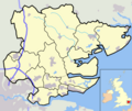
Essex UK locator map 2010.svg 1,108 × 1,345; 302 KB
-
Abberton Reservoir.jpg 947 × 569; 48 KB
-
Ancient Essex 750.png 578 × 557; 20 KB
-
BCRC MCZ location.png 583 × 463; 107 KB
-
Billericay1955Constituency.svg 118 × 91; 45 KB
-
Billericay1983Constituency.svg 438 × 349; 176 KB
-
Bridgemarsh Island map.jpg 974 × 425; 151 KB
-
Bridgemarsh Island map.png 974 × 425; 71 KB
-
Chelmsford1918.png 700 × 481; 63 KB
-
Chelmsford1945.png 700 × 481; 66 KB
-
Cindery Island map.jpg 778 × 438; 144 KB
-
Cindery Island map.png 778 × 438; 47 KB
-
Coalhouse Fort area map.png 730 × 869; 346 KB
-
Cobmarsh Island map.jpg 522 × 460; 71 KB
-
Cobmarsh Island map.png 522 × 460; 23 KB
-
Colchester1918.png 700 × 481; 63 KB
-
Dagenham1945.png 700 × 481; 66 KB
-
Districts of thames gateway.png 810 × 419; 18 KB
-
EastHamNorth1918.png 700 × 481; 63 KB
-
EastHamSouth1918.png 700 × 481; 63 KB
-
England Police Forces (Essex).svg 1,108 × 1,345; 312 KB
-
EnglandEssex.png 200 × 247; 22 KB
-
EnglandEssexTrad.png 200 × 250; 28 KB
-
EnglandPoliceEssex.png 2,165 × 2,670; 87 KB
-
Epping1918.png 700 × 481; 63 KB
-
Epping1945.png 700 × 481; 66 KB
-
Essex - British Isles.svg 1,250 × 1,835; 1,024 KB
-
Essex Brit Isles Sect 5.svg 809 × 743; 939 KB
-
Essex Ceremonial Numbered.png 200 × 168; 3 KB
-
Essex Heptarchie 800.png 544 × 711; 14 KB
-
Essex outline highlighting Manningtree map.png 712 × 600; 150 KB
-
Essex outline map.png 712 × 600; 152 KB
-
Essex outline map.svg 799 × 673; 119 KB
-
Essex UK constituency map (blank).svg 1,425 × 1,141; 1.5 MB
-
Essex UK district map (blank).svg 1,425 × 1,141; 1.41 MB
-
Essex UK electoral division map (blank).svg 1,425 × 1,141; 2.06 MB
-
Essex UK electoral division map 2025 (blank).svg 625 × 456; 1.38 MB
-
Essex UK location map.svg 1,425 × 1,141; 2.52 MB
-
Essex UK parish map (blank).svg 1,425 × 1,141; 3.18 MB
-
Essex UK relief location map.jpg 1,999 × 1,600; 346 KB
-
Essex UK ward map (blank).svg 1,425 × 1,141; 2.97 MB
-
Essex1832Map.png 2,000 × 1,534; 470 KB
-
EssexBrit5.PNG 625 × 569; 26 KB
-
EssexNumbered.png 200 × 148; 14 KB
-
Fitzwalter manors in Essex.png 713 × 598; 157 KB
-
Foulness Island map.jpg 701 × 467; 102 KB
-
Foulness Island map.png 701 × 467; 48 KB
-
Hanningfield Reservoir Map - geograph.org.uk - 257685.jpg 640 × 456; 74 KB
-
Harwich1918.png 700 × 481; 63 KB
-
Havering liberty 1881.png 681 × 957; 22 KB
-
Hinckford Hundred.jpg 1,624 × 1,309; 316 KB
-
Hoo Peninsula.png 873 × 608; 58 KB
-
Hornchurch1945.png 700 × 481; 66 KB
-
Hundreds of Essex.png 2,594 × 2,023; 373 KB
-
Ilford1918.png 700 × 481; 63 KB
-
IlfordNorth1945.png 700 × 481; 66 KB
-
IlfordSouth1945.png 700 × 481; 66 KB
-
Ingatestone Hall plan.png 2,149 × 1,299; 142 KB
-
LeytonEast.png 700 × 481; 63 KB
-
LeytonWest.png 700 × 481; 63 KB
-
London TTWA 2001.png 1,648 × 1,171; 121 KB
-
Maldon1918.png 700 × 481; 63 KB
-
Map of Essex 1777 - Chapman and Andre (cropped).jpg 4,211 × 3,273; 4.85 MB
-
Map of Essex 1777 - Chapman and Andre.jpg 30,208 × 23,808; 149.05 MB
-
Map rayleigh.jpg 3,166 × 2,203; 3.73 MB
-
Map showing the traditional, geographical county of Essex, England.png 4,967 × 4,967; 4.34 MB
-
Maunsell Fort Locations.png 1,359 × 1,019; 392 KB
-
Ordnance Survey 1-250000 - TL.jpg 4,000 × 4,000; 8.45 MB
-
Ordnance Survey 1-250000 - TM.jpg 4,000 × 4,000; 3.74 MB
-
Ordnance Survey 1-250000 - TR.jpg 4,000 × 4,000; 2.13 MB
-
Osea Island map.jpg 1,022 × 485; 110 KB
-
Osea Island map.png 1,022 × 485; 52 KB
-
Plaistow1918.png 700 × 481; 63 KB
-
River crouch course.png 954 × 570; 62 KB
-
Romford1918.png 700 × 481; 63 KB
-
Romford1945.png 700 × 481; 66 KB
-
SaffronWalden1918.png 700 × 481; 63 KB
-
Silvertown1918.png 700 × 481; 63 KB
-
South Essex Combined Authority proposal map.png 2,558 × 2,048; 622 KB
-
SouthEastEssex1918.png 700 × 481; 63 KB
-
SouthEastEssex1945.png 700 × 481; 66 KB
-
Southend1918.png 700 × 481; 63 KB
-
Stratford1918.png 700 × 481; 63 KB
-
Ukmap-ess.png 145 × 173; 6 KB
-
WalthamstowEast1918.png 700 × 481; 63 KB
-
WalthamstowWest1918.png 700 × 481; 63 KB
-
Woodford1945.png 700 × 481; 66 KB


