Category:Maps of rivers in Oregon
Jump to navigation
Jump to search
States of the United States: Alabama · Alaska · Arizona · Arkansas · California · Colorado · Connecticut · Delaware · Florida · Georgia · Idaho · Illinois · Indiana · Iowa · Kansas · Kentucky · Louisiana · Maine · Maryland · Massachusetts · Michigan · Minnesota · Mississippi · Missouri · Montana · Nebraska · Nevada · New Hampshire · New Jersey · New Mexico · New York · North Carolina · North Dakota · Ohio · Oklahoma · Oregon · Pennsylvania · Rhode Island · South Carolina · South Dakota · Tennessee · Texas · Utah · Vermont · Virginia · Washington · West Virginia · Wisconsin · Wyoming – Washington, D.C.
Subcategories
This category has the following 4 subcategories, out of 4 total.
M
- Maps of the Columbia River (63 F)
- Maps of the Klamath River (1 P, 12 F)
- Maps of the Snake River (10 F)
- Maps of the Willamette River (15 F)
Media in category "Maps of rivers in Oregon"
The following 110 files are in this category, out of 110 total.
-
Oregon Rivers.png 1,500 × 1,125; 3.37 MB
-
USGS Oregon river basins.png 1,849 × 1,501; 642 KB
-
121W45Ni10a.png 2,375 × 3,375; 2.65 MB
-
A map exhibiting all the new discoveries in the interior parts of North America. NYPL465250.tiff 8,909 × 7,687; 195.96 MB
-
Applegate River Watershed.png 1,188 × 949; 2.07 MB
-
Bear Creek Rogue River Route.png 640 × 704; 186 KB
-
Big Butte Creek Watershed.png 1,162 × 975; 1.64 MB
-
Blue River Map.jpg 500 × 495; 59 KB
-
Bull run river oregon watershed map.png 710 × 420; 64 KB
-
California fish and game (20325278880).jpg 2,976 × 1,664; 636 KB
-
Chetco River Watershed.png 1,500 × 1,000; 1.8 MB
-
Clackamasrivermap.png 2,917 × 3,333; 3.13 MB
-
Coastforkwillamettemap.png 2,917 × 3,333; 3.12 MB
-
Columbia River Basin map-sr.svg 1,480 × 1,474; 1,014 KB
-
Columbiarivermap.png 1,500 × 1,500; 3.6 MB
-
Columbiasloughwatershed.png 1,539 × 1,200; 302 KB
-
Crooked River Map.png 821 × 609; 90 KB
-
Crooked Wild and Scenic River (24151937137).jpg 2,700 × 3,300; 1.03 MB
-
Crooked Wild and Scenic River (24151937357).jpg 2,700 × 3,300; 1,010 KB
-
Deschutes Wild and Scenic River -- Map 1 (38299803164).jpg 5,900 × 8,200; 3.23 MB
-
Deschutes Wild and Scenic River -- Map 2 (38299802284).jpg 3,300 × 4,800; 1.85 MB
-
Deschutes Wild and Scenic River -- Map 3 (38979851642).jpg 4,500 × 6,000; 2.17 MB
-
Deschutes Wild and Scenic River -- Map 4 (38979851252).jpg 5,400 × 6,900; 3.07 MB
-
Deschutes Wild and Scenic River -- Map 5 (38299800534).jpg 5,400 × 6,900; 3.28 MB
-
Donner Und Blitzen Wild and Scenic River (38299799974).jpg 3,750 × 4,651; 2.07 MB
-
Elkhorn Creek Wild and Scenic River (38299799634).jpg 6,000 × 4,800; 2.33 MB
-
Fanno Creek (large).png 4,578 × 450; 4.32 MB
-
Fanno Creek (medium).png 3,052 × 300; 1.97 MB
-
Fanno Creek (small).jpg 1,526 × 150; 95 KB
-
Fanno Creek watershed.png 427 × 412; 164 KB
-
Fifteenmile Creek Watershed.png 1,425 × 1,124; 1.63 MB
-
FMIB 33392 Fisheries of Coquille River Entrance, Oregon 1889.jpeg 1,161 × 981; 111 KB
-
Grande Ronde Wild and Scenic River (38979849962).jpg 6,300 × 5,400; 3.65 MB
-
Granderonderivermap.jpg 700 × 710; 249 KB
-
Hood river watershed elements.png 1,429 × 1,949; 151 KB
-
John Day Wild and Scenic River -- Map 1 (38299798514).jpg 5,400 × 3,600; 1.77 MB
-
John Day Wild and Scenic River -- Map 2 (38979849042).jpg 3,000 × 4,500; 1.82 MB
-
John Day Wild and Scenic River -- Map 3 (38979848492).jpg 4,500 × 6,000; 3.04 MB
-
John Day Wild and Scenic River -- Map 4 (25145267798).jpg 4,500 × 6,000; 2.12 MB
-
John Day Wild and Scenic River -- Map 5 (38979847362).jpg 4,500 × 6,000; 2 MB
-
Johndayrivermap.png 561 × 500; 396 KB
-
Johnson Creek watershed map.png 698 × 425; 325 KB
-
Johnsoncreekmap.png 575 × 408; 443 KB
-
Journal of the Association of Engineering Societies (1881) (14764453912).jpg 3,992 × 1,482; 525 KB
-
Kiger Creek Wild and Scenic River (38979847102).jpg 3,750 × 4,651; 2.09 MB
-
Klamath Basin map.png 1,179 × 1,121; 1.83 MB
-
Klamath Mountains map.gif 515 × 684; 33 KB
-
Klamath Wild and Scenic River (25145266218).jpg 5,300 × 5,800; 1.93 MB
-
KlamathRiver watershed (cropped).png 316 × 316; 45 KB
-
KlamathRiver watershed.png 469 × 445; 54 KB
-
Little Applegate River Watershed.png 1,047 × 980; 1.51 MB
-
Little Butte Creek Diversion Map.png 1,525 × 1,505; 984 KB
-
Little Butte Creek Watershed.png 1,496 × 984; 2.08 MB
-
McKenzie River watershed (9357445131).jpg 2,413 × 1,580; 2.64 MB
-
McKenzie River Watershed.jpg 1,525 × 849; 429 KB
-
Mckenzierivermap.png 2,917 × 3,333; 3.14 MB
-
MetoliusRiverDiagram.jpg 1,863 × 2,196; 492 KB
-
Mfwillamettemap.png 2,917 × 3,333; 3.15 MB
-
Mount Jefferson (Oregon) topographic map-fr.svg 1,772 × 1,369; 2.26 MB
-
Multnomah County cadastral map, 1889.jpg 1,785 × 2,560; 770 KB
-
North Fork Crooked Wild and Scenic River (38979846512).jpg 5,100 × 6,600; 2.09 MB
-
North Umpqua Wild and Scenic River (38321285394).jpg 1,585 × 1,224; 1.68 MB
-
NorthWest Oregon Rivers.svg 663 × 484; 22 KB
-
OregonCoastRangeRivers.png 410 × 1,056; 92 KB
-
Owyhee river basin map.png 1,000 × 1,372; 2.39 MB
-
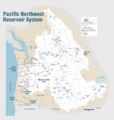
Pacific Northwest River System.png 1,930 × 2,032; 412 KB
-
Pistol River Watershed.png 1,074 × 1,125; 1.24 MB
-
Powder Wild and Scenic River (38321285164).jpg 1,232 × 1,510; 1.58 MB
-
Quartzville Wild and Scenic River (38979846142).jpg 3,300 × 2,550; 1,001 KB
-
Quinnrivermap.png 500 × 500; 323 KB
-
Rogue river access map.png 958 × 1,923; 577 KB
-
Rogue River Watershed.png 1,459 × 809; 1.45 MB
-
Rogue Wild and Scenic River -- Recreation Section (25145265148).jpg 3,450 × 4,650; 1.98 MB
-
Rogue Wild and Scenic River Wild Section (38979845712).jpg 4,650 × 3,600; 2.62 MB
-
Roguerivermap.png 954 × 623; 1.09 MB
-
Salmon Wild and Scenic River (38979845252).jpg 3,300 × 2,550; 971 KB
-
Sandy Wild and Scenic River (38979844882).jpg 6,600 × 5,100; 2.56 MB
-
Santiamrivermap.png 2,917 × 3,333; 3.15 MB
-
Snake River watershed map.png 1,211 × 1,119; 2.1 MB
-
SOCR rivers.png 311 × 322; 21 KB
-
South Fork Clackamas Wild and Scenic River (38299803694).jpg 2,550 × 3,300; 1.12 MB
-
South Fork John Day Wild and Scenic River (38979844422).jpg 3,600 × 6,300; 2.16 MB
-
Southern oregon cascades map.gif 1,186 × 1,114; 97 KB
-
Southern oregon cascades map.png 593 × 557; 24 KB
-
Southwest Oregon rivers map.jpg 300 × 200; 40 KB
-
TrinityRiver watershed.png 462 × 441; 55 KB
-
Trout Creek Watershed.png 1,050 × 1,125; 1.53 MB
-
Umpqua River basin area.jpg 300 × 200; 35 KB
-
Umpqua River watershed.png 1,336 × 1,057; 2.02 MB
-
Umpquarivermap.jpg 926 × 633; 216 KB
-
Usgs deschutes watershed.png 911 × 1,325; 215 KB
-
Usgs rogue river watershed map.png 1,624 × 1,286; 314 KB
-
Wallowa Wild and Scenic River (25145262548).jpg 2,700 × 3,450; 1.12 MB
-
Warm springs river basin.png 750 × 842; 36 KB
-
Wenaha river map.png 1,741 × 1,342; 3.35 MB
-
White Wild and Scenic River (38979843612).jpg 5,400 × 3,600; 2.28 MB
-
Wild Horse Creek Wild and Scenic River (38979842732).jpg 3,750 × 4,651; 2.09 MB
-
Willamette river map new.png 2,917 × 3,333; 3.28 MB
-
Willamette watershed.png 150 × 150; 8 KB
-
Willametterivermap.jpg 562 × 689; 297 KB
-
Willow Creek Watershed.png 1,051 × 1,125; 1.43 MB
-
Wpdms shdrlfi020l chetco river.jpg 300 × 180; 34 KB
-
Wpdms shdrlfi020l smith river oregon.jpg 300 × 200; 35 KB
-
Wpdms shdrlfi020l sprague river.jpg 300 × 222; 45 KB
-
Wpdms shdrlfi020l tillamook bay.jpg 300 × 240; 33 KB


