Category:Maps of the Willamette River
Jump to navigation
Jump to search
Media in category "Maps of the Willamette River"
The following 15 files are in this category, out of 15 total.
-
Willamette watershed.png 150 × 150; 8 KB
-
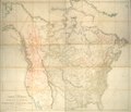
A map exhibiting all the new discoveries in the interior parts of North America. NYPL465250.tiff 8,909 × 7,687; 195.96 MB
-
Columbiasloughwatershed.png 1,539 × 1,200; 302 KB
-
Fanno Creek watershed.png 427 × 412; 164 KB
-
Journal of the Association of Engineering Societies (1881) (14764453912).jpg 3,992 × 1,482; 525 KB
-
Mfwillamettemap.png 2,917 × 3,333; 3.15 MB
-
Multnomah County cadastral map, 1889.jpg 1,785 × 2,560; 770 KB
-
Plat of Portland OR c1850s.png 1,200 × 1,418; 3.21 MB
-
Santiamrivermap.png 2,917 × 3,333; 3.15 MB
-
Swan Island 1913 sketch.jpg 362 × 439; 41 KB
-
Willametterivermap.jpg 562 × 689; 297 KB


