Category:Maps of rivers in Alaska
Jump to navigation
Jump to search
States of the United States: Alabama · Alaska · Arizona · Arkansas · California · Colorado · Connecticut · Delaware · Florida · Georgia · Idaho · Illinois · Indiana · Iowa · Kansas · Kentucky · Louisiana · Maine · Maryland · Massachusetts · Michigan · Minnesota · Mississippi · Missouri · Montana · Nebraska · Nevada · New Hampshire · New Jersey · New Mexico · New York · North Carolina · North Dakota · Ohio · Oklahoma · Oregon · Pennsylvania · Rhode Island · South Carolina · South Dakota · Tennessee · Texas · Utah · Vermont · Virginia · Washington · West Virginia · Wisconsin · Wyoming – Washington, D.C.
Subcategories
This category has the following 3 subcategories, out of 3 total.
M
- Maps of Alsek River (1 F)
- Maps of Matanuska River (3 F)
S
- Maps of Stikine River (4 F)
Media in category "Maps of rivers in Alaska"
The following 37 files are in this category, out of 37 total.
-
Acsa2 map.jpg 422 × 359; 241 KB
-
AK map Nenana river.svg 2,878 × 1,537; 179 KB
-
AK map Tanana river.svg 2,878 × 1,537; 182 KB
-
Ambler Road Project Area Administered Lands.png 1,499 × 961; 2.17 MB
-
Anchorage Watersheds.jpg 770 × 606; 304 KB
-
Bw Yukon River drainage basin.png 542 × 292; 14 KB
-
Colvillerivermap.png 500 × 500; 113 KB
-
Copper River Route.svg 776 × 580; 938 KB
-
FMIB 38813 Sketch of Klawak Stream and Lake.jpeg 1,069 × 919; 109 KB
-
FMIB 38814 Sketch of Vicinity of Orca and Odiak.jpeg 1,060 × 994; 105 KB
-
FMIB 40733 Freehand Sketch of Mouth of Naknek River, Bristol Bay.jpeg 1,007 × 536; 76 KB
-
FMIB 40758 Humpback Stream, Shipley Bay, Prince of Wales Island.jpeg 693 × 1,098; 89 KB
-
FMIB 40761 Sketches of East and West Streams, North Bay of Pillars.jpeg 893 × 785; 126 KB
-
FMIB 40763 Thoms Stream and Lake, Wrangell Island.jpeg 859 × 955; 139 KB
-
FMIB 40764 Meyers Stream, Cleveland Peninsula.jpeg 445 × 676; 63 KB
-
FMIB 40767 Behm Canal, Naha Stream and Lake System.jpeg 1,848 × 1,487; 365 KB
-
FMIB 44424 -Nushagak River-.jpeg 931 × 1,625; 334 KB
-
FMIB 49139 Sketch of Boca de Quadra Hatchery and vicinity.jpeg 1,253 × 1,385; 183 KB
-
Katmai National Park Geologic Map.png 1,829 × 756; 1.9 MB
-
Koyukuk river map.jpg 2,400 × 1,536; 768 KB
-
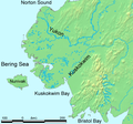
Kuskokwimrivermap.png 981 × 869; 360 KB
-
Maniilaq Service Area.png 1,242 × 840; 503 KB
-
Map of Koyukuk River, Alaska LOC 2006629787.jpg 6,327 × 7,350; 5.17 MB
-
Noatak River on a map.png 776 × 580; 639 KB
-
NorthForkKoyukukLargeMap.jpg 1,220 × 1,876; 596 KB
-
NorthForkKoyukukRiver.jpg 437 × 677; 85 KB
-
Northwest-relief StikineRiver.jpg 660 × 660; 464 KB
-
RiversOfAlaska.png 1,800 × 1,600; 2.48 MB
-
USGS Anchorage, Alaska Waterways.jpg 816 × 734; 89 KB
-
Yukon River Basin USGS.jpg 745 × 511; 47 KB
-
Yukon River drainage basin.gif 563 × 290; 80 KB
-
Yukon watershed.png 500 × 500; 123 KB
-
Yukon-Kuskokwim-Delta.png 428 × 401; 81 KB


