Category:Maps of rivers in Wisconsin
Jump to navigation
Jump to search
States of the United States: Alabama · Alaska · Arizona · Arkansas · California · Colorado · Connecticut · Delaware · Florida · Georgia · Idaho · Illinois · Indiana · Iowa · Kansas · Kentucky · Louisiana · Maine · Maryland · Massachusetts · Michigan · Minnesota · Mississippi · Missouri · Montana · Nebraska · Nevada · New Hampshire · New Jersey · New Mexico · New York · North Carolina · North Dakota · Ohio · Oklahoma · Oregon · Pennsylvania · Rhode Island · South Carolina · South Dakota · Tennessee · Texas · Utah · Vermont · Virginia · Washington · West Virginia · Wisconsin · Wyoming – Washington, D.C.
- English: Maps of the Rivers in Wisconsin.
Media in category "Maps of rivers in Wisconsin"
The following 25 files are in this category, out of 25 total.
-
Badwirivermap.png 500 × 500; 133 KB
-
Blackwirivermap.png 500 × 500; 94 KB
-
Chippewawirivermap.png 500 × 500; 101 KB
-
Des Plaines River.png 1,000 × 1,555; 692 KB
-
Driftless trout streams1.png 3,956 × 3,955; 20.36 MB
-
East Branch Pecatonica River Map.png 999 × 934; 364 KB
-
Fox River Map.png 518 × 828; 118 KB
-
Foxandwolfrivermap.png 500 × 500; 97 KB
-
Kickapoo River Map.png 830 × 915; 243 KB
-
La Crosse River Map.png 1,094 × 692; 252 KB
-
Lake Delton Wisconsin map.png 422 × 372; 8 KB
-
Little Sugar River Map.png 639 × 778; 208 KB
-
Menomineerivermap.png 500 × 502; 106 KB
-
Milwaukeerivermap.png 497 × 500; 159 KB
-
Mouth of Root River, Wisconsin - DPLA - 72e8574dadeb39c45da767efa0b33b24.jpg 7,108 × 5,656; 2.32 MB
-
Pecatonica River Map.png 999 × 934; 376 KB
-
Rockilrivermap.png 500 × 500; 108 KB
-
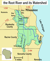
Root River WI map.png 486 × 583; 88 KB
-
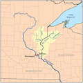
Stcroixmnwirivermap.png 500 × 502; 112 KB
-
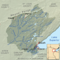
Stlouisrivermap.png 1,000 × 1,003; 652 KB
-
Sugar River Map.png 1,919 × 2,335; 675 KB
-
Upper Mississippi River Valley AVA.png 415 × 500; 100 KB
-
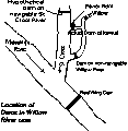
Willow.gif 272 × 280; 3 KB
-
Wisconsinrivermap.png 500 × 500; 103 KB
-
Yahara River WI map.png 2,518 × 2,528; 3.46 MB
