Category:Maps of rivers in Wyoming
Jump to navigation
Jump to search
States of the United States: Alabama · Alaska · Arizona · Arkansas · California · Colorado · Connecticut · Delaware · Florida · Georgia · Idaho · Illinois · Indiana · Iowa · Kansas · Kentucky · Louisiana · Maine · Maryland · Massachusetts · Michigan · Minnesota · Mississippi · Missouri · Montana · Nebraska · Nevada · New Hampshire · New Jersey · New Mexico · New York · North Carolina · North Dakota · Ohio · Oklahoma · Oregon · Pennsylvania · Rhode Island · South Carolina · South Dakota · Tennessee · Texas · Utah · Vermont · Virginia · Washington · West Virginia · Wisconsin · Wyoming – Washington, D.C.
Subcategories
This category has the following 3 subcategories, out of 3 total.
M
- Maps of the Snake River (10 F)
Media in category "Maps of rivers in Wyoming"
The following 18 files are in this category, out of 18 total.
-
Bearrivermap.png 500 × 500; 95 KB
-
Belle Fourche map 1.jpg 633 × 473; 105 KB
-
Bighornrivermap.jpg 493 × 599; 302 KB
-
CheyenneCourseWatershed1.png 814 × 567; 43 KB
-
Coloradorivermap (Utah detail).jpg 799 × 652; 402 KB
-
Coloradorivermapnew1.jpg 871 × 1,130; 701 KB
-
Geology and water resources of the Bighorn Basin, Wyoming (1906) (14755510426).jpg 3,588 × 3,448; 2.45 MB
-
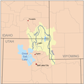
Great salt lake drainage map.jpg 1,060 × 1,227; 1.13 MB
-
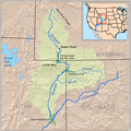
Greenutrivermap.png 500 × 500; 409 KB
-
Littlemissouririvermap.png 836 × 878; 1,019 KB
-
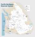
Pacific Northwest River System.png 1,930 × 2,032; 412 KB
-
Platterivermap.jpg 1,382 × 919; 2.29 MB
-
Shell Creek.jpg 2,636 × 2,048; 680 KB
-
Wpdms nasa topo chugwater creek.jpg 300 × 250; 45 KB
-
Wpdms nasa topo laramie river.jpg 300 × 250; 45 KB
-
Wpdms nasa topo little snake river.jpg 300 × 300; 60 KB
-
Wpdms nasa topo madison river.jpg 300 × 250; 45 KB
-
YellowstoneRiverMap.jpg 1,066 × 967; 1.55 MB


