Category:Maps of rivers in Mississippi (state)
Jump to navigation
Jump to search
States of the United States: Alabama · Alaska · Arizona · Arkansas · California · Colorado · Connecticut · Delaware · Florida · Georgia · Idaho · Illinois · Indiana · Iowa · Kansas · Kentucky · Louisiana · Maine · Maryland · Massachusetts · Michigan · Minnesota · Mississippi · Missouri · Montana · Nebraska · Nevada · New Hampshire · New Jersey · New Mexico · New York · North Carolina · North Dakota · Ohio · Oklahoma · Oregon · Pennsylvania · Rhode Island · South Carolina · South Dakota · Tennessee · Texas · Utah · Vermont · Virginia · Washington · West Virginia · Wisconsin · Wyoming – Washington, D.C.
Media in category "Maps of rivers in Mississippi (state)"
The following 13 files are in this category, out of 13 total.
-
 American malacological bulletin (1986) (18152655652).jpg 1,157 × 1,248; 143 KB
-
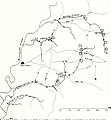
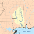
 Amiterivermap.png 500 × 500; 176 KB
-
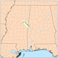
 Bigblackrivermap.png 417 × 500; 118 KB
-
 Bulletin of the U.S. Department of Agriculture (1913-1923.) (19875672674).jpg 3,452 × 2,378; 1.37 MB
-
 Bulletin of the U.S. Department of Agriculture (1913-1923.) (19877414403).jpg 3,486 × 2,340; 1.16 MB
-
 Bulletin of the U.S. Department of Agriculture (1913-1923.) (19877421013).jpg 3,539 × 2,376; 1.25 MB
-
 Bulletin of the U.S. Department of Agriculture (1913-1923.) (20472125556).jpg 3,517 × 2,507; 1.31 MB
-
 Bulletin of the U.S. Department of Agriculture (1913-1923.) (20498342265).jpg 3,880 × 1,638; 1.78 MB
-
 Noxubeerivermap.png 500 × 500; 163 KB
-
 Pascagoularivermap.png 467 × 467; 138 KB
-
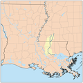
 Pearlmsrivermap.png 500 × 500; 152 KB
-
 Tallahatchie River Head of Navigation, Batesville.JPG 2,736 × 3,648; 2.1 MB
-
 Yazoo river.gif 776 × 975; 46 KB
_(18152655652).jpg)


_(19875672674).jpg)
_(19877414403).jpg)
_(19877421013).jpg)
_(20472125556).jpg)
_(20498342265).jpg)


