Category:Maps of rivers in Florida
Jump to navigation
Jump to search
States of the United States: Alabama · Alaska · Arizona · Arkansas · California · Colorado · Connecticut · Delaware · Florida · Georgia · Idaho · Illinois · Indiana · Iowa · Kansas · Kentucky · Louisiana · Maine · Maryland · Massachusetts · Michigan · Minnesota · Mississippi · Missouri · Montana · Nebraska · Nevada · New Hampshire · New Jersey · New Mexico · New York · North Carolina · North Dakota · Ohio · Oklahoma · Oregon · Pennsylvania · Rhode Island · South Carolina · South Dakota · Tennessee · Texas · Utah · Vermont · Virginia · Washington · West Virginia · Wisconsin · Wyoming – Washington, D.C.
Media in category "Maps of rivers in Florida"
The following 35 files are in this category, out of 35 total.
-
Alafiarivermap.png 500 × 500; 131 KB
-
Alapaharivermap.png 500 × 500; 165 KB
-
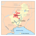
Apalachicola watershed.png 300 × 278; 102 KB
-
Aucillarivermap.png 500 × 500; 148 KB
-
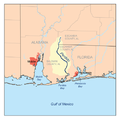
Blackwaterflrivermap.png 500 × 500; 94 KB
-
Caloosahatcheerivermap.png 500 × 500; 116 KB
-
Chipolarivermap.png 500 × 500; 128 KB
-
Choctawhatcheerivermap.png 500 × 500; 142 KB
-
Conecuhrivermap.png 500 × 500; 123 KB
-
Econfinarivermap.png 500 × 500; 144 KB
-
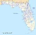
FlaWaterwaysMap.png 1,602 × 1,551; 549 KB
-
Halifaxrivermap fl.png 1,000 × 1,000; 285 KB
-
Hillsboroughrivermap.png 500 × 500; 132 KB
-
Kissimmeerivermap.png 467 × 467; 107 KB
-
Littlemanateerivermap.png 500 × 500; 131 KB
-
Manateerivermap.png 500 × 500; 131 KB
-
Myakkarivermap.png 500 × 500; 131 KB
-
Ochlockoneerivermap.png 500 × 500; 159 KB
-
Ocklawaharivermap.png 500 × 500; 144 KB
-
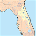
Peaceflrivermap.png 500 × 500; 121 KB
-
Perdidorivermap.png 500 × 500; 100 KB
-
Santaferivermap.png 500 × 500; 158 KB
-
South Florida Big Cypress Swamp.jpg 1,000 × 1,069; 116 KB
-
St. Lucie Estuary Watershed.png 1,750 × 1,342; 976 KB
-
Stjohnsriver detailmap.png 1,000 × 1,455; 890 KB
-
Stjohnsriver detailmap.svg 2,203 × 3,215; 478 KB
-
Stjohnsrivermap.png 467 × 467; 134 KB
-
Stmarksrivermap.png 500 × 500; 123 KB
-
Stmarysflrivermap.png 500 × 500; 135 KB
-
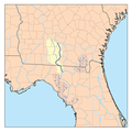
Suwanneerivermap.png 500 × 500; 162 KB
-
TT survey 1843.jpg 6,800 × 4,400; 3.12 MB
-
Withlacoocheenorthrivermap.png 500 × 500; 167 KB
-
Withlacoocheesouthrivermap.png 500 × 500; 147 KB
-
Yellowflrivermap.png 500 × 500; 121 KB

