Category:Maps of rivers in Idaho
Jump to navigation
Jump to search
States of the United States: Alabama · Alaska · Arizona · Arkansas · California · Colorado · Connecticut · Delaware · Florida · Georgia · Idaho · Illinois · Indiana · Iowa · Kansas · Kentucky · Louisiana · Maine · Maryland · Massachusetts · Michigan · Minnesota · Mississippi · Missouri · Montana · Nebraska · Nevada · New Hampshire · New Jersey · New Mexico · New York · North Carolina · North Dakota · Ohio · Oklahoma · Oregon · Pennsylvania · Rhode Island · South Carolina · South Dakota · Tennessee · Texas · Utah · Vermont · Virginia · Washington · West Virginia · Wisconsin · Wyoming – Washington, D.C.
Media in category "Maps of rivers in Idaho"
The following 16 files are in this category, out of 16 total.
-
Bearrivermap.png 500 × 500; 95 KB
-
Boise river basin map.png 1,000 × 660; 1.24 MB
-
Boiserivermap.png 1,875 × 1,204; 3.26 MB
-
BoiseRiverMapFinal.jpg 877 × 621; 191 KB
-
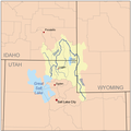
Great salt lake drainage map.jpg 1,060 × 1,227; 1.13 MB
-
LatahCreekMap.jpg 831 × 850; 224 KB
-
Owyhee river basin map.png 1,000 × 1,372; 2.39 MB
-
Owyheerivermap.jpg 937 × 1,109; 1.04 MB
-
Payette river basin.png 800 × 822; 1.32 MB
-
PayetteRiverMapFinal.jpg 912 × 808; 680 KB
-
Pendoreillerivermap.jpg 909 × 895; 1.01 MB
-
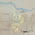
Salmon falls creek map-01.png 869 × 860; 229 KB
-
Salmon falls creek.jpg 388 × 762; 241 KB
-
Salmon river basin map.png 1,200 × 1,176; 2.51 MB
-
Salmonrivermapfinal.jpg 624 × 463; 275 KB
-
Snake River watershed map.png 1,211 × 1,119; 2.1 MB


