Category:Maps of rivers in West Virginia
Jump to navigation
Jump to search
States of the United States: Alabama · Alaska · Arizona · Arkansas · California · Colorado · Connecticut · Delaware · Florida · Georgia · Idaho · Illinois · Indiana · Iowa · Kansas · Kentucky · Louisiana · Maine · Maryland · Massachusetts · Michigan · Minnesota · Mississippi · Missouri · Montana · Nebraska · Nevada · New Hampshire · New Jersey · New Mexico · New York · North Carolina · North Dakota · Ohio · Oklahoma · Oregon · Pennsylvania · Rhode Island · South Carolina · South Dakota · Tennessee · Texas · Utah · Vermont · Virginia · Washington · West Virginia · Wisconsin · Wyoming – Washington, D.C.
Media in category "Maps of rivers in West Virginia"
The following 70 files are in this category, out of 70 total.
-
Armstrong Creek WV map.png 2,659 × 2,472; 5.17 MB
-
Arnold Creek WV map.png 2,891 × 2,252; 5.9 MB
-
Barkers Creek map.png 2,405 × 1,961; 164 KB
-
BigSandy watershed.png 288 × 240; 70 KB
-
Buckeye Creek WV map.png 2,891 × 2,252; 5.44 MB
-
Buffalo Creek Guyandotte map.png 2,634 × 2,203; 153 KB
-
Cabin Creek WV map.png 2,499 × 2,409; 5.68 MB
-
Campbells Creek WV map.png 3,169 × 2,434; 6.71 MB
-
Monon-CheatRiver.png 387 × 466; 46 KB
-
Chesapeakewatershedmap.png 1,500 × 1,656; 2.79 MB
-
Clear Fork Guyandotte map.png 2,405 × 2,176; 164 KB
-
Copperas Mine Fork map.png 3,103 × 2,247; 181 KB
-
Davis Creek WV map.png 3,169 × 2,422; 6.86 MB
-
East River (New River) map.png 3,170 × 1,779; 4.97 MB
-
Elk Creek WV map.png 2,883 × 2,125; 5.78 MB
-
Elk Fork (Point Pleasant Creek) map.png 2,538 × 2,383; 5.52 MB
-
Elk River WV map.png 3,041 × 1,672; 6.42 MB
-
Flint Run WV map.png 2,891 × 2,252; 4.69 MB
-
Greenbrierrivermap.png 500 × 500; 165 KB
-
Guyandotterivermap.png 498 × 500; 184 KB
-
Huff Creek WV map.png 2,544 × 2,006; 161 KB
-
Indian Creek (Middle Island Creek) map.png 2,572 × 2,174; 5.05 MB
-
Indian Creek Guyandotte map.png 2,405 × 2,178; 169 KB
-
Island Creek WV map.png 3,103 × 2,247; 180 KB
-
Kanawha River map.png 677 × 658; 444 KB
-
Kanawha watershed.png 288 × 280; 80 KB
-
Kellys Creek WV map.png 2,474 × 2,409; 4.92 MB
-
Laurel Fork Guyandotte map.png 2,405 × 2,176; 166 KB
-
Lens Creek WV map.png 3,186 × 2,302; 5.2 MB
-
Littlekanawhamap.png 500 × 500; 153 KB
-
Loop Creek WV map.png 2,659 × 2,472; 5.6 MB
-
McElroy Creek map.png 2,690 × 2,174; 5.69 MB
-
McKim Creek WV map.png 2,684 × 2,387; 6.26 MB
-
Meathouse Fork WV map.png 2,891 × 2,252; 5.97 MB
-
Middle Island Creek map.png 2,832 × 2,387; 8.26 MB
-
Mill Creek (western WV) map.png 2,623 × 2,100; 207 KB
-
Monon BlackFork.png 388 × 467; 45 KB
-
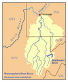
Monon BlackwaterRiver.png 387 × 465; 47 KB
-
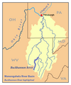
Monon BuckhannonRiver.png 387 × 465; 47 KB
-
Monon CheatRiver.png 385 × 463; 48 KB
-
Monon DryFork.png 387 × 465; 46 KB
-
Monon MiddleForkRiver.png 387 × 465; 47 KB
-
Monon ShaversFork.png 385 × 463; 48 KB
-
Monon TygartValleyRiver.png 363 × 441; 52 KB
-
Monon WestForkRiver.png 363 × 441; 49 KB
-
Monon YoughioghenyRiver.png 361 × 439; 52 KB
-
Monongahela River.png 361 × 439; 51 KB
-
NewRiver watershed.png 288 × 286; 82 KB
-
Ohiorivermap.png 467 × 469; 76 KB
-
Paint Creek WV map.png 2,381 × 2,411; 6.01 MB
-
Pinnacle Creek map.png 2,405 × 2,176; 170 KB
-
Point Pleasant Creek map.png 2,538 × 2,383; 5.6 MB
-
Pond Creek WV map.png 2,247 × 2,009; 167 KB
-
Reedy Creek WV map.png 2,630 × 2,369; 7.28 MB
-
Sancho Creek WV map.png 2,538 × 2,387; 5.49 MB
-
Sandy Creek (Ohio River) map.png 2,850 × 2,100; 227 KB
-
Shenandoah River map.png 1,000 × 1,000; 1.69 MB
-
Shenandoah watershed.png 500 × 500; 113 KB
-
Simpson Creek WV map.png 2,750 × 2,125; 5.38 MB
-
Smithers Creek WV map.png 2,627 × 2,413; 4.31 MB
-
Spring Creek Little Kanawha River map.png 2,606 × 1,962; 154 KB
-
Sugar Creek (Middle Island Creek) map.png 2,685 × 2,254; 5.47 MB
-
Toms Fork WV map.png 2,611 × 2,252; 4.2 MB
-
Twomile Creek WV map.png 3,188 × 2,470; 5.37 MB
-
Tygart Creek map.png 2,276 × 1,988; 5.31 MB
-
Walker Creek WV map.png 2,201 × 1,872; 133 KB
-
West Fork Little Kanawha River map.png 2,356 × 2,147; 193 KB
-
Wheeling Creek WV map.png 2,939 × 2,148; 6.97 MB
-
Witcher Creek WV map.png 3,169 × 2,409; 6.5 MB
-
Worthington Creek map.png 2,300 × 1,901; 142 KB


