Category:Maps of rivers in Colorado
Jump to navigation
Jump to search
States of the United States: Alabama · Alaska · Arizona · Arkansas · California · Colorado · Connecticut · Delaware · Florida · Georgia · Idaho · Illinois · Indiana · Iowa · Kansas · Kentucky · Louisiana · Maine · Maryland · Massachusetts · Michigan · Minnesota · Mississippi · Missouri · Montana · Nebraska · Nevada · New Hampshire · New Jersey · New Mexico · New York · North Carolina · North Dakota · Ohio · Oklahoma · Oregon · Pennsylvania · Rhode Island · South Carolina · South Dakota · Tennessee · Texas · Utah · Vermont · Virginia · Washington · West Virginia · Wisconsin · Wyoming – Washington, D.C.
Subcategories
This category has the following 5 subcategories, out of 5 total.
C
- Maps of the Colorado River (37 F)
M
- Maps of the Arkansas River (19 F)
S
- South Platte River maps (4 F)
Media in category "Maps of rivers in Colorado"
The following 41 files are in this category, out of 41 total.
-
Arkansas river basin map.png 1,200 × 759; 1.46 MB
-
Arkansasrivermap.jpg 771 × 533; 259 KB
-
Blue River Colorado map.png 1,174 × 1,326; 2.17 MB
-
Colorado River Banner for WikiVoyage.jpg 2,837 × 405; 1.64 MB
-
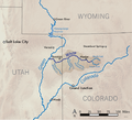
Coloradorivermap (Utah detail).jpg 799 × 652; 402 KB
-
Coloradorivermapnew1.jpg 871 × 1,130; 701 KB
-
Dolores river basin map.png 1,200 × 1,211; 2.43 MB
-
Doloresrivermap.png 1,600 × 1,680; 2.86 MB
-
Eagle river colorado map.png 1,200 × 926; 1.86 MB
-
Greenutrivermap.png 500 × 500; 409 KB
-
Gunnison river basin map.png 1,684 × 1,416; 4.04 MB
-
Gunnisonrivermap.jpg 565 × 521; 426 KB
-
Image from page 116 of "A biological survey of Colorado" (1911) (19758148394).jpg 2,160 × 1,616; 726 KB
-
Kansasrivermap.png 654 × 500; 308 KB
-
Littlecoloradomap.png 1,379 × 1,308; 847 KB
-
Wpdms nasa topo platte river.jpg 300 × 250; 45 KB
-
Platterivermap.jpg 1,382 × 919; 2.29 MB
-
Platterivermap.png 716 × 500; 485 KB
-
Republican River with Beecher Island highlighted.png 2,047 × 835; 760 KB
-
Rio Grande dams and diversions.svg 1,000 × 1,181; 2.65 MB
-
Riogranderivermap.png 1,000 × 1,181; 1.95 MB
-
Roaring Fork Colorado basin map.png 1,224 × 1,160; 2.22 MB
-
SanJuanBasinUSGS.jpg 728 × 601; 160 KB
-
Sanjuanrivermap-new.png 2,030 × 1,749; 3.91 MB
-
Sanjuanrivermap.jpg 617 × 429; 247 KB
-
Southplatterivermap.png 1,106 × 613; 1.23 MB
-
White River (Colorado and Utah) basin map.png 1,200 × 867; 1.88 MB
-
Whiteriverutmap.png 1,142 × 1,035; 541 KB
-
Wpdms nasa topo big thompson river.jpg 300 × 250; 45 KB
-
Wpdms nasa topo gunnison river.jpg 300 × 300; 60 KB
-
Wpdms nasa topo laramie river.jpg 300 × 250; 45 KB
-
Wpdms nasa topo little snake river.jpg 300 × 300; 60 KB
-
Wpdms nasa topo roaring fork river.jpg 300 × 300; 60 KB
-
Wpdms nasa topo san juan river utah.jpg 300 × 300; 60 KB
-
Wpdms nasa topo san miguel river colorado.jpg 300 × 300; 60 KB
-
Wpdms nasa topo smoky hill river.jpg 300 × 250; 45 KB
-
Wpdms nasa topo uncompahgre river.jpg 300 × 300; 60 KB
-
Yampa river basin map.png 1,200 × 1,072; 2.15 MB
-
Yamparivermap.png 2,604 × 2,125; 2.04 MB


