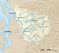
Category:Maps of rivers in Washington (state)
Jump to navigation
Jump to search
States of the United States: Alabama · Alaska · Arizona · Arkansas · California · Colorado · Connecticut · Delaware · Florida · Georgia · Idaho · Illinois · Indiana · Iowa · Kansas · Kentucky · Louisiana · Maine · Maryland · Massachusetts · Michigan · Minnesota · Mississippi · Missouri · Montana · Nebraska · Nevada · New Hampshire · New Jersey · New Mexico · New York · North Carolina · North Dakota · Ohio · Oklahoma · Oregon · Pennsylvania · Rhode Island · South Carolina · South Dakota · Tennessee · Texas · Utah · Vermont · Virginia · Washington · West Virginia · Wisconsin · Wyoming – Washington, D.C.
Subcategories
This category has the following 2 subcategories, out of 2 total.
M
- Maps of the Columbia River (63 F)
- Maps of the Snake River (10 F)
Media in category "Maps of rivers in Washington (state)"
The following 37 files are in this category, out of 37 total.
-
Baker River Map.jpg 632 × 542; 213 KB
-
BakerRiverMap.jpg 689 × 607; 180 KB
-
Bakerwamap-01.png 2,831 × 2,415; 1.98 MB
-
Carbonwamap.png 2,292 × 1,979; 1.76 MB
-
Cedarrivermap.png 2,083 × 2,225; 1.59 MB
-
Chehalis River Basin.PNG 912 × 1,032; 114 KB
-
Chehaliswamap-01.png 3,542 × 3,229; 3.68 MB
-
Clearwaterwamap.png 2,292 × 1,979; 1.76 MB
-
Cowlitzmap.png 3,326 × 2,665; 4.56 MB
-
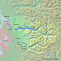
Duwamishmap.png 1,979 × 1,875; 1.34 MB
-
FMIB 34173 Kettle Falls.jpeg 727 × 427; 58 KB
-
Greenwamap.png 1,979 × 1,875; 1.35 MB
-
Greenwaterwamap.png 2,292 × 1,979; 1.76 MB
-
Kettle River Map.png 669 × 727; 103 KB
-
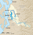
LakeWashington-watershed.png 2,083 × 2,225; 1.58 MB
-
LatahCreekMap.jpg 831 × 850; 224 KB
-
Mowichwamap.png 2,292 × 1,979; 1.75 MB
-
NorthWest Oregon Rivers.svg 663 × 484; 22 KB
-
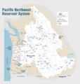
Pacific Northwest River System.png 1,930 × 2,032; 412 KB
-
Pend Oreille-Clark Fork dams.jpg 689 × 605; 151 KB
-
Pilchuckmap.png 2,800 × 2,490; 2.58 MB
-
Pilchuckrivermap.jpg 720 × 720; 242 KB
-
Puyallupmap.png 2,292 × 1,979; 1.77 MB
-
Sammamishmap.png 2,083 × 2,225; 1.58 MB
-
Skagitrivermap.png 500 × 500; 353 KB
-
Skykomishmap.png 2,800 × 2,490; 2.58 MB
-
Skykomishrivermap.jpg 720 × 720; 243 KB
-
Snohomishmap.png 2,800 × 2,490; 2.58 MB
-
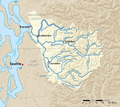
Snohomishrivermap.jpg 720 × 720; 242 KB
-
Snoqualmiemap.png 2,800 × 2,490; 2.58 MB
-
Snoqualmierivermap.jpg 720 × 720; 241 KB
-
Sultanmap.png 2,800 × 2,490; 2.58 MB
-
Toltmap.png 2,800 × 2,490; 2.57 MB
-
Toltrivermap.jpg 720 × 720; 242 KB
-
Whitewamap.png 2,292 × 1,979; 1.77 MB
-
Yakimarivermap.jpg 666 × 676; 599 KB


