Category:Maps of rivers in Ohio
Jump to navigation
Jump to search
States of the United States: Alabama · Alaska · Arizona · Arkansas · California · Colorado · Connecticut · Delaware · Florida · Georgia · Idaho · Illinois · Indiana · Iowa · Kansas · Kentucky · Louisiana · Maine · Maryland · Massachusetts · Michigan · Minnesota · Mississippi · Missouri · Montana · Nebraska · Nevada · New Hampshire · New Jersey · New Mexico · New York · North Carolina · North Dakota · Ohio · Oklahoma · Oregon · Pennsylvania · Rhode Island · South Carolina · South Dakota · Tennessee · Texas · Utah · Vermont · Virginia · Washington · West Virginia · Wisconsin · Wyoming – Washington, D.C.
Media in category "Maps of rivers in Ohio"
The following 29 files are in this category, out of 29 total.
-
Alumrivermap.png 500 × 500; 125 KB
-
American antiquities and discoveries in the West- (1838) (14747261036).jpg 2,320 × 2,710; 1.46 MB
-
Ashtabularivermap.png 400 × 400; 44 KB
-
Beaver Creek, or Riviere en Grys-1778.jpg 863 × 304; 164 KB
-
Beaverriverpamap.png 500 × 500; 98 KB
-
Bigwalnutrivermap.png 500 × 500; 126 KB
-
Blacklickrivermap.png 500 × 500; 123 KB
-
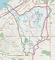
Euclid creek watershed.jpg 911 × 1,006; 448 KB
-
Hockingrivermap.png 500 × 500; 114 KB
-
Leading Creek Ohio map.png 2,763 × 2,378; 232 KB
-
Leatherwood Creek Ohio map.png 2,695 × 2,146; 173 KB
-
Little Hocking River map.png 2,763 × 2,378; 6.99 MB
-
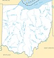
Major rivers and lakes of Ohio.jpg 1,242 × 1,330; 335 KB
-
Maumeerivermap.png 500 × 500; 106 KB
-
Miami Valley-map-1919.jpg 800 × 1,230; 450 KB
-
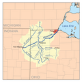
MiamiRivers watershed.png 300 × 277; 81 KB
-
Muskingumrivermap.png 800 × 800; 271 KB
-
Ohiopaintrivermap.svg 500 × 500; 177 KB
-
Ohiorivermap.png 467 × 469; 76 KB
-
Olentangyrivermap.svg 500 × 500; 166 KB
-
Portagerivermap.png 500 × 500; 192 KB
-
Reneshua river-1778.jpg 863 × 304; 111 KB
-
Sanduskyrivermap.png 500 × 500; 64 KB
-
Sciotorivermap.png 500 × 500; 135 KB
-
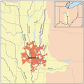
Shade River map.png 2,763 × 2,378; 273 KB
-
Wabash-River-Watershed.jpg 506 × 504; 32 KB
-
Wabashrivermap.png 1,000 × 1,000; 581 KB
-
Walhondingrivermap.png 500 × 500; 134 KB
-
Walhondingrivermap.svg 1,000 × 1,000; 343 KB


