Category:Maps of Turkey
Jump to navigation
Jump to search
Wikimedia category | |||||
| Upload media | |||||
| Instance of | |||||
|---|---|---|---|---|---|
| Category combines topics | |||||
 | |||||
Subcategories
This category has the following 27 subcategories, out of 27 total.
*
A
B
- Blank maps of Turkey (19 F)
C
D
E
- ECHO Daily Maps of Türkiye (20 F)
F
K
L
M
O
P
S
U
- Unidentified maps in Turkish (empty)
Pages in category "Maps of Turkey"
The following 2 pages are in this category, out of 2 total.
Media in category "Maps of Turkey"
The following 181 files are in this category, out of 181 total.
-
1927-widowhood-Turkey.png 824 × 533; 307 KB
-
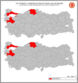
1947 Türkiye Cumhuriyeti Milletvekili Ara Seçimleri.png 1,894 × 2,035; 273 KB
-
1948 Türkiye Cumhuriyeti Milletvekili Ara Seçimleri.png 1,894 × 2,035; 291 KB
-
Series 1404 sheet 342-D Bodrum, published 1960.jpg 6,888 × 5,707; 11.15 MB
-
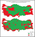
2017 Türkiye Cumhuriyeti Anayasa Referandumu.png 1,894 × 2,004; 265 KB
-
20180108 Atatürk 2789 (24960486577).jpg 7,952 × 5,304; 23.09 MB
-
20180108 Atatürk 2790 (24960481177).jpg 7,952 × 5,304; 19.13 MB
-
Admiralty Chart No 1886 Approaches to Fethiye Korfezi, Published 1962.jpg 11,255 × 8,215; 22.07 MB
-
Admiralty Chart No 241 Anchorages on the South Coast of Turkey, Published 1962.jpg 16,233 × 11,200; 18.27 MB
-
Aegean Sea map bathymetry-es.png 2,500 × 3,040; 8.49 MB
-
Aegean Sea region Cropped.jpg 1,383 × 740; 260 KB
-
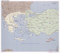
Aegean Sea region. LOC 2006625576.jpg 7,142 × 6,358; 8.18 MB
-
AIESEC Türkiye Haritası.png 1,044 × 555; 88 KB
-
AK Parti'nin başkan adaylarını açıkladığı şehirler (7.01.2024) (cropped).png 5,577 × 2,416; 1.31 MB
-
Anadolu Türkmenleri.jpg 800 × 444; 183 KB
-
Anatolia Turkey.png 514 × 331; 41 KB
-
Armenianhighlandorg.png 700 × 472; 138 KB
-
Asiaminore188aC.png 742 × 599; 125 KB
-
Assyriella thospitis menkhorsti - ZooKeys-171-017-g007.jpg 1,512 × 950; 667 KB
-
Atatürk Köşkü'nde Bulunan Harita, Trabzon.jpg 3,464 × 3,464; 1.4 MB
-
Bağımsız Türk Devletleri.png 1,415 × 714; 380 KB
-
BBP İl Başkanlıkları.png 5,392 × 3,330; 858 KB
-
BKDMAGLV.png 1,281 × 880; 39 KB
-
BlankMapTurkeyMM.png 1,024 × 500; 41 KB
-
BlankMapTurkeyProvincesباکوور.png 506 × 386; 20 KB
-
Bosnian (1950).png 1,900 × 1,000; 75 KB
-
BTKC.svg 1,580 × 677; 784 KB
-
Bulgarian (1927).png 1,900 × 1,000; 76 KB
-
CartaBig.jpg 600 × 432; 49 KB
-
Cities by number of herbaria.png 6,576 × 3,162; 816 KB
-
Cukurova.png 800 × 356; 93 KB
-
Cumhur.png 1,419 × 727; 297 KB
-
Eastern Turkey and vicinity..jpg 2,268 × 1,355; 2.81 MB
-
El mundo centrado en europa3.gif 361 × 229; 26 KB
-
Emplacement du mont Siplyos.png 737 × 375; 144 KB
-
Ereglimap.png 1,800 × 1,400; 349 KB
-
EUAS Santral Haritası.jpg 901 × 445; 158 KB
-
EuropeesTurkije.PNG 634 × 324; 26 KB
-
EÜAŞ Atık Isı Haritası.jpg 836 × 417; 131 KB
-
Fen Bilimleri Merkezi.png 524 × 247; 46 KB
-
FLII Turkey.png 1,533 × 677; 612 KB
-
Frontier defined by the Bulgarian–Ottoman Convention of 1915.png 1,500 × 3,000; 586 KB
-
Gaziantep Kahramanmaraş depremi uluslararası tepkiler.jpg 3,132 × 1,928; 2.01 MB
-
GOBEKLI TEBE.png 250 × 107; 68 KB
-
Gray Zones 21.png 530 × 596; 165 KB
-
Grayzone 141.jpg 349 × 326; 38 KB
-
Göktürkmap.png 1,688 × 1,017; 3.05 MB
-
Gökçeada Dilsiz Harita 2.png 1,200 × 626; 111 KB
-
Gökçeada Dilsiz Harita 3.png 1,200 × 626; 118 KB
-
Gökçeada Mahalle ve Köylere göre çoğunluk etnik gruplar.png 1,200 × 626; 59 KB
-
Harta politike e turqis.jpg 480 × 330; 36 KB
-
Hasköy in Malkara.png 720 × 738; 188 KB
-
Hattic-language-ka.svg 3,283 × 2,306; 3.34 MB
-
Hayrenatirutyan day Map small.jpg 600 × 600; 443 KB
-
Haziran 2012 vurulan Türk uçağının rotası.png 464 × 466; 37 KB
-
Herbaryum sayılarına göre şehirler.png 6,576 × 3,162; 816 KB
-
Ilısu dam map.png 1,030 × 616; 670 KB
-
ImbrosTenedos-ar.png 770 × 715; 123 KB
-
Istasyon harita kasım 2010.jpg 1,653 × 1,169; 547 KB
-
Iğdır İl Haritası.png 597 × 294; 10 KB
-
Jobs amenable to remote working in Turkey (2018).svg 1,200 × 486; 704 KB
-
KAFFED'in üye dernekleri olduğu şehirler.png 1,034 × 597; 40 KB
-
Karadeniz Bolgesi Yeryuzu Sekilleri Haritasi.jpg 365 × 186; 14 KB
-
Karia yolu - carian trail - карийская тропа.png 1,188 × 1,150; 484 KB
-
Karte der Türkei.png 1,500 × 916; 400 KB
-
Kireçtaşı TR.png 1,026 × 490; 95 KB
-
Kızılcahamam Turkey map.jpg 4,128 × 3,096; 3.02 MB
-
Kızılhisar topografik haritası.svg 920 × 614; 638 KB
-
Konya 651515 04.jpg 4,000 × 3,000; 5.79 MB
-
KummeVorschläge.jpg 1,638 × 551; 1.02 MB
-
Limits of the Mardin High.jpg 850 × 455; 208 KB
-
Localización de las siete iglesias del apocalipsis.jpg 767 × 542; 70 KB
-
Malkara'nın Mahalleleri.png 746 × 765; 123 KB
-
Manav türklerinin dağılımı.png 1,124 × 614; 158 KB
-
Manav Türklerinin Çoğunlukla Yaşadığı Şehirler Güncel.jpg 2,000 × 1,054; 231 KB
-
Map of churches likely established on Paul's second journey.gif 500 × 393; 14 KB
-
Map of the Samanli-Dag peninsula.png 1,174 × 526; 61 KB
-
Map of Turkey (hy).png 1,268 × 728; 421 KB
-
Map of Turkey001 (hy).png 1,881 × 1,071; 225 KB
-
MapaTopográficoDeAsiaMenor-Caria.png 1,692 × 1,200; 475 KB
-
MapaTopográficoDeAsiaMenor-Caria.svg 1,423 × 1,007; 7 MB
-
MapaTopográficoDeAsiaMenor-Eólida.png 1,224 × 1,352; 416 KB
-
MapaTopográficoDeAsiaMenor-Eólida.svg 787 × 1,093; 19.74 MB
-
MapaTopográficoDeAsiaMenor-jonia.png 1,154 × 840; 220 KB
-
Menemen map Smyrna region.png 404 × 346; 34 KB
-
Mother language in 1965 Turkey census - Kurdish & Zaza.jpg 4,032 × 2,025; 552 KB
-
MSGE.png 570 × 552; 566 KB
-
NETWORK ANALİZ.png 769 × 500; 204 KB
-
Nur daglari guneydogu bolgesi.png 1,176 × 968; 1.8 MB
-
Operational Navigation Chart F-4, 7th edition.jpg 9,254 × 6,681; 18.57 MB
-
Parasite160048-fig1 - Collection site of Echinorhynchus baeri from Salmo trutta.png 2,657 × 2,781; 676 KB
-
Paspargos Islands.PNG 733 × 532; 238 KB
-
Perinthus-map.png 1,168 × 596; 33 KB
-
Pilgerwegverlauf Kleinasien.jpg 1,021 × 768; 254 KB
-
Polling station in Ankara, 14 May 2023 - 52897475093.jpg 4,032 × 3,024; 2.71 MB
-
Pontisches Gebirge.png 900 × 431; 608 KB
-
Sakarya map.png 413 × 456; 12 KB
-
Salmo chilo range.svg 182 × 96; 18 KB
-
Sark Islahat Raporu - Uygulanan İller.png 1,737 × 977; 173 KB
-
Serv Harita.jpg 4,590 × 3,239; 1.91 MB
-
Sevr'den Lozan'a Türkiye.jpg 2,559 × 1,600; 1.81 MB
-
Shoremap.jpeg 557 × 273; 90 KB
-
Sivas kongresinin ingilizlerce engellenmesi.PNG 1,123 × 606; 141 KB
-
Slip-dist.png 798 × 441; 192 KB
-
Soviet claims on Turkey 1945-1953.png 1,623 × 1,283; 174 KB
-
Technopolis in Turkey.svg 1,024 × 500; 521 KB
-
The Turkish Lakes Region.gif 579 × 262; 11 KB
-
Tu-map tr.png 737 × 375; 143 KB
-
Tu-map-ar.png 737 × 375; 172 KB
-
Tu-map-HE.png 737 × 375; 135 KB
-
Tuerqi-ditu-chengshi-zh.png 2,113 × 1,213; 769 KB
-
Tuerqi-ditu-zh.png 632 × 322; 67 KB
-
Turchia mediterranea.png 785 × 251; 226 KB
-
Turkey - DPLA - 24f47e233aee8aaa4c7b942287e7c80e.jpg 11,548 × 8,131; 5.25 MB
-
Turkey - DPLA - 43d24429e45a1c73983621b58b90795a.jpg 3,136 × 2,408; 1.12 MB
-
Turkey - DPLA - 4ca1d17c2e7d11b6fd0e401e68954531.jpg 3,282 × 2,562; 1.5 MB
-
Turkey - DPLA - 624b320713943fcdd458889a712dadf8.jpg 3,276 × 2,554; 1.77 MB
-
Turkey - DPLA - df470f946e285e182aab679289567a55.jpg 3,290 × 2,556; 1.46 MB
-
Turkey area.png 819 × 460; 241 KB
-
Turkey five most2.png 1,732 × 768; 367 KB
-
Turkey Forest Cover - DPLA - 4e0bea843accb898ffbdba2486459689.jpg 9,456 × 5,424; 5.11 MB
-
Turkey Ground Condition Snow Covered - DPLA - 189fdfb0a2bc4f3f451b5b628c24914d.jpg 11,379 × 6,993; 10.79 MB
-
Turkey Ground Water Resources - DPLA - bd484f27b007f712e9cd824f303d5393.jpg 11,451 × 6,942; 10.98 MB
-
Turkey map 1.jpg 1,844 × 784; 214 KB
-
Turkey map with 30. & 45. meridians.png 788 × 363; 150 KB
-
Turkey South.gif 535 × 461; 192 KB
-
Turkey statistical regions map.png 1,579 × 677; 216 KB
-
Turkey Strategic Drainage - DPLA - 791e8487aa7b9a7e260b8bea9e93d2d4.jpg 11,377 × 6,993; 6.97 MB
-
Turkey Vegetation - DPLA - 48f05fd0278727adbf41f72cbca20b16.jpg 11,437 × 7,021; 8.44 MB
-
TurkeyOMC.png 1,793 × 941; 101 KB
-
TurkijeKaart.png 634 × 324; 21 KB
-
Turkish Aegean Coast.png 466 × 723; 429 KB
-
Turkish in Turkey (1927).png 1,900 × 1,000; 138 KB
-
Turkish in Turkey (1935).png 1,900 × 1,000; 132 KB
-
Turkish in Turkey (1945).png 1,900 × 1,000; 138 KB
-
Turkish in Turkey (1950).png 1,900 × 1,000; 137 KB
-
Turkish in Turkey (1955).png 1,900 × 1,000; 141 KB
-
Turkish in Turkey (1960).png 1,900 × 1,000; 141 KB
-
Turkish in Turkey (1965).png 1,900 × 1,000; 137 KB
-
Turkish Strait disambig AR.png 469 × 388; 49 KB
-
TurkishRivieraMap1.png 1,354 × 576; 16 KB
-
TurkishRivieraMapHeb.png 1,354 × 576; 17 KB
-
TurkiyeProvinces.png 1,700 × 1,000; 356 KB
-
Türkei Karte 1.png 634 × 324; 25 KB
-
Türkische-Bevölkerung-nach-Provinzen.png 402 × 288; 26 KB
-
Türkiye Hazine Toprağı Haritası (Yüzdesel olarak).png 2,048 × 860; 684 KB
-
Türkiye'de dağılışı.jpg 1,350 × 722; 429 KB
-
Türkiye'de Holosen Dönemine Ait Omurgalı Fosil Buluntuları.JPG 512 × 384; 22 KB
-
Türkiye'de maske takma zorunluluğu olan iller.png 1,800 × 1,200; 324 KB
-
Türkiye'de Pleistosen Dönemine Ait Omurgalı Fosil Buluntuları.JPG 671 × 476; 119 KB
-
Türkiye'de Salur Boyu.png 1,920 × 1,080; 426 KB
-
Türkiye'deki Buzullar.JPG 1,339 × 830; 174 KB
-
Türkiye'deki teknokentler, harita.png 6,576 × 3,162; 1,003 KB
-
Türkiye, 15-16.07.2016.png 1,226 × 493; 258 KB
-
Türkiye-En gelişmiş beş il.png 2,659 × 1,306; 1.22 MB
-
Türkiyede boz ayıların yaşam alanı haritası.png 493 × 271; 136 KB
-
Vakifli musa mountain location.png 469 × 298; 17 KB
-
Viatges de Egeria - ORIGINAL-gl.svg 653 × 945; 479 KB
-
Viatges de Egeria - ORIGINAL.svg 512 × 1,080; 317 KB
-
Western Anatolia.png 431 × 794; 91 KB
-
WhatsApp-Image-20160501.jpg 800 × 444; 150 KB
-
Yaşa göre nüfus dağılımı haritası.png 6,576 × 2,981; 996 KB
-
Yesilyurt.png 586 × 381; 485 KB
-
Zaza (1950).png 1,900 × 1,000; 85 KB
-
Zaza (1965).png 1,900 × 1,000; 82 KB
-
Zonage viticole Turquie.jpg 1,771 × 1,335; 473 KB
-
Éclipse 28 Mai -584 n2.png 1,419 × 843; 1.45 MB
-
Éclipse 28 Mai -584.png 1,419 × 843; 1.26 MB
-
Öğretmenlerin Şehit Edildikleri İller. 1930-2023.png 5,260 × 2,920; 996 KB
-
İstasyon Türkoğlu.png 617 × 497; 130 KB
-
Карта Малой Азии.png 8,500 × 4,137; 3.76 MB
-
Карты сражений русских и турок в Чесменской бухте в 1770г. 18в. rusneb2 e1.jpg 2,546 × 1,831; 1.33 MB
-
Сивиллы древнего мира.jpg 587 × 359; 62 KB
-
Таджеддин+хаджи амир 2.svg 2,452 × 1,384; 869 KB
-
Таджеддин+Хаджи амир.svg 2,452 × 1,384; 870 KB
-
Тыркуем икъалэхэм дэт Адыгэ къуаджэхэм япчъагъэхэр.png 6,576 × 4,015; 1.35 MB
-
نقشه عثمانی ها و سایر بیگ نشین های آناتولی در زمان حمله تیمور لنگ 1402 میلادی.jpg 2,400 × 1,080; 1.08 MB

