Category:Maps of the British Indian Ocean Territory
Jump to navigation
Jump to search
| NO WIKIDATA ID FOUND! Search for Maps of the British Indian Ocean Territory on Wikidata | |
| Upload media |
Subcategories
This category has the following 6 subcategories, out of 6 total.
Pages in category "Maps of the British Indian Ocean Territory"
This category contains only the following page.
Media in category "Maps of the British Indian Ocean Territory"
The following 28 files are in this category, out of 28 total.
-
Atoll research bulletin (1971) (20336900672).jpg 2,992 × 2,014; 2.17 MB
-
B.I.O.T location map.svg 1,581 × 1,768; 57 KB
-
Chagos large.png 1,311 × 1,947; 1.28 MB
-
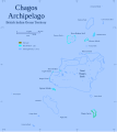
Chagos map 2.svg 1,581 × 1,768; 162 KB
-
Chagos map deutsch.png 1,581 × 1,768; 76 KB
-
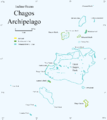
Chagos map.PNG 1,581 × 1,768; 111 KB
-
Chagos map.svg 1,581 × 1,768; 145 KB
-
Chagos map2y.PNG 1,581 × 1,768; 107 KB
-
Danger Island in Chagos - map.svg 1,581 × 1,768; 145 KB
-
Diego Garcia Island Map.jpg 888 × 1,240; 203 KB
-
Diego Garcia map - British Indian Ocean Territory.svg 3,240 × 3,960; 414 KB
-
DiegoGarcia1.png 349 × 140; 9 KB
-
Egmont map.png 2,089 × 1,455; 105 KB
-
Egmont3804q.PNG 2,089 × 1,440; 105 KB
-
EgmontIslands Map.jpg 1,240 × 904; 258 KB
-
Flag map of British Indian Ocean Territory.png 992 × 1,710; 29 KB
-
FMIB 53018 Great Chagos Bank.jpeg 480 × 348; 29 KB
-
Mv-baffin-strait-route.png 488 × 487; 42 KB
-
PAT - British Indian Ocean Territory.gif 800 × 1,035; 34 KB
-
Peros banhos map2.PNG 1,153 × 833; 56 KB
-
Peros banhos snr1w.PNG 936 × 689; 36 KB
-
Peros Banhos Strict Nature Reserve, BIOT.svg 1,153 × 833; 88 KB
-
Peros Banhos, British Indian Ocean Territory.svg 1,153 × 833; 86 KB
-
Salomon Islands (1907).jpg 837 × 612; 206 KB
-
Salomon Islands, British Indian Ocean Territory.svg 2,419 × 1,982; 124 KB
-
Salomon islands1.png 2,419 × 1,982; 163 KB
-
SeychellesBIOT1970.jpg 780 × 283; 72 KB
-
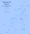
Карта на Чагос.svg 1,581 × 1,768; 457 KB


