Category:Maps of Singapore
Jump to navigation
Jump to search
Wikimedia category | |||||
| Upload media | |||||
| Instance of | |||||
|---|---|---|---|---|---|
| Category combines topics | |||||
 | |||||
Subcategories
This category has the following 15 subcategories, out of 15 total.
Pages in category "Maps of Singapore"
The following 2 pages are in this category, out of 2 total.
Media in category "Maps of Singapore"
The following 44 files are in this category, out of 44 total.
-
2013 Bukit Panjang Internet Exchange fire affected areas.svg 512 × 326; 178 KB
-
2023 Zone Map for Wiki.jpg 3,000 × 1,688; 297 KB
-
Admiralty Chart No 795 Cape Rachado to Singapore, Published 1896.jpg 18,457 × 11,363; 51.19 MB
-
Ang mo kio planning area.png 1,574 × 836; 372 KB
-
Ang Mo Kio Singapore.png 300 × 192; 39 KB
-
Base Map of Singapore.png 1,114 × 696; 427 KB
-
Bukit Batok location in reference to Singapore.png 798 × 454; 756 KB
-
Distribucion de las areas del territorio de singapur.png 627 × 459; 54 KB
-
ECDM 20151120 Indonesia Fires.pdf 1,625 × 1,125; 1.3 MB
-
ECHO Singapore Editable A4 Landscape.pdf 1,754 × 1,239; 230 KB
-
ECHO Singapore Editable A4 Landscape.png 1,123 × 794; 383 KB
-
Expressways of Singapore.png 1,179 × 787; 219 KB
-
FLII Singapore.png 1,249 × 656; 186 KB
-
Greater Indonesia Locator.svg 784 × 415; 1.77 MB
-
Kawasan undi ditanding pilihan raya umum Singapura 2015.svg 2,383 × 1,684; 2.35 MB
-
Kovan double murder map view.jpg 534 × 296; 144 KB
-
Location Map of Orita Sinclair School of Design & Music.jpg 1,288 × 1,000; 675 KB
-
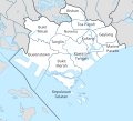
Map of Central Region, Singapore Planning Areas (+Central Area PAs).svg 356 × 322; 352 KB
-
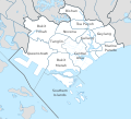
Map of Central Region, Singapore Planning Areas (Central Area).svg 356 × 322; 349 KB
-
PacificTheaterAug1942.jpg 1,199 × 873; 256 KB
-
PAT - Singapore.gif 1,035 × 800; 115 KB
-
Queenstown Singapore Subzones.png 4,096 × 4,096; 11.17 MB
-
Sengkang Locator Map.png 600 × 326; 80 KB
-
Sgp Mid90 outline v05 smth.png 1,000 × 640; 130 KB
-
Singapore - DPLA - 1e45a118e7b6a7f2b76afd90bea7ce08.jpg 3,274 × 2,554; 1.41 MB
-
Singapore - DPLA - 2c6cbbcc6e4ff6930e06b68da922e07e.jpg 3,276 × 2,554; 1.55 MB
-
Singapore be.png 1,709 × 1,126; 314 KB
-
Singapore Map Places with labels.png 900 × 575; 280 KB
-
Singapore Marine Guide Map.jpg 2,048 × 1,195; 2.34 MB
-
Singapore Planning Regions.svg 3,247 × 2,061; 1.05 MB
-
Singapore Population Density, 2000 (5457625724).jpg 2,507 × 3,265; 594 KB
-
Singapore Population Density, 2000 (6172447260).jpg 2,361 × 3,160; 694 KB
-
Singapore sd4 ds2 outline changi.png 1,679 × 1,125; 279 KB
-
Singapore sd4 ds2 planning areas.png 1,679 × 1,125; 395 KB
-
Singapore Shape.svg 500 × 500; 23 KB
-
SingaporePlanningAreasTentative1.png 1,200 × 762; 287 KB
-
SingaporePlanningAreasTentative2.png 1,200 × 762; 290 KB
-
Singapura em português.png 340 × 297; 19 KB
-
SubzonesOfSingapore.png 3,195 × 2,161; 379 KB
-
Wikimapathon background map.png 7,757 × 5,052; 39.12 MB


