Category:Maps of San Marino
Jump to navigation
Jump to search
Wikimedia category | |||||
| Upload media | |||||
| Instance of | |||||
|---|---|---|---|---|---|
| Category combines topics | |||||
 | |||||
Subcategories
This category has the following 15 subcategories, out of 15 total.
Pages in category "Maps of San Marino"
The following 2 pages are in this category, out of 2 total.
Media in category "Maps of San Marino"
The following 29 files are in this category, out of 29 total.
-
Aviosuperficie di Torraccia.png 617 × 732; 61 KB
-
Blank map of San Marino.PNG 1,251 × 1,464; 54 KB
-
Carta Rio San Marino .png 470 × 699; 164 KB
-
Circoscrizioni scolastiche di San Marino (scuole medie).png 970 × 1,196; 131 KB
-
European Microstates Map.png 626 × 408; 82 KB
-
European Union and five microstates.PNG 481 × 473; 21 KB
-
FLII SanMarino.png 817 × 682; 33 KB
-
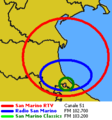
FreqSMRTV.PNG 236 × 252; 8 KB
-
Lago di Faetano.png 896 × 611; 70 KB
-
Linee autobus San Marino.png 876 × 846; 463 KB
-
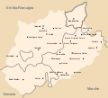
Map of Montefeltro.svg 1,680 × 1,520; 97 KB
-
Map of Valmarecchia.svg 2,899 × 2,658; 63 KB
-
Map San Marino-it.svg 330 × 355; 34 KB
-
Map San Marino-mk.svg 330 × 355; 106 KB
-
PAT - San Marino.gif 800 × 800; 158 KB
-
Plano de San Marino.png 1,149 × 1,211; 245 KB
-
Republic of San Marino (1944).svg 2 × 2; 470 KB
-
San Marino (city) location map.png 2,123 × 1,870; 2.92 MB
-
San Marino general map-fr.svg 2,242 × 2,557; 599 KB
-
San Marino map-fr.svg 2,242 × 2,557; 3.47 MB
-
San marino map-he.png 1,159 × 1,504; 215 KB
-
San marino map.png 1,159 × 1,504; 100 KB
-
San Marino Population Density, 2000 (5457625976).jpg 2,502 × 3,233; 570 KB
-
San Marino Population Density, 2000 (6172447880).jpg 2,387 × 3,161; 588 KB
-
SAN MARINO-en-xtrct.png 494 × 420; 285 KB
-
SAN MARINO-pl.png 1,018 × 1,432; 1.87 MB
-
SAN MARINO-superstrada.png 1,021 × 1,437; 2.05 MB
-
SanMarino-Info-01.jpg 4,592 × 1,897; 705 KB
-
Satellite image of San Marino in March 2003.jpg 49 × 56; 1 KB


