Category:Maps of the Bailiwick of Guernsey
Jump to navigation
Jump to search
Constituent countries of the United Kingdom: England · Northern Ireland · Scotland · Wales – British Crown dependencies: Guernsey · Isle of Man · Jersey
British overseas territories: Akrotiri and Dhekelia · Anguilla · Bermuda · British Antarctic Territory · British Indian Ocean Territory · British Virgin Islands · Cayman Islands · Falkland Islands · Gibraltar · Montserrat · Pitcairn Islands · Saint Helena, Ascension and Tristan da Cunha · South Georgia and the South Sandwich Islands · Turks and Caicos Islands
British overseas territories: Akrotiri and Dhekelia · Anguilla · Bermuda · British Antarctic Territory · British Indian Ocean Territory · British Virgin Islands · Cayman Islands · Falkland Islands · Gibraltar · Montserrat · Pitcairn Islands · Saint Helena, Ascension and Tristan da Cunha · South Georgia and the South Sandwich Islands · Turks and Caicos Islands
Subcategories
This category has the following 9 subcategories, out of 9 total.
Pages in category "Maps of the Bailiwick of Guernsey"
This category contains only the following page.
Media in category "Maps of the Bailiwick of Guernsey"
The following 19 files are in this category, out of 19 total.
-
Bailiwick of Guernsey coronavirus deaths map.svg 588 × 278; 97 KB
-
Bailiwick of Guernsey coronavirus map.svg 588 × 278; 145 KB
-
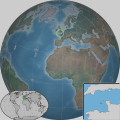
Bailiwick of Guernsey in the English Channel.svg 640 × 640; 211 KB
-
Bailiwick of Guernsey location map.svg 770 × 496; 281 KB
-
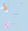
Gemeinden Guernsey 2020.png 2,500 × 2,787; 401 KB
-
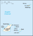
Gk-map.png 329 × 355; 5 KB
-
Guernsey COVID-19 sources of infection map.svg 400 × 300; 367 KB
-
Guernsey Population Density, 2000 (5457620162).jpg 2,502 × 3,265; 591 KB
-
Guernsey Population Density, 2000 (6171908649).jpg 2,375 × 3,161; 561 KB
-
Guernsey w1 locator.svg 1,000 × 1,000; 127 KB
-
Guernsey w2 locator.svg 1,000 × 1,000; 239 KB
-
Guernsey-islands-he.png 926 × 864; 39 KB
-
Guernsey-islands.png 926 × 864; 45 KB
-
Guernsey.png 600 × 550; 13 KB
-
GuernseySR-2.PNG 330 × 355; 52 KB
-
Le littoral du Cotentin ERNOUF Guillaume.gif 600 × 826; 1.2 MB
-
Map of Bailwick of Guernsey (rus).svg 717 × 631; 21 KB
-
The Bailiwick of Guernsey in the English Channel.svg 610 × 669; 217 KB
-
Wikivoyage Guernsey mapPNG.png 1,282 × 1,379; 282 KB


