
Category:Maps of the United Arab Emirates
Maps of the United Arab Emirates.
See also:
Wikimedia category | |||||
| Upload media | |||||
| Instance of | |||||
|---|---|---|---|---|---|
| Category combines topics | |||||
 | |||||
Subcategories
This category has the following 23 subcategories, out of 23 total.
Pages in category "Maps of the United Arab Emirates"
The following 2 pages are in this category, out of 2 total.
Media in category "Maps of the United Arab Emirates"
The following 74 files are in this category, out of 74 total.
-
 1974 Treaty of Jeddah.png 2,100 × 1,634; 204 KB
-
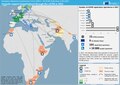 20220121 DM Overview2021 repatriation v2.pdf 1,754 × 1,239; 757 KB
-
 Ajman location map (UAE).svg 1,228 × 1,056; 157 KB
-
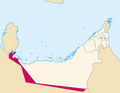
 Al Qawasem Map.png 1,476 × 1,272; 725 KB
-
 Arhipelag Bu Tina.svg 744 × 850; 88 KB
-
 AT1306 map.png 763 × 806; 23 KB
-
 Birleşik Arap Emirlikleri.png 636 × 323; 14 KB
-
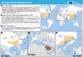
 Earnest Will map.png 887 × 711; 81 KB
-
 ECDM 20140429 World Events.pdf 1,625 × 1,125; 472 KB
-
 ECDM 20150608 Mexico ArabianSea TCs.jpg 1,040 × 720; 167 KB
-
 ECHO United Arab Emirates Editable A4 Landscape.pdf 1,754 × 1,239; 270 KB
-
 Electrical Power Grid - UAE + Qatar.png 5,233 × 3,528; 1.09 MB
-
 Emiratos.PNG 1,080 × 599; 162 KB
-
 Emirats-russian.png 901 × 1,000; 107 KB
-
 Emirats.png 1,269 × 1,000; 88 KB
-
 Emiratus 761.PNG 761 × 600; 79 KB
-
 Future railway lines of UAE (2022).jpg 4,360 × 3,368; 7.84 MB
-
 Future Railways of UAE (2022).jpg 4,304 × 3,368; 4.34 MB
-
 GeneralMapADAC2010.jpg 3,508 × 2,442; 804 KB
-
 Iran Air 655 Strait of hormuz 80.jpg 376 × 417; 59 KB
-
 Iranian borders in Omans and Persian Gulf (Cro).PNG 1,410 × 770; 1.65 MB
-
 Liwa oasis location.jpg 1,228 × 1,055; 675 KB
-
 Madhab UAE.png 2,000 × 1,577; 159 KB
-
 Map AbuDhabi NASA.jpg 1,272 × 1,084; 323 KB
-
 Map of Ajman.png 634 × 498; 58 KB
-
 Map of Ras al-Khaimah.png 634 × 498; 60 KB
-
 Map of Umm al-Qaiwain.png 697 × 599; 69 KB
-
 Map Praying Mantis.png 517 × 378; 152 KB
-
 MapEmirateAjman.PNG 603 × 492; 14 KB
-
 MapEmirateRasalKhaimah.PNG 597 × 486; 7 KB
-
 MapEmirateUmmalQuaiwain.PNG 603 × 492; 16 KB
-
 Maskat & Oman map-ar.png 763 × 806; 23 KB
-
 Maskat & Oman map.png 763 × 806; 21 KB
-
 PAT - United Arab Emirates.gif 1,025 × 800; 145 KB
-
 Population density of the United Arab Emirates.png 5,026 × 3,971; 356 KB
-
 Sharjah Districts Names.jpg 5,610 × 3,380; 1.02 MB
-
 Sharjah location map (UAE).svg 1,228 × 1,056; 161 KB
-
 Strait of Hormuz AR.jpg 583 × 357; 106 KB
-
 Strait of Hormuz.jpg 583 × 357; 54 KB
-
 The-seven-emirates-of-the-uae-1.png 1,379 × 1,129; 365 KB
-
 The-seven-emirates-of-the-uae.jpg 1,379 × 1,129; 263 KB
-
 UAE admin fr.svg 636 × 430; 71 KB
-
 UAE admin1.svg 630 × 490; 205 KB
-
 UAE ar-map.png 1,414 × 1,123; 172 KB
-
 UAE be-map.png 1,414 × 1,123; 161 KB
-
 UAE divisions.jpg 617 × 496; 96 KB
-
 Uae econ.jpg 700 × 1,002; 88 KB
-
 UAE en-map-2.png 1,414 × 1,123; 218 KB
-
 UAE en-map.png 1,414 × 1,123; 214 KB
-
 UAE fa-map.png 1,414 × 1,123; 134 KB
-
 UAE hr-map.png 1,414 × 1,123; 187 KB
-
 UAE ja-map.png 1,600 × 1,130; 298 KB
-
 UAE locator map arabic.svg 853 × 465; 300 KB
-
 UAE locator map German.svg 853 × 465; 298 KB
-
 UAE locator map sr.svg 853 × 465; 301 KB
-
 UAE locator map.svg 853 × 465; 298 KB
-
 UAE Outline map.svg 744 × 1,052; 496 KB
-
 UAE Regions map ru.png 2,945 × 2,142; 804 KB
-
 UAE Regions map-ar.jpg 800 × 581; 94 KB
-
 UAE Regions map.png 2,947 × 2,132; 805 KB
-
 UAE vi-map.png 1,694 × 1,345; 309 KB
-
 UAE-he.png 1,414 × 1,123; 165 KB
-
 UAE.svg 512 × 663; 248 KB
-
 UAEOMCmap-ar.png 928 × 829; 73 KB
-
 UAEOMCmap.png 928 × 829; 39 KB
-
 United Arab Emirates Base Map.png 1,101 × 690; 241 KB
-
 United Arab Emirates disputed w1 countrymap.svg 1,000 × 1,000; 9 KB
-
 United Arab Emirates Population Density, 2000 (5457010009).jpg 2,530 × 3,265; 633 KB
-
 United Arab Emirates Population Density, 2000 (6172431910).jpg 2,322 × 3,160; 603 KB
-
 United Arab Emirates Topography.png 1,967 × 1,730; 2 MB
-
 VAE de-map.png 1,414 × 1,123; 203 KB
-
 ZEA pl-map.png 1,414 × 1,123; 218 KB
-
 Рельеф ОАЭ.png 1,914 × 1,480; 2.21 MB
-
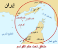
 زرکوه و صیر ابونعیر.jpg 611 × 389; 162 KB

.svg)


.jpg)
.jpg)


.PNG)


.svg)


.jpg)
.jpg)


