Category:Maps of East Timor
Jump to navigation
Jump to search
Wikimedia category | |||||
| Upload media | |||||
| Instance of | |||||
|---|---|---|---|---|---|
| Category combines topics | |||||
 | |||||
English: East Timor (officially the Democratic Republic of Timor-Leste) is a country in Southeast Asia. It comprises the eastern half of the island of Timor, the nearby islands of Atauro and Jaco, and Oecussi-Ambeno, an exclave on the northwestern side of the island, within Indonesian West Timor. The small country of 15,410 km² (5,400 sq mi) is located about 640 km (400 mi) northwest of Darwin, Australia.
East Timor was colonized by Portugal in the 16th century, and was known as Portuguese Timor until Portugal's decolonization of the country. In late 1975 East Timor declared its independence but was invaded and occupied by Indonesia later that year, and declared that country's 27th province the following year. In 1999, following the United Nations-sponsored act of self-determination, Indonesia relinquished control of the territory and East Timor became the first new sovereign state of the twenty-first century on May 20, 2002. East Timor is one of only two predominantly Roman Catholic countries in Asia, the other being the Philippines.
East Timor was colonized by Portugal in the 16th century, and was known as Portuguese Timor until Portugal's decolonization of the country. In late 1975 East Timor declared its independence but was invaded and occupied by Indonesia later that year, and declared that country's 27th province the following year. In 1999, following the United Nations-sponsored act of self-determination, Indonesia relinquished control of the territory and East Timor became the first new sovereign state of the twenty-first century on May 20, 2002. East Timor is one of only two predominantly Roman Catholic countries in Asia, the other being the Philippines.
Subcategories
This category has the following 25 subcategories, out of 25 total.
*
B
F
G
H
L
M
O
P
R
T
Pages in category "Maps of East Timor"
The following 2 pages are in this category, out of 2 total.
Media in category "Maps of East Timor"
The following 64 files are in this category, out of 64 total.
-
ARKTL radio stations.png 2,000 × 1,223; 415 KB
-
Australia-easttimor-border.png 4,096 × 2,560; 814 KB
-
Cyrtodactylus santana (10.3897-zookeys.1139.96508.figure1) location map.jpg 1,512 × 981; 669 KB
-
East Timor (Timor-Leste) - DPLA - 8438b7c8478a52c4202e99d8882328e3.jpg 2,558 × 3,278; 3.57 MB
-
East Timor municipalities names 2003-2015.png 2,000 × 884; 184 KB
-
East Timor-regions Loro Munu.png 3,344 × 1,929; 179 KB
-
East Timor-regions Loro Sae.png 3,344 × 1,929; 179 KB
-
East Timor. LOC 2003630702.jpg 2,436 × 3,023; 579 KB
-
East Timor. LOC 2003630702.tif 2,436 × 3,023; 21.07 MB
-
ECHO Timor-Leste Editable A4 Landscape.pdf 1,754 × 1,239; 243 KB
-
Electrical Power Grid - Timor-Leste.png 1,936 × 1,227; 100 KB
-
FLII TimorLeste.png 1,418 × 709; 279 KB
-
Geology of Timor-Leste.png 2,336 × 1,728; 1.04 MB
-
Grenzen in der Timorsee.png 5,650 × 2,060; 522 KB
-
Haustypen in Osttimor.png 2,000 × 1,235; 625 KB
-
Hydrogeology of Timor-Leste, Potential aquifer yield.png 2,320 × 1,696; 846 KB
-
Map of Timor Gap in Chinese.png 1,832 × 1,670; 660 KB
-
National agro-ecological zones A3-001.png 3,508 × 2,481; 2.68 MB
-
National Map of Soil pH A3-001.png 3,508 × 2,481; 3.02 MB
-
National Map of Soil Texture A3-001.png 3,508 × 2,481; 3.23 MB
-
National ricefields A3-001.png 4,959 × 3,506; 1.16 MB
-
Ninjas in East Timor 2010.jpg 3,152 × 1,527; 324 KB
-
PAT - East Timor.gif 1,035 × 800; 116 KB
-
PCA Timor Annexe A.jpg 7,016 × 4,960; 1.61 MB
-
Population density of East Timor municipalities.png 3,551 × 1,821; 265 KB
-
Recharge of Timor-Leste.png 2,288 × 1,776; 2.36 MB
-
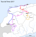
Route map Tour de Timor 2017.png 5,414 × 5,467; 1.37 MB
-
Soil types of Timor-Leste.png 2,388 × 1,761; 1.15 MB
-
TIM freedom of speech.png 3,180 × 1,476; 577 KB
-
Timor - Mangroven.png 3,088 × 1,852; 220 KB
-
Timor Air.jpg 844 × 574; 78 KB
-
Timor Important Bird Area.png 1,854 × 1,002; 605 KB
-
Timor Kaffee.png 3,128 × 1,856; 324 KB
-
Timor Kokos.png 3,128 × 1,856; 289 KB
-
Timor leste Population Density, 2000 (6172449688).jpg 2,397 × 3,160; 585 KB
-
Timor Mais.png 3,128 × 1,856; 292 KB
-
Timor Maniok.png 3,128 × 1,856; 297 KB
-
Timor map.jpg 739 × 415; 45 KB
-
Timor Plate map-fr.png 458 × 279; 178 KB
-
Timor PoliticMap.png 551 × 318; 22 KB
-
Timor Reis.png 3,128 × 1,856; 301 KB
-
Timor sea.jpg 459 × 282; 37 KB
-
Timor-Leste Geological map of zone A.png 2,923 × 2,068; 1.35 MB
-
Timor-Leste Geological map of zone B.png 2,560 × 1,811; 1.56 MB
-
Timor-Leste Geological map of zone C.png 2,924 × 2,068; 1.95 MB
-
Timor-Leste Geological map of zone D.png 2,923 × 2,068; 1.57 MB
-
Timor-Leste Geological map of zone E.png 2,923 × 2,068; 1.28 MB
-
Timor-Leste Geological map of zones.png 8,268 × 5,846; 1.17 MB
-
TL A3 Water Body 112113-001.png 14,044 × 9,934; 5.47 MB
-
TL population 2004-2010.png 2,000 × 1,223; 225 KB
-
TL-AEZ Map A4 111313-001.png 3,509 × 2,481; 939 KB
-
TL-Hydrogeological map-001 Main map.jpg 8,172 × 3,951; 4.48 MB
-
TL-Hydrogeological map-001.png 16,772 × 10,169; 18.92 MB
-
TL-Land Cover Map A4 111313-001.png 3,509 × 2,481; 811 KB
-
TL-Slope Map A4 111313-001.png 3,509 × 2,481; 678 KB
-
TL-Watershed Map A4 111313-001.png 3,509 × 2,481; 794 KB
-
Tour de Timor 2009.png 2,000 × 1,223; 252 KB
-
Tour de Timor 2010.png 2,000 × 1,223; 248 KB
-
Tour de Timor 2011.png 2,000 × 1,223; 256 KB
-
Tour de Timor 2012.png 2,000 × 1,223; 275 KB
-
Tour de Timor 2013.png 2,000 × 1,223; 250 KB
-
Wallacea biodiversity.png 344 × 265; 9 KB
-
印度尼西亞佔領東帝汶形勢.svg 512 × 214; 506 KB
-
帝汶海沟划界示意图.png 797 × 433; 115 KB


