Category:Maps of Iraq
Appearance
| Category Maps of Iraq on sister projects: | |||||||||
|---|---|---|---|---|---|---|---|---|---|
English: Maps of Iraq
Wikimedia category | |||||
| Upload media | |||||
| Instance of | |||||
|---|---|---|---|---|---|
| Category combines topics | |||||
 | |||||
Subcategories
This category has the following 41 subcategories, out of 41 total.
- Blank maps of Iraq (11 F)
*
A
- Maps of Iraq in art (4 F)
B
- Maps of borders of Iraq (14 F)
C
D
E
- ECHO Daily Maps of Iraq (23 F)
- Economic maps of Iraq (3 F)
F
G
H
- HDI maps of Iraq (3 F)
I
- Insolation maps of Iraq (3 F)
K
L
- Linguistic maps of Iraq (6 F)
- Location maps of Iraq (15 F)
M
- Maps of Hatra (4 F)
- Maps of the Tigris (35 F)
- Maps of Tikrit (9 F)
O
P
R
S
- Maps of Iraq on stamps (9 F)
- Sunni triangle (2 F)
T
- Transport maps of Iraq (3 F)
W
Media in category "Maps of Iraq"
The following 200 files are in this category, out of 213 total.
(previous page) (next page)-
1950s CIA map of Iraq – tribes of Iraq (Iraqi Kurdistan detail).jpg 2,884 × 2,031; 1.25 MB
-
1950s CIA map of Iraq – tribes of Iraq.jpg 6,510 × 5,705; 3.62 MB
-
20150120 Syrian Neighbouring Refugees IDPs Landscape A2.pdf 3,508 × 2,479; 380 KB
-
20150819 Syrian IDPs Refugees Neighbouring Countries Landscape A2.pdf 3,506 × 2,479; 383 KB
-
20150819 Syrian IDPs Refugees Neighbouring Countries Landscape A2.png 2,245 × 1,587; 494 KB
-
20151103 Iraq situation map-November 2015 A3.pdf 2,100 × 1,575; 726 KB
-
20151103 Iraq situation map-November 2015 A3.png 1,344 × 1,008; 559 KB
-
20151120 Iraq situation map-November 2015 A3.pdf 2,100 × 1,575; 657 KB
-
20151120 Iraq situation map-November 2015 A3.png 1,344 × 1,008; 617 KB
-
20160907 Iraq InternalOverview 4.pdf 1,625 × 1,125; 545 KB
-
20160907 Iraq InternalOverview 4.png 1,040 × 720; 553 KB
-
27 Special Group Members Captured or Killed since February 9, 2007.jpg 1,086 × 819; 160 KB
-
A DoD map of Iraq -a.jpg 626 × 522; 38 KB
-
Abu Kharjah-ar.png 255 × 228; 38 KB
-
Actualnewsirakkarte.png 471 × 169; 18 KB
-
Al dibis district.png 1,280 × 1,304; 409 KB
-
Al jazeera desert.png 248 × 252; 51 KB
-
Al Muntafiq at its greatest extent.png 3,000 × 3,056; 749 KB
-
Al-qaim-area ar.svg 429 × 328; 450 KB
-
Al-qaim-area.svg 429 × 328; 415 KB
-
Assyrian autonomy map 2003.jpg 655 × 452; 70 KB
-
AssyrianChaldeanSyriacRegionMap.jpg 600 × 558; 125 KB
-
Attach to Qsirak.jpg 605 × 547; 86 KB
-
Autonomous region of Ezidkhan.png 821 × 821; 419 KB
-
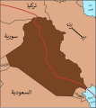
B&W Iraq map with oil infrastructure-ar.png 2,004 × 1,935; 161 KB
-
B&W Iraq map with oil infrastructure.png 2,009 × 1,937; 88 KB
-
Baghdad Province borders 1970.jpg 500 × 587; 55 KB
-
Baghdad Province borders 1976.jpg 501 × 519; 58 KB
-
Baghdad Province borders 2013.jpg 512 × 515; 66 KB
-
Barrages irakiens (cropped).png 377 × 241; 11 KB
-
Barrages irakiens.png 812 × 800; 162 KB
-
Caliph Abu Bakr's empire at its peak2-mohammad adil rais.PNG 1,196 × 580; 44 KB
-
Carte final.png 246 × 293; 19 KB
-
Chamakor map irak.png 764 × 767; 25 KB
-
Civilizations Iraq map.jpg 6,000 × 4,000; 6.29 MB
-
December 10, 2008 Kirkuk bombings.png 267 × 284; 57 KB
-
Decriminalization of same-sex intercourse in Iraq.svg 23 × 23; 51 KB
-
Defense.gov News Photo 030515-D-2987S-049.jpg 3,008 × 2,000; 1.56 MB
-
Defense.gov News Photo 960904-O-00000-001.jpg 3,279 × 2,370; 959 KB
-
Diwaniya districts.jpg 1,593 × 1,528; 1.07 MB
-
Dschabal Sindschar - Höhenkarte.jpg 4,296 × 2,369; 1.21 MB
-
Early Islamic watercourses and settlements east of the Tigris.png 1,602 × 1,824; 95 KB
-
ECDM 20150129 Syria IDPs.pdf 1,625 × 1,125; 304 KB
-
ECDM 20150209 World Events.pdf 1,625 × 1,125; 374 KB
-
ECDM 20150227 World Events.pdf 1,625 × 1,125; 712 KB
-
ECDM 20150229 Syria IDPs.pdf 1,625 × 1,125; 516 KB
-
ECDM 20150313 Syria IDPs.pdf 1,625 × 1,125; 337 KB
-
ECDM 20150320 Syria IDPs.pdf 1,625 × 1,125; 424 KB
-
ECDM 20150331 Syria IDPs.pdf 1,625 × 1,125; 441 KB
-
ECDM 20150420 Iraq Crisis v02.pdf 1,625 × 1,125; 537 KB
-
ECDM 20150518 World Events.pdf 1,625 × 1,125; 460 KB
-
ECDM 20150609 Syria IDPs.pdf 1,625 × 1,125; 579 KB
-
ECDM 20150630 World Events.pdf 1,625 × 1,125; 873 KB
-
ECDM 20150703 World Events.pdf 1,625 × 1,125; 556 KB
-
ECDM 20150916 Syria IDP Refugees.pdf 1,625 × 1,125; 494 KB
-
ECDM 20151008 Syria Refugees.pdf 1,625 × 1,125; 781 KB
-
ECDM 20151104 Syria IDP Refugees.pdf 1,625 × 1,125; 482 KB
-
ECDM 20151127 Syria IDP Refugees.pdf 1,625 × 1,125; 374 KB
-
ECDM 20151211 Worldevents.pdf 1,625 × 1,125; 441 KB
-
ECDM 20160127 Syria IDP Refugees.pdf 1,625 × 1,125; 622 KB
-
ECDM 20160203 Syria IDP Refugees.pdf 1,625 × 1,125; 622 KB
-
ECDM 20160219 Syria IDP Refugees.pdf 1,625 × 1,125; 510 KB
-
ECDM 20160224 CountriesOfOrigin DailyMap.pdf 1,754 × 1,239; 910 KB
-
ECDM 20160309 Syria IDP Refugees.pdf 1,625 × 1,125; 649 KB
-
ECDM 20160630 Syria IDP Refugees.pdf 1,625 × 1,125; 616 KB
-
ECDM 20190326 Iran-Iraq Floods.pdf 1,625 × 1,125; 808 KB
-
ECDM 20191107 Syria Crisis.pdf 2,479 × 1,754; 908 KB
-
ECHO Iraq Editable A4 Landscape.pdf 1,754 × 1,239; 382 KB
-
ECHO Iraq Editable A4 Landscape.png 1,123 × 794; 324 KB
-
Enmerk-2.gif 1,000 × 808; 26 KB
-
Ezidikhan Map.jpg 1,280 × 1,121; 118 KB
-
Ezidkhan autonomous region 2018-03.png 941 × 652; 135 KB
-
Ezidkhan Map.jpg 800 × 701; 61 KB
-
Ezidxan Map.jpg 1,115 × 960; 153 KB
-
Faw empty.jpeg 486 × 486; 90 KB
-
FGM prevalence UNICEF 2013 Iraq.png 1,046 × 900; 359 KB
-
FLII Iraq.png 1,399 × 743; 73 KB
-
Flüsse in und um Irak.JPG 932 × 637; 107 KB
-
Gibson - Late Abbasid Map of Kish Area.png 902 × 681; 177 KB
-
GénocideSimele.png 698 × 617; 70 KB
-
Haditha location map-Recovered-ar.png 876 × 660; 172 KB
-
Haditha location map.png 876 × 660; 70 KB
-
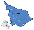
Hadiyah.PNG 126 × 44; 283 bytes
-
Hadiyah2.PNG 45 × 44; 186 bytes
-
Halabja Province.svg 694 × 930; 159 KB
-
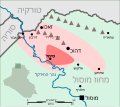
Hawija offensive.svg 1,440 × 900; 1.74 MB
-
Idlib Governorate with Districts.png 725 × 600; 69 KB
-
Initial Geophys for the Archaeological site of Naysan, Iraq.png 1,006 × 289; 22 KB
-
Irak 3 dyw strz karp.png 1,559 × 2,008; 1,004 KB
-
Irak karte.png 1,260 × 1,279; 441 KB
-
Irak karte2 pol.png 1,274 × 1,294; 661 KB
-
Irak karte2.png 1,274 × 1,294; 680 KB
-
Irak satkart 1.jpg 400 × 418; 114 KB
-
Irak umkreis bagdad-arabic.png 420 × 466; 43 KB
-
Irak umkreis bagdad.png 868 × 651; 34 KB
-
IranAndNeighbours.png 538 × 316; 11 KB
-
Iraq - Clima.png 725 × 659; 74 KB
-
Iraq - DPLA - 0b5cfba76ed6ebbd05899d94821b8537.jpg 3,704 × 4,911; 1.34 MB
-
Iraq - DPLA - 1d81a8f9abcc032b752fabae696cbea0.jpg 2,554 × 3,278; 5.84 MB
-
Iraq - DPLA - 244f395fb10d3d027badb9df568c6f3f.jpg 3,727 × 4,559; 1.91 MB
-
Iraq - DPLA - 265634ff3eb205e95d54fc4a1fe6866f (page 1).jpg 9,222 × 8,008; 7.26 MB
-
Iraq - DPLA - 265634ff3eb205e95d54fc4a1fe6866f (page 2).jpg 9,294 × 8,039; 7.43 MB
-
Iraq - DPLA - 458092889aa3529b01744f744ff1ce21.jpg 2,558 × 3,276; 6.23 MB
-
Iraq - DPLA - 55020d6ae819e1dd33d9d7cb16148518.jpg 11,402 × 8,051; 4.42 MB
-
Iraq - DPLA - 59d535a450c33acf8186fd994705e8a7.jpg 2,556 × 3,276; 5.6 MB
-
Iraq - DPLA - 66b19acc29031288fbee83d5ee07dd35.jpg 2,554 × 3,280; 5.76 MB
-
Iraq - DPLA - 78c257559b3fa1c6f92a41229cb5b069.jpg 2,552 × 3,274; 5.76 MB
-
Iraq - DPLA - 911ec909198d8eb6785cb24a16b562e1.jpg 3,384 × 4,896; 1.92 MB
-
Iraq - DPLA - af8ab387533e7244e1cd11701694892f.jpg 2,546 × 3,272; 5.74 MB
-
Iraq - DPLA - b67b9dff175c74ebd208d00eb79915d0.jpg 9,264 × 8,049; 8.2 MB
-
Iraq - DPLA - c29cbcd2b599413096860d2bbd0c5c32.jpg 2,554 × 3,278; 6.8 MB
-
Iraq - DPLA - c7972d4a6225ca890a32dd0eb6441065.jpg 2,550 × 3,272; 5.38 MB
-
Iraq - DPLA - e42d509b2eba591bedab651ba4a816ad.jpg 2,402 × 3,130; 6.26 MB
-
Iraq - Lengas.png 712 × 689; 82 KB
-
Iraq - Provincia di Baghdad.png 200 × 201; 17 KB
-
Iraq - Religion.png 713 × 690; 92 KB
-
Iraq - Topografia.png 1,004 × 1,056; 371 KB
-
Iraq 1966.jpg 6,416 × 4,672; 4.08 MB
-
Iraq 1992 CIAbsmaller.png 3,500 × 3,350; 18.04 MB
-
IRAQ Administration Map.jpg 1,092 × 1,198; 271 KB
-
Iraq archaeological map - Babylon.jpg 597 × 800; 178 KB
-
Iraq Base Map.png 1,107 × 694; 354 KB
-
Iraq GHI Solar-resource-map GlobalSolarAtlas World-Bank-Esmap-Solargis.png 1,842 × 2,411; 1.31 MB
-
Iraq Jul06.png 1,260 × 1,084; 64 KB
-
Iraq Map.png 539 × 574; 309 KB
-
Iraq NASA.jpg 2,201 × 2,125; 726 KB
-
Iraq NIMA 2514x2716.jpg 2,514 × 2,716; 1.43 MB
-
Iraq NO FLY ZONES HE.svg 1,106 × 1,191; 272 KB
-
Iraq NO FLY ZONES.PNG 326 × 351; 10 KB
-
Iraq outline map.png 800 × 700; 33 KB
-
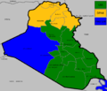
Iraq Parliament January 2005.png 1,260 × 1,084; 39 KB
-
Iraq Political Map 2015 (Arabic).png 1,218 × 1,070; 145 KB
-
Iraq Provinces Handed Over To Iraqi Security.png 1,368 × 1,570; 108 KB
-
Iraq rivers and governorates.png 700 × 599; 29 KB
-
Iraq Somalia Locator.png 1,097 × 630; 85 KB
-
Iraq wall det 2003.jpg 1,984 × 2,183; 631 KB
-
Iraq war 2017.png 294 × 288; 58 KB
-
Iraq-cities-arabic.png 457 × 530; 55 KB
-
Iraq-cities-arabic2.png 457 × 530; 55 KB
-
Iraq-Kufe.jpg 1,077 × 1,103; 69 KB
-
Iraq-map-cites-3.png 712 × 652; 42 KB
-
Iraq.A2003060.0750.500m.jpg 2,000 × 2,600; 1,012 KB
-
Iraq14.jpg 250 × 230; 69 KB
-
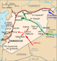
IraqforceInSyria1941.png 328 × 352; 19 KB
-
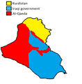
Iraqi civil war 2006.png 589 × 600; 56 KB
-
Iraqi Deaths in 2012 - By Province, Per 100,000 People-ar.png 700 × 712; 192 KB
-
Iraqi Deaths in 2012 - By Province, Per 100,000 People.png 581 × 591; 63 KB
-
Iraqi Development path map.svg 365 × 408; 127 KB
-
Iraqi governorate elections 2008.png 200 × 201; 13 KB
-
Iraqi Governorates map in Edessan Aramaic (Syriac).svg 512 × 521; 780 KB
-
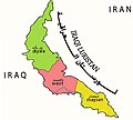
Iraqi-Luristan.jpg 542 × 488; 88 KB
-
Iraqmapinsureth.png 550 × 560; 101 KB
-
IraqNumbered-2005-10-15.png 300 × 301; 13 KB
-
IraqProvinces Babil.jpg 1,275 × 1,123; 170 KB
-
IraqProvinces Baghdadrv2.jpg 1,375 × 1,123; 211 KB
-
Iraqreferendum.PNG 362 × 304; 9 KB
-
IraqStubMapRed.png 200 × 201; 9 KB
-
ISF.battlespace.Aug7-2006.JPG 670 × 607; 56 KB
-
ISF.battlespace.Aug9-2006.JPG 870 × 580; 66 KB
-
ISF.battlespace.Aug9-2006corrected.JPG 870 × 580; 66 KB
-
ISF.battlespace.December01-2006.JPG 1,082 × 791; 178 KB
-
ISF.battlespace.Feb-2007.JPG 619 × 575; 54 KB
-
ISF.battlespace.Mar30-2006.JPG 627 × 574; 45 KB
-
ISF.battlespace.May07.JPG 870 × 813; 109 KB
-
ISF.battlespace.November07.JPG 820 × 756; 66 KB
-
ISF.battlespace.October26-2006.jpg 870 × 630; 121 KB
-
ISF.battlespace.Sep6-2006.jpg 1,500 × 1,125; 304 KB
-
Kaart.png 1,000 × 1,000; 56 KB
-
Kerbala governate map.svg 464 × 420; 96 KB
-
Kirkuk offensive-ar.svg 1,440 × 900; 1.71 MB
-
Kirkuk offensive.svg 1,440 × 900; 1.71 MB
-
Kufa.gif 866 × 752; 72 KB
-
Kurdish language.jpg 1,190 × 954; 310 KB
-
Lakhmids.jpg 284 × 285; 12 KB
-
LittleIraq.png 165 × 178; 6 KB
-
Localisation Irak.png 553 × 553; 172 KB
-
Map of Iraq - Battle of Mosul Ar Virision-ar.png 1,314 × 1,244; 210 KB
-
Map of Iraq - Battle of Mosul.png 1,314 × 1,244; 259 KB
-
Map showing religious populations in Iraq.jpg 225 × 225; 8 KB
-
Map300616.png 4,501 × 3,439; 1.98 MB
-
Mapa político de Iraq.svg 1,500 × 1,489; 1.22 MB
-
Mesopotamia.PNG 450 × 364; 198 KB
-
Narodyiraku.png 379 × 301; 13 KB
-
Near east lrg.jpg 2,987 × 3,967; 2.62 MB
-
Operational Navigation Chart H-6, 4th edition.jpg 8,938 × 6,500; 16.41 MB
-
PSTA.December2008.png 1,234 × 1,068; 106 KB
-
PSTA.February.2007.JPG 667 × 567; 49 KB
-
PSTA.July2006.JPG 673 × 543; 45 KB
-
PSTA.March.2008.jpg 815 × 644; 56 KB
-
PSTA.May.2007.JPG 948 × 825; 77 KB
-
PSTA.November.2006.JPG 540 × 450; 34 KB
-
PSTA.November.2007.JPG 927 × 757; 74 KB
-
PSTA.September.2008.png 826 × 619; 55 KB
-
Qarmat Ali map.jpg 1,024 × 850; 291 KB
-
Revendications EIIL.png 2,000 × 1,528; 508 KB
-
Revendications Etat islamique d'Irak.png 2,000 × 1,528; 509 KB
-
Répratition des déplacés internes en Irak.png 787 × 947; 42 KB
-
Shatt al-Arab map.png 409 × 332; 339 KB
-
Simele he.svg 875 × 775; 111 KB
-
Spring11.png 1,428 × 1,249; 3.39 MB


