Category:Maps of the Isle of Man
Jump to navigation
Jump to search
Subcategories
This category has the following 13 subcategories, out of 13 total.
!
E
F
L
M
P
T
Pages in category "Maps of the Isle of Man"
The following 2 pages are in this category, out of 2 total.
Media in category "Maps of the Isle of Man"
The following 91 files are in this category, out of 91 total.
-
A Correct Map of the ISLE of MANN, published 1816.jpg 4,054 × 2,922; 5.54 MB
-
Ayre Sheading - Isle of Man.svg 841 × 1,014; 1.03 MB
-
Baljyn Vannin.png 690 × 815; 33 KB
-
British and Irish Isles after Scottish independence.png 4,765 × 6,618; 2.38 MB
-
Carte-de-Castletown.jpg 1,000 × 904; 184 KB
-
Castletown-map.jpg 1,000 × 904; 99 KB
-
EllanVannin SheadinynAsSkeeraghyn gv-en.svg 1,200 × 1,100; 208 KB
-
Garff Sheading - Isle of Man.svg 841 × 1,014; 1.03 MB
-
Gemeinden Isle of Man 2020.png 2,500 × 2,791; 583 KB
-
Glenfaba Sheading - Isle of Man.svg 841 × 1,014; 1.03 MB
-
IOMPolice.PNG 387 × 443; 8 KB
-
Irish.Sea.at.Man.cross.section.jpg 1,800 × 420; 48 KB
-
Isle of Man - British Isles.svg 1,250 × 1,835; 1,024 KB
-
Isle of Man - Douglas.png 600 × 714; 348 KB
-
Isle of Man A1 road (OpenStreetMap).png 436 × 491; 71 KB
-
Isle of Man A18 road (OpenStreetMap).png 436 × 491; 71 KB
-
Isle of Man A2 road (OpenStreetMap).png 436 × 491; 70 KB
-
Isle of Man A3 road (OpenStreetMap).png 436 × 491; 72 KB
-
Isle of Man A5 road (OpenStreetMap).png 436 × 491; 70 KB
-
Isle of Man Brit Isles Sect 2.svg 915 × 841; 909 KB
-
Isle of Man Brit Isles Sect 3.svg 939 × 677; 1,012 KB
-
Isle of Man Brit Isles Sect 4.svg 627 × 643; 1,012 KB
-
Isle of Man cities villages.png 690 × 815; 12 KB
-
Isle of Man constituencies-fr.svg 1,200 × 1,100; 311 KB
-
Isle of Man Input Administrative Boundaries (5457151343).jpg 2,524 × 3,209; 618 KB
-
Isle of Man location map.svg 1,200 × 1,100; 93 KB
-
Isle of Man map of roads.png 416 × 496; 88 KB
-
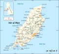
Isle of Man map-en.svg 1,200 × 1,100; 686 KB
-
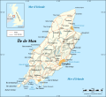
Isle of Man map-fr.svg 1,200 × 1,100; 687 KB
-
Isle of Man outline map.png 600 × 714; 348 KB
-
Isle of Man Population Density, 2000 (6171910641).jpg 2,355 × 3,161; 577 KB
-
Isle of Man topographic map-ca.svg 1,200 × 1,100; 642 KB
-
Isle of Man topographic map-de.svg 1,200 × 1,100; 334 KB
-
Isle of Man topographic map-el.svg 1,200 × 1,100; 653 KB
-
Isle of Man topographic map-es.svg 1,200 × 1,100; 643 KB
-
Isle of Man topographic map-fr.svg 1,200 × 1,100; 644 KB
-
Isle of Man topographic map-hu.svg 1,200 × 1,100; 645 KB
-
Isle of Man topographic map-it.svg 1,200 × 1,100; 745 KB
-
Isle of Man topographic map-mk.svg 1,200 × 1,100; 644 KB
-
Isle of Man topographic map-nb.svg 1,200 × 1,100; 643 KB
-
Isle of Man topographic map-ru.svg 1,200 × 1,100; 644 KB
-
Isle of Man TT.png 1,541 × 1,186; 280 KB
-
Isle-of-man-map.jpg 600 × 600; 41 KB
-
IsleOfMan LocAuths and Sheadings2020.svg 1,200 × 1,100; 191 KB
-
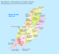
IsleOfMan SheadingsAndParishes-en.svg 1,200 × 1,100; 222 KB
-
IsleOfMan SheadingsAndParishes-es.svg 1,200 × 1,100; 166 KB
-
IsleOfMan SheadingsAndParishes-fr.svg 1,200 × 1,100; 166 KB
-
IsleOfMan SheadingsAndParishes-it.svg 1,200 × 1,100; 168 KB
-
IsleOfMan SheadingsAndParishes-mk.svg 1,200 × 1,100; 395 KB
-
IsleOfMan SheadingsAndParishes-no.svg 1,200 × 1,100; 223 KB
-
IsleOfMan SheadingsAndParishes-ru.svg 1,200 × 1,100; 229 KB
-
IsleOfMan SheadingsAndParishes-sv.svg 1,200 × 1,100; 223 KB
-
IsleOfMan SheadingsAndParishes-uk.svg 1,200 × 1,100; 222 KB
-
IsleOfMan2021OSM.png 6,666 × 7,777; 10.54 MB
-
IsleofManmap.png 548 × 591; 17 KB
-
Keys-Rushen.png 744 × 1,052; 73 KB
-
Kingdom of Mann and the Isles-blank.svg 1,297 × 1,362; 164 KB
-
Kingdom of Mann and the Isles-de.svg 1,297 × 1,362; 302 KB
-
Kingdom of Mann and the Isles-en.svg 1,297 × 1,362; 209 KB
-
Kingdom of Mann and the Isles-es.svg 1,297 × 1,362; 207 KB
-
Kingdom of Mann and the Isles-fr.svg 1,297 × 1,362; 208 KB
-
Location of isle-of-man.jpg 800 × 988; 82 KB
-
Manx dialects map-fr.svg 655 × 600; 40 KB
-
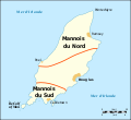
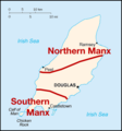
Manx dialects.png 330 × 355; 23 KB
-
Map - Kingdom of the Isles, Isle of Man (png).png 595 × 713; 71 KB
-
Map - Kingdom of the Isles, Isle of Man (svg).svg 595 × 713; 20 KB
-
Map of Celtic Nations-flag shades.svg 675 × 1,300; 173 KB
-
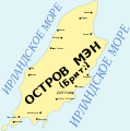
Map of Isle of Man (rus).svg 651 × 658; 29 KB
-
Michael Sheading - Isle of Man.svg 841 × 1,014; 1.03 MB
-
Middle Sheading - Isle of Man.svg 841 × 1,014; 1.03 MB
-
Ogham map.png 1,155 × 1,279; 571 KB
-
Ordnance Survey 1-250000 - SC.jpg 4,000 × 4,000; 1.26 MB
-
Ordnance Survey 1-250000 - SC.tif 4,000 × 4,000; 494 KB
-
Ostrov man.gif 888 × 547; 77 KB
-
Plaque atop Snaefell Mountain - Isle of Man - kingsley - 24-JUN-09.jpg 2,560 × 1,920; 1.09 MB
-
Rushen Sheading - Isle of Man.svg 841 × 1,014; 1.03 MB
-
Sheadings and parishes - Isle of Man.svg 845 × 980; 223 KB
-
Sheadings of the Isle of Man.svg 841 × 1,014; 1.03 MB
-
Sheadings-Ayre.svg 744 × 1,052; 89 KB
-
Sheadings-Garff.svg 744 × 1,052; 89 KB
-
Sheadings-Glenfaba.svg 744 × 1,052; 89 KB
-
Sheadings-Michael.svg 744 × 1,052; 89 KB
-
Sheadings-Middle.svg 744 × 1,052; 89 KB
-
Sheadings-Rushen.svg 744 × 1,052; 89 KB
-
Skeeraghyn Vannin Parishes of Man EN-GV.svg 1,200 × 1,100; 225 KB
-
Solway Firth map.png 1,000 × 622; 320 KB
-
Steam packet route map.png 304 × 195; 24 KB
-
Steam packet route map.svg 628 × 503; 46 KB
-
Tynwaldday.jpg 548 × 591; 69 KB
-
Villes-de-Man.jpg 690 × 815; 263 KB


