Category:Maps of Romania
Jump to navigation
Jump to search
Wikimedia category | |||||
| Upload media | |||||
| Instance of | |||||
|---|---|---|---|---|---|
| Category combines topics | |||||
 | |||||
Subcategories
This category has the following 54 subcategories, out of 54 total.
*
+
B
- Maps of borders of Romania (13 F)
C
- Campus maps of Romania (1 F)
- Maps of caves in Romania (3 F)
D
E
F
G
H
- HDI maps of Romania (2 F)
L
- Location maps of Romania (22 F)
M
O
P
R
S
T
W
Pages in category "Maps of Romania"
The following 5 pages are in this category, out of 5 total.
Media in category "Maps of Romania"
The following 200 files are in this category, out of 269 total.
(previous page) (next page)-
2 digit postcode areas romania .png 1,181 × 944; 356 KB
-
20220121 DM Overview2021 repatriation v2.pdf 1,754 × 1,239; 757 KB
-
20220308 Modules deployed 2021.pdf 1,625 × 1,125; 961 KB
-
20230731 FFseason prepositioning1-15August.pdf 1,500 × 1,125; 755 KB
-
20230814 FFseason prepositioning1-15September (1).pdf 1,625 × 1,125; 646 KB
-
Areas polderised under Ceausescu.png 727 × 674; 436 KB
-
Aruncuta 1867-1918.jpg 1,168 × 657; 113 KB
-
Autostrazi propunere.png 1,789 × 1,266; 4.25 MB
-
BC VN map Judete.png 290 × 207; 21 KB
-
Bgiusca Jirecek Line.jpg 614 × 561; 176 KB
-
Brazaville Politic Map.png 800 × 572; 90 KB
-
Bucharest metropolitan area.png 3,150 × 1,750; 441 KB
-
Bélavar castle plan.jpg 350 × 400; 86 KB
-
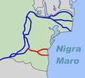
Canale Danubio-Mar Nero.jpg 315 × 291; 91 KB
-
Apuseni in Romania.jpg 917 × 574; 244 KB
-
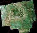
Carpathians-satellite.jpg 2,625 × 2,521; 2.6 MB
-
CathoRomania.jpg 773 × 1,169; 191 KB
-
Charta Principateloru 1.jpg 2,581 × 3,331; 1.78 MB
-
Charta Principateloru 10.jpg 2,482 × 3,411; 2.73 MB
-
Charta Principateloru 11.jpg 2,482 × 3,400; 3.27 MB
-
Charta Principateloru 12.jpg 2,155 × 2,917; 1.5 MB
-
Charta Principateloru 13.jpg 2,505 × 3,349; 1.89 MB
-
Charta Principateloru 14.jpg 2,166 × 2,897; 877 KB
-
Charta Principateloru 15.jpg 2,155 × 2,906; 868 KB
-
Charta Principateloru 16.jpg 2,152 × 2,899; 2.11 MB
-
Charta Principateloru 17.jpg 2,140 × 2,953; 1.42 MB
-
Charta Principateloru 18.jpg 2,160 × 3,115; 1.02 MB
-
Charta Principateloru 19.jpg 2,508 × 3,380; 3.09 MB
-
Charta Principateloru 2.jpg 2,582 × 3,314; 1.91 MB
-
Charta Principateloru 20.jpg 2,573 × 3,341; 4.38 MB
-
Charta Principateloru 21.jpg 2,588 × 3,338; 4.11 MB
-
Charta Principateloru 22.jpg 2,585 × 3,375; 4.37 MB
-
Charta Principateloru 23.jpg 2,585 × 3,402; 2.82 MB
-
Charta Principateloru 24.jpg 2,591 × 3,412; 2.6 MB
-
Charta Principateloru 25.jpg 2,505 × 3,407; 2.6 MB
-
Charta principateloru 26.jpg 2,134 × 2,909; 4.21 MB
-
Charta principateloru 27.jpg 2,491 × 3,371; 3.76 MB
-
Charta Principateloru 28.jpg 2,467 × 3,419; 2.93 MB
-
Charta Principateloru 29.jpg 2,470 × 3,406; 3.9 MB
-
Charta Principateloru 3.jpg 2,581 × 3,350; 1.35 MB
-
Charta Principateloru 30.jpg 2,456 × 3,428; 2.76 MB
-
Charta Principateloru 31.jpg 2,637 × 3,495; 2.32 MB
-
Charta Principateloru 32.jpg 2,593 × 3,458; 2.5 MB
-
Charta Principateloru 33.jpg 2,597 × 3,526; 1.4 MB
-
Charta Principateloru 34.jpg 2,554 × 3,457; 1.91 MB
-
Charta Principateloru 36.jpg 2,647 × 3,562; 1.9 MB
-
Charta Principateloru 37.jpg 2,661 × 3,524; 1.68 MB
-
Charta Principateloru 38.jpg 2,676 × 3,508; 3.47 MB
-
Charta Principateloru 39.jpg 2,646 × 3,508; 3.35 MB
-
Charta Principateloru 4.jpg 2,577 × 3,368; 2.1 MB
-
Charta Principateloru 40.jpg 2,215 × 2,926; 924 KB
-
Charta Principateloru 41.jpg 2,680 × 3,493; 1.47 MB
-
Charta Principateloru 42.jpg 2,645 × 3,493; 1.7 MB
-
Charta Principateloru 43.jpg 2,548 × 3,556; 3.31 MB
-
Charta Principateloru 44.jpg 2,548 × 3,527; 2.79 MB
-
Charta Principateloru 45.jpg 2,558 × 3,545; 1.46 MB
-
Charta Principateloru 46.jpg 2,528 × 3,517; 1.6 MB
-
Charta Principateloru 47.jpg 2,492 × 3,399; 1.46 MB
-
Charta Principateloru 48.jpg 2,464 × 3,410; 1,017 KB
-
Charta Principateloru 49.jpg 2,623 × 3,531; 1.19 MB
-
Charta Principateloru 5.jpg 2,577 × 3,373; 3.25 MB
-
Charta Principateloru 50.jpg 2,949 × 3,928; 2.94 MB
-
Charta Principateloru 51.jpg 2,914 × 3,855; 1.92 MB
-
Charta Principateloru 52.jpg 2,625 × 3,476; 2.05 MB
-
Charta Principateloru 53.jpg 2,914 × 3,855; 1.97 MB
-
Charta Principateloru 54.jpg 2,911 × 4,534; 2.21 MB
-
Charta Principateloru 6.jpg 2,594 × 3,383; 4.4 MB
-
Charta Principateloru 7.jpg 2,487 × 3,378; 2.09 MB
-
Charta Principateloru 8.jpg 2,491 × 3,407; 2.63 MB
-
Charta Principateloru 9.jpg 2,477 × 3,370; 2.18 MB
-
Charta schema.jpg 546 × 747; 102 KB
-
COB data Romania.PNG 1,357 × 628; 62 KB
-
Covasna County Hungarians.png 400 × 405; 15 KB
-
Cricovul Sărat.jpg 404 × 476; 28 KB
-
CT TL map Judete.png 290 × 207; 21 KB
-
Dacian ornaments multi spirals palmettes and protome.jpg 1,789 × 1,266; 543 KB
-
Danube-Black Sea Canal.png 315 × 291; 12 KB
-
DealuFrumosSB.JPG 3,264 × 2,448; 1.87 MB
-
Deda-Saratel 1942.png 885 × 703; 41 KB
-
Dislocation of Csangos Hu-Baranya map.png 981 × 1,165; 1.14 MB
-
Dislocation of Csangos Hu-Ro.png 1,493 × 909; 1.37 MB
-
Dispunerea provinciilor istorice pe harta României.jpg 3,476 × 2,376; 425 KB
-
Eastern Romania and Bessarabia in 1917.png 1,541 × 1,919; 6.16 MB
-
ECDM 2013 09 16 Romania FlashFloods.pdf 1,625 × 1,125; 600 KB
-
ECDM 20130617 Europe Floods.pdf 1,625 × 1,125; 855 KB
-
ECDM 20230829 Romania explosion.pdf 1,589 × 1,125; 443 KB
-
ECDM 20240621 Firefighting season prepositioning EU.pdf 1,500 × 1,125; 381 KB
-
ECDM 20240916 ST Central Eastern Europe(1).pdf 2,479 × 1,754; 1.71 MB
-
ECDM 20240918 ST Central Eastern Europe.pdf 2,479 × 1,754; 1.75 MB
-
ECDM 20240920 Central Eastern Europe(2).pdf 2,479 × 1,754; 1.86 MB
-
ECHO Romania Editable A4 Landscape 20221215.pdf 1,754 × 1,239; 647 KB
-
ECHO Romania Editable A4 Landscape 20221215.png 3,509 × 2,482; 11.69 MB
-
ETH-BIB-Kasan-Pass, Eisernes Thor, Karte-Dia 247-Z-00312.tif 3,692 × 2,783; 29.48 MB
-
EU location ROM.png 1,600 × 1,200; 470 KB
-
Eurazhdarcho-1.png 975 × 774; 378 KB
-
Europe location ROM.png 1,600 × 1,200; 712 KB
-
Evoluţia implementării tehnologiei DVB-T2 în România între anii 2015-2016.png 4,048 × 5,040; 35.67 MB
-
FLII Romania.png 1,336 × 857; 1.06 MB
-
Forumaugust2011.jpg 1,024 × 706; 395 KB
-
GL BR map Judete 290px.png 290 × 207; 21 KB
-
Géta-fennsík.JPG 800 × 527; 64 KB
-
Harta administrativă a județului Gorj din 1930.png 2,032 × 1,782; 2.32 MB
-
Harta autostrăzilor și drumurilor expres din Romania.png 9,933 × 7,015; 71.29 MB
-
Harta etnica jud Harghita.png 855 × 1,000; 46 KB
-
Harta jud bihor localitati.png 726 × 1,000; 77 KB
-
Harta prefixe romania.png 830 × 593; 126 KB
-
Harta protopopiatelor din Episcopia Sălajului.png 888 × 573; 518 KB
-
Harta romania2 vazuta din avion.jpg 945 × 854; 214 KB
-
Harta României Mari studiouri radio în 1939.jpg 1,374 × 1,013; 328 KB
-
Harta Rotest.png 2,462 × 1,700; 132 KB
-
Harta Transport Public Cluj-Napoca.jpg 7,015 × 4,960; 4.56 MB
-
Harta Zona Metropolitană Baia Mare.jpg 3,438 × 4,144; 6.55 MB
-
Hartă semnal digital terestru în noiembrie 2016.png 1,522 × 1,085; 3.26 MB
-
Hartă.jpg 225 × 225; 6 KB
-
HD AB SB CJ MS SJ BN map Judete.png 290 × 207; 22 KB
-
HongaarsRoemenië.PNG 284 × 226; 4 KB
-
Infractionalitate Romania (2009).PNG 929 × 664; 48 KB
-
Instantele civile.png 2,880 × 2,039; 1.06 MB
-
Instantele militare.png 2,880 × 2,039; 581 KB
-
Insula Serpilor map es.png 333 × 249; 18 KB
-
Insula Serpilor map german.png 333 × 249; 8 KB
-
Insula Serpilor map Masri-2.JPG 333 × 249; 12 KB
-
Insula Serpilor map.png 333 × 249; 10 KB
-
IS VS map Judete 290px.png 290 × 207; 21 KB
-
Its Rumania.png 265 × 210; 127 KB
-
Jibou-Baia Mare.png 1,024 × 738; 1.22 MB
-
Judete & Regions of Romania.png 303 × 225; 56 KB
-
Județul Subscriptions.png 854 × 292; 59 KB
-
Kanalo Danubo-Nigra Maro.png 315 × 291; 20 KB
-
Kép 587.jpg 640 × 480; 126 KB
-
Lagekarte Moldauisches Platte.png 1,473 × 1,198; 1.02 MB
-
Lagekarte Siebenbürgische Platte.png 1,473 × 1,198; 1.03 MB
-
Language influence border between Latin and Hellenic.png 3,763 × 2,557; 4.49 MB
-
Limba romana Atlanticul.png 2,436 × 994; 78 KB
-
Loc acțiune în opere de război.svg 1,611 × 1,152; 378 KB
-
Local lockdowns in Romania during COVID-19 pandemic.png 1,601 × 1,027; 185 KB
-
Locations Dacians multi-spiral palmette protome.jpg 1,789 × 1,266; 543 KB
-
Locuri cu nume Racovita.PNG 283 × 214; 16 KB
-
Magyars en Roumanie (2011).png 1,053 × 744; 208 KB
-
Map of AOIs to be updated in OSM.jpg 1,379 × 1,066; 282 KB
-
Map of Romania.png 267 × 189; 8 KB
-
Map of Romanian roads quality 2013.png 3,500 × 2,467; 3.05 MB
-
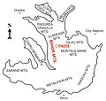
Map Padis.jpg 1,906 × 1,812; 154 KB
-
Map Railway Prundu Bargaului-Vatra Dornei.png 727 × 800; 36 KB
-
Map Romanian Settling and Autonomy in Medieval Hungary.jpg 2,252 × 2,606; 1.95 MB
-
Mapa da Roménia (OCHA)-es.svg 1,000 × 1,000; 1.12 MB
-
Mapa da Roménia (OCHA).svg 254 × 254; 1,004 KB
-
MapRObcf.jpg 597 × 418; 136 KB
-
Maraloiu1.jpg 971 × 672; 207 KB
-
Marsulminerilor.jpg 1,148 × 767; 392 KB
-
MoldovaToday.png 800 × 537; 209 KB
-
Movement for the unification of Romania and Moldova.png 312 × 335; 16 KB
-
Nagy Romania 1923.png 663 × 521; 159 KB
-
NUTS 2 regions of Romania by HDI.svg 1,544 × 1,111; 175 KB
-
Operational Navigation Chart E-3, 6th edition.jpg 9,254 × 6,671; 20.94 MB
-
Origine of Tokajer and Grasa de Cotnari.png 228 × 179; 11 KB
-
Otzelovitz 1790.jpg 1,567 × 949; 656 KB
-
Palas tunnel map.jpg 1,302 × 825; 143 KB
-
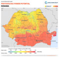
PAT - Romania.gif 890 × 950; 348 KB
-
PH BZ Judete 290px.png 120 × 85; 7 KB
-
PH BZ map Judete 290px.png 290 × 207; 21 KB
-
Pitesti Map.png 686 × 648; 34 KB
-
Plan Cotroceni 1876.jpg 1,600 × 959; 187 KB
-
Ploieşti,Romania. Telephone code map, June 1994 (4033048118).jpg 1,513 × 987; 279 KB
-
Poienile map1.jpg 500 × 368; 50 KB
-
Poloha Huedinu v Rumunssku.png 800 × 572; 122 KB
-
Potential union of Romania and Moldova including Transnistria.png 1,496 × 1,098; 394 KB
-
Prundu Vatra 1914.png 977 × 624; 18 KB
-
Regiunea Arad.PNG 207 × 113; 6 KB
-
Repedea mapa.jpg 500 × 368; 51 KB
-
Ro-topo-icon.png 50 × 36; 5 KB
-
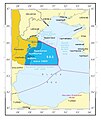
Rom.territ-waters.jpg 503 × 599; 197 KB
-
Romania (Balkan and Central Europe).PNG 929 × 664; 53 KB
-
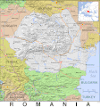
Romania (modern) Map.jpg 600 × 448; 50 KB
-
Romania - DPLA - 3626c3ba66c4cf66c588ee3cddf5c0e5.jpg 2,554 × 3,280; 5.44 MB
-
Romania - Net Salary per County.png 1,008 × 720; 214 KB
-
Romania - Nominal GDP per Capita by County.png 1,777 × 1,269; 422 KB
-
Romania 1859-1878-es.svg 551 × 387; 338 KB
-
Romania 1859-1878b-es.svg 551 × 387; 322 KB
-
Romania 1918 united whit Moldavia flagmap.png 1,400 × 1,372; 81 KB
-
Romania 1945 vs. 1940.png 500 × 389; 59 KB
-
Romania A11 Motorway (Arad North).svg 1,200 × 1,000; 29 KB
-
Romania D1 2008-2009.png 793 × 572; 93 KB
-
Romania Graiuri2007.jpg 691 × 460; 47 KB
-
Romania in 2008.PNG 587 × 413; 52 KB
-
Romania map - 1938.svg 294 × 232; 39 KB
-
Romania Map Chart.png 1,146 × 854; 158 KB
-
Romania Mare1.jpg 4,942 × 3,921; 4.63 MB
-
Romania Natural Parks.png 1,006 × 714; 730 KB
-
Romania Ribbon Shadowed.png 930 × 330; 413 KB
-
Romania senate colleges.png 1,601 × 1,027; 190 KB
-
Romania total fertility rate by county 2019.png 1,280 × 915; 238 KB
-
Romania Unitati de relief.png 510 × 373; 84 KB
-
Romania with the Municipality of Bucharest highlighted.png 1,601 × 1,027; 192 KB
-
Romania+MASSR 1924-40.jpg 373 × 279; 79 KB
-
Romania+Moldova.png 803 × 617; 46 KB


