Category:Maps of Malta
Appearance
Wikimedia category | |||||
| Upload media | |||||
| Instance of | |||||
|---|---|---|---|---|---|
| Category combines topics | |||||
 | |||||
Subcategories
This category has the following 23 subcategories, out of 23 total.
Pages in category "Maps of Malta"
The following 2 pages are in this category, out of 2 total.
Media in category "Maps of Malta"
The following 48 files are in this category, out of 48 total.
-
20160321 DailyMap WesternBalkans.pdf 1,754 × 1,239; 945 KB
-
Bluefin 12 AUV mapping of seabed around Malta.jpg 499 × 726; 173 KB
-
Cyprus, Malta and Gibraltar - DPLA - b98ea8cdc4a95fcf6ad251906a7edad2.jpg 8,412 × 12,607; 6.97 MB
-
Dingli - Triq Panoramika 02 ies.jpg 5,616 × 3,744; 9.02 MB
-
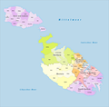
DistritosMalta.PNG 686 × 599; 43 KB
-
ECDM 20240621 Firefighting season prepositioning EU.pdf 1,500 × 1,125; 381 KB
-
ECHO Malta Editable A4 Landscape.pdf 1,754 × 1,239; 295 KB
-
ECHO Malta Editable A4 Landscape.png 1,123 × 794; 274 KB
-
ETH-BIB-Malta, Karte-Dia 247-Z-00097.tif 3,744 × 2,866; 30.8 MB
-
Filfla map.jpg 400 × 237; 30 KB
-
Flag map of Gżira.png 599 × 416; 60 KB
-
Gemeinden Malta 2020.png 2,500 × 2,457; 615 KB
-
Gozo Comino.png 966 × 454; 178 KB
-
Immigration Centre in Malta.gif 1,195 × 959; 149 KB
-
Italy-Malta maritime border.png 173 × 243; 59 KB
-
Kaart Beleg van Malta.png 641 × 578; 36 KB
-
Kaart Beleg van Malta1-he.png 272 × 211; 16 KB
-
Kaart Beleg van Malta1.png 272 × 211; 16 KB
-
Kaart Beleg van Malta3-he.png 272 × 211; 17 KB
-
L-irjieħ.svg 2,285 × 2,285; 63 KB
-
Malta - Attard - Ta' Qali Crafts Village 24 ies.jpg 5,616 × 3,744; 12.59 MB
-
Malta - DPLA - b414d4dec6ea3cac5c4846ff43eb211b.jpg 2,554 × 3,286; 4.24 MB
-
Malta Base Map.png 1,101 × 690; 261 KB
-
Malta Gozo Comino-ar.png 2,000 × 1,600; 493 KB
-
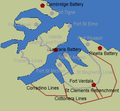
Malta Grand Harbour forts.png 330 × 305; 23 KB
-
Malta Municipality Map.jpg 1,946 × 1,136; 831 KB
-
Malta Population Density, 2000 (5457623212).jpg 2,525 × 3,249; 597 KB
-
Malta Population Density, 2000 (6171913687).jpg 2,324 × 3,161; 528 KB
-
Malta-map-de.svg 512 × 489; 52 KB
-
Malta1718.jpg 768 × 1,024; 126 KB
-
Malta2021OSM.png 5,240 × 4,592; 6.76 MB
-
Map malta.png 641 × 578; 10 KB
-
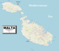
Map of Malta with scale.png 832 × 410; 79 KB
-
Map of Maltese Electoral Districts.svg 1,298 × 1,007; 108 KB
-
Map of the island of Malta (1910).jpg 18,839 × 17,774; 55.33 MB
-
Map rabat gozo.png 641 × 578; 10 KB
-
Mapa de Malta (OCHA).svg 254 × 254; 961 KB
-
Noun Project Malta icon 2335416.svg 875 × 875; 38 KB
-
Operationsplan Frankreich 1798.png 330 × 355; 10 KB
-
Outline map of Malta.png 400 × 400; 7 KB
-
PAT - Malta.gif 800 × 800; 65 KB
-
Sketch plan of Casal Zabbar (1901).jpg 1,911 × 1,607; 558 KB
-
Sudika Malta Budapest.jpg 890 × 890; 239 KB
-
Sudika Malta urban regions.jpg 1,635 × 1,635; 310 KB
-
Sudika Templomok helye Máltán.jpg 766 × 655; 142 KB
-
Taxbiex-map.png 520 × 465; 14 KB
-
WikiProject Malta Location Taskforce Symbol.png 272 × 272; 24 KB
-
Мальта.png 961 × 874; 103 KB


