
Category:Maps of the State of Palestine
Wikimedia category | |||||
| Upload media | |||||
| Instance of | |||||
|---|---|---|---|---|---|
| |||||
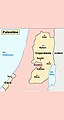
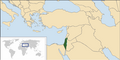
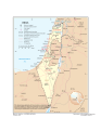
Maps of the Palestinian territories. It is an organized and commented collection of geographical, political and historical maps of Palestine and the Palestinian Occupied Territories.
For maps of Palestine before the creation of Israel in 1948 please see the parent category: Category:Maps of Palestine.
Resources:
- Commons:Map resources
- United Nations Cartographic Section Web Site: [1]. Public domain info: Commons:Copyright tags#United Nations and {{UN map}}
- "UN Office for the Coordination of Humanitarian Affairs - Occupied Palestinian territory" (OCHAOPT). Map Centre: [2]. Google search of Issuu documents for OCHAOPT maps (try adding various search terms). "West Bank" search, "Gaza" search, etc.).
- Commons:PDF to image files.
- Maps are also available as part of the
 Wikimedia Atlas of the World project in the Atlas of Palestine.

Subcategories
This category has the following 19 subcategories, out of 19 total.
!
*
C
H
O
P
S
Media in category "Maps of the State of Palestine"
The following 37 files are in this category, out of 37 total.
-
 Arc Regional View.jpg 1,200 × 1,458; 667 KB
-
 Carte .jpg 510 × 960; 23 KB
-
 Israel Map , Status of The Territories.png 800 × 401; 74 KB
-
 Israel-UN.svg 816 × 1,056; 690 KB
-
 Israeli-controlled territories.png 1,998 × 3,712; 518 KB
-
 Koppen-Geiger Map PSE present.svg 1,330 × 850; 544 KB
-
 Location Palestine AW.png 385 × 238; 10 KB
-
 LocationPalestine.png 250 × 115; 6 KB
-
 Map of Israel, Palestinian Territories and Jordan.png 4,145 × 4,034; 4.03 MB
-
 Map of Palestine for talk page.png 1,925 × 2,213; 528 KB
-
 Map Palestinian territories acquired by war Not annexed to Israel.jpg 2,828 × 8,208; 17.93 MB
-
 Mapa do Plano de Paz de Trump.jpg 933 × 1,534; 389 KB
-
 Mapa territorios palestinos con colonias de Israel.gif 617 × 767; 136 KB
-
 Negara Palestin.png 250 × 465; 32 KB
-
 OutlineofPalestineinBlue.png 1,879 × 1,668; 16 KB
-
 Palestijnse Autoriteit-locator.png 330 × 715; 5 KB
-
 Palestine (orthographic projection).png 600 × 600; 132 KB
-
 Palestine Base Map.png 1,101 × 699; 249 KB
-
 Palestine governorates-he.png 755 × 874; 10 KB
-
 Palestine Map 2007 (Settlements).gif 780 × 970; 107 KB
-
 Palestine Map 2007.gif 780 × 970; 103 KB
-
 Palestine-locator.png 330 × 715; 5 KB
-
 Palestine-map PL.jpg 368 × 489; 112 KB
-
 Palestinian territories (orthographic projection).svg 550 × 550; 1.37 MB
-
 State of Palestine Lands and Claims.png 2,000 × 2,000; 667 KB
-
 Trump Peace Plan (cropped).jpg 1,176 × 1,951; 848 KB
-
 Trump Peace Plan Map.jpg 1,242 × 1,619; 348 KB
-
 Trump Peace Plan Map.svg 2,441 × 3,965; 2.31 MB
-
 Wbgz zh.svg 587 × 732; 285 KB
-
 West Bank & Gaza Map 2007 (Settlements)-ar.png 482 × 599; 240 KB
-
 West Bank & Gaza Map 2007 (Settlements)-he.png 780 × 970; 210 KB
-
 West Bank & Gaza Map 2007 (Settlements)-he2.jpg 780 × 970; 590 KB
-
 West Bank & Gaza Map 2007 (Settlements).png 780 × 970; 86 KB
-
 West bank and Gaza Governotates.jpg 891 × 952; 69 KB
-
 West Bank Bantustans proposed in the Trump Peace Plan Map (cropped).jpg 222 × 530; 132 KB
-
 West Bank Gaza Strip Population Density, 2000 (5457017417).jpg 2,550 × 3,299; 586 KB
-
 خريطة صفقة القرن.jpg 1,242 × 1,612; 112 KB


.png)


.gif)


.svg)

.jpg)


-ar.png)
-he.png)
-he2.jpg)
.png)

.jpg)
.jpg)
