Category:Maps of Serbia
Jump to navigation
Jump to search

Српски / srpski: Република Србија је држава у Европи. Њен главни град је Београд / Republika Srbija je država u Evropi. Njen glavni grad je Beograd.
Български: Сърбия е държава в Европа. Нейна столица е Белград.
Esperanto: La Respubliko Serbio, aŭ simple Serbio aŭ Serbujo, estas lando en Eŭropo. Ĝia ĉefurbo estas Beogrado.
Italiano: La Repubblica Serba è uno stato dell'Europa. La sua capitale è Belgrado.
日本語: セルビア共和国は欧州の国で首都はベオグラードである。
Polski: Republika Serbii jest państwem leżącym w Europie, którego stolicą jest Belgrad.
Wikimedia category | |||||
| Upload media | |||||
| Instance of | |||||
|---|---|---|---|---|---|
| Category combines topics | |||||
 | |||||
Serbia
[edit]-
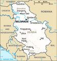
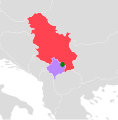
Location of Serbia in Europe -
Districts of Serbia -
Political map of Serbia -
Autonomous provinces, districts and municipalities of Serbia -
Serbia flag map -
Autonomous provinces of Serbia -
Main cities of Serbia -
Russian-language physical map of Serbia
-
Location of Serbia in Europe (without Kosovo) -
Districts of Serbia (without Kosovo) -
Political map of Serbia (without Kosovo) -
Autonomous provinces, districts and municipalities of Serbia (without Kosovo) -
Serbia map flag (without Kosovo) -
Autonomous provinces of Serbia (without Kosovo) -
Main cities of Serbia (without Kosovo)
References
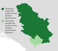
[edit]- ↑ Kosovo declared independence in 2008. This category includes maps of Serbia with and without Kosovo.
Subcategories
This category has the following 36 subcategories, out of 36 total.
+
B
- Blank maps of Serbia (24 F)
C
- Maps of caves in Serbia (4 F)
D
E
F
G
H
L
- Maps of lakes of Serbia (6 F)
- Location maps of Serbia (13 F)
M
- Maps of Kovin (4 F)
O
P
R
S
T
Pages in category "Maps of Serbia"
This category contains only the following page.
Media in category "Maps of Serbia"
The following 103 files are in this category, out of 103 total.
-
20160108 Serbia UCPM Offers.pdf 1,754 × 1,239; 1 MB
-
20160108 Serbia UCPM Requests.pdf 1,754 × 1,239; 1.08 MB
-
20160208 WesternBalkans Feb2016.pdf 1,754 × 1,239; 912 KB
-
20160307 DailyMap Activations.pdf 1,754 × 1,239; 1.03 MB
-
20161014 WesternBalkans.pdf 1,754 × 1,239; 1.09 MB
-
20170109 SE Europe SW v2.pdf 1,625 × 1,125; 806 KB
-
20170111 Europe SW update v5.pdf 1,625 × 1,125; 958 KB
-
20170208 DailyMap Serbia.pdf 1,754 × 1,239; 853 KB
-
4q0s4y.png 658 × 653; 77 KB
-
Autoputevi u Srbiji.jpg 800 × 1,186; 199 KB
-
Blank map of alternate Serbian constituencies.png 1,430 × 2,048; 369 KB
-
Croatia Serbia border Backa Baranja.png 520 × 520; 94 KB
-
Districts-of-Serbia.png 630 × 899; 219 KB
-
ECDM 20130610 CentralEurope Floods.jpg 1,040 × 720; 193 KB
-
ECDM 20130610 CentralEurope Floods.pdf 1,625 × 1,125, 2 pages; 1.28 MB
-
ECDM 20130617 Europe Floods.pdf 1,625 × 1,125; 855 KB
-
ECDM 20150817 Med Migrants.pdf 1,754 × 1,239; 824 KB
-
ECDM 20150825 Greece RefugeeCrisis.pdf 1,625 × 1,125; 820 KB
-
ECDM 20150827 World Events.pdf 1,625 × 1,125; 469 KB
-
ECDM 20150918 WesternBalkansRoute.pdf 1,754 × 1,239; 1.18 MB
-
ECDM 20150930 WestBalk Refug.pdf 1,754 × 1,239; 1.1 MB
-
ECDM 20151030 RefugeeCrisis UCPMActivations.pdf 1,754 × 1,239; 1 MB
-
ECDM 20160107 Activations.pdf 1,754 × 1,239; 1,020 KB
-
ECDM 20160223 WesternBalkans.pdf 1,754 × 1,239; 1.02 MB
-
ECDM 20160308 World SW.pdf 1,625 × 1,125; 904 KB
-
ECDM 20160311 Serbia Floods.pdf 1,625 × 1,125; 801 KB
-
ECDM 20160330 WesternBalkans.pdf 1,754 × 1,239; 1.08 MB
-
ECDM 20160902 DailyMap FINAL.pdf 1,754 × 1,239; 895 KB
-
ECDM 20161107 EuropeFloodForecast SE.pdf 1,625 × 1,125; 733 KB
-
ECDM 20171130 Western-Balkans Severe Weather.pdf 2,479 × 1,754; 1.07 MB
-
FLII Serbia.png 746 × 838; 545 KB
-
Gollak Mountainous.svg 646 × 655; 405 KB
-
Gradovi Srbije dopuna.png 536 × 776; 271 KB
-
IronGates Locator map.png 2,000 × 1,029; 1,012 KB
-
Kosovo and Serbia with proposed land swap.png 400 × 565; 7 KB
-
Kosovo and Serbia.png 400 × 565; 7 KB
-
Kosovo Presevo location map.png 800 × 1,056; 181 KB
-
Krahina Gora.png 1,695 × 2,048; 375 KB
-
Manastir Sv.Pantelejmona U Lepcincu i okolina.jpg 828 × 1,063; 74 KB
-
Map of motorways in Serbia september.jpg 800 × 1,186; 174 KB
-
Map present in Serbia.png 571 × 800; 48 KB
-
Mapa crkve u stanicenju.jpg 2,978 × 1,750; 630 KB
-
Mapa de Sèrbia.png 573 × 722; 318 KB
-
Mapa1.jpg.opt522x424o0,0s522x424.jpg 522 × 424; 52 KB
-
Mačva Srez, Kingdom of Serbia 1914.png 4,096 × 4,096; 1.6 MB
-
Naseljapozitivna.png 1,076 × 1,440; 527 KB
-
New map of Autoput A1.png 800 × 1,186; 187 KB
-
New map of motorways in Serbia.png 404 × 599; 72 KB
-
Nikolic4.jpg 283 × 598; 47 KB
-
Nova Crnja Map.PNG 400 × 565; 26 KB
-
Open Balkan map.png 2,004 × 2,048; 599 KB
-
Orthetrum bruneum - mapa rasprostranjenja u Srbiji.jpg 301 × 352; 20 KB
-
PAT - Serbia.gif 860 × 975; 397 KB
-
Pobuna JSO mapa.jpg 825 × 957; 276 KB
-
Population density of Serbia districts.png 4,017 × 4,171; 719 KB
-
Preševo Valley.png 400 × 510; 6 KB
-
RefugeeCrisis WesternBalkanRoute DailyMap.pdf 1,754 × 1,239; 795 KB
-
Regions in Serbia.png 740 × 1,059; 91 KB
-
Republic of Serbia disputed w1 countrymap.svg 1,000 × 1,000; 19 KB
-
Serbia (1).png 100 × 132; 6 KB
-
Serbia - DPLA - 5cf3fd568d60212734fb94b45f682ebb.jpg 2,546 × 3,278; 5.65 MB
-
Serbia - DPLA - 7988154aa71df76dcd1fe8461b20336e.jpg 2,552 × 3,280; 5.77 MB
-
Serbia adm location map 1878.png 837 × 1,197; 154 KB
-
Serbia adm location map 1878b.png 837 × 1,197; 154 KB
-
Serbia adm location map 1878c.png 837 × 1,197; 155 KB
-
Serbia Blank Map (de facto borders).png 1,905 × 1,659; 143 KB
-
Serbia CIA WFB Map 2006.png 326 × 350; 33 KB
-
Serbia DNI Solar-resource-map GlobalSolarAtlas World-Bank-Esmap-Solargis.png 1,842 × 2,605; 2.42 MB
-
Serbia GHI Solar-resource-map GlobalSolarAtlas World-Bank-Esmap-Solargis.png 1,842 × 2,605; 2.21 MB
-
Serbia location map 1876.png 300 × 428; 36 KB
-
Serbia location map 1878.png 837 × 1,197; 147 KB
-
Serbia location map 1878c.png 837 × 1,197; 148 KB
-
Serbia location map 1878d.png 837 × 1,197; 147 KB
-
Serbia map3.jpg 253 × 325; 10 KB
-
Serbia Mineral Deposits and Energetics Map-sr.png 800 × 1,158; 412 KB
-
Serbia municipality websites.png 400 × 565; 19 KB
-
Serbia PVOUT Photovoltaic-power-potential-map GlobalSolarAtlas World-Bank-Esmap-Solargis.png 1,842 × 2,605; 2.15 MB
-
Serbia Timoshko.png 400 × 565; 27 KB
-
Serbia-Serbia.png 100 × 132; 10 KB
-
SerbiaKosovoMap.jpg 1,100 × 593; 149 KB
-
SerbiamapA33BF3E5-CE35-4206-B460-8752C1022F84.jpg 1,535 × 1,608; 476 KB
-
Serbian Empire and it internal division before Battle of Maritsa(1371.).jpg 2,635 × 2,777; 1.47 MB
-
Serbian Passport Visa Free Travel.png 1,348 × 623; 66 KB
-
SerbiaOwnMapEN.jpg 1,293 × 1,900; 1.22 MB
-
Srbija-razmeri.GIF 466 × 584; 8 KB
-
Starovlaska-visija.jpg 367 × 477; 47 KB
-
Vinca123.png 360 × 270; 14 KB
-
Vinregioner-serbien-karta.png 720 × 829; 835 KB
-
Visa requirements for Serbian citizens (New Map).png 1,425 × 625; 67 KB
-
VocarBrus.jpg 768 × 614; 67 KB
-
WesternBalkans DailyMap 3092015 v2.pdf 1,754 × 1,239; 1.22 MB
-
Žagubica opština.jpg 640 × 813; 60 KB
-
Železnička karta Srbije.jpg 2,000 × 1,456; 359 KB
-
Акругі Сербіі.png 553 × 796; 192 KB
-
Бела Србија краља Милодуха.png 7,458 × 6,038; 3.84 MB
-
Велешки.png 997 × 1,310; 76 KB
-
Народни музеј Крушевац - рељефна мапа граница Србије 1833. године.jpg 6,720 × 4,480; 10.27 MB
-
Община Враня на картата на Сърбия.png 400 × 565; 25 KB
-
Пећина Верњикица.png 462 × 557; 647 KB
-
Полимље.JPG 258 × 330; 26 KB
-
Положај Цркава у насељу Црквине Тутин.jpg 720 × 619; 174 KB
-
Пример позиционог гласања у Србији.png 1,600 × 2,533; 144 KB


